Kedarnath – Geography & Demographics

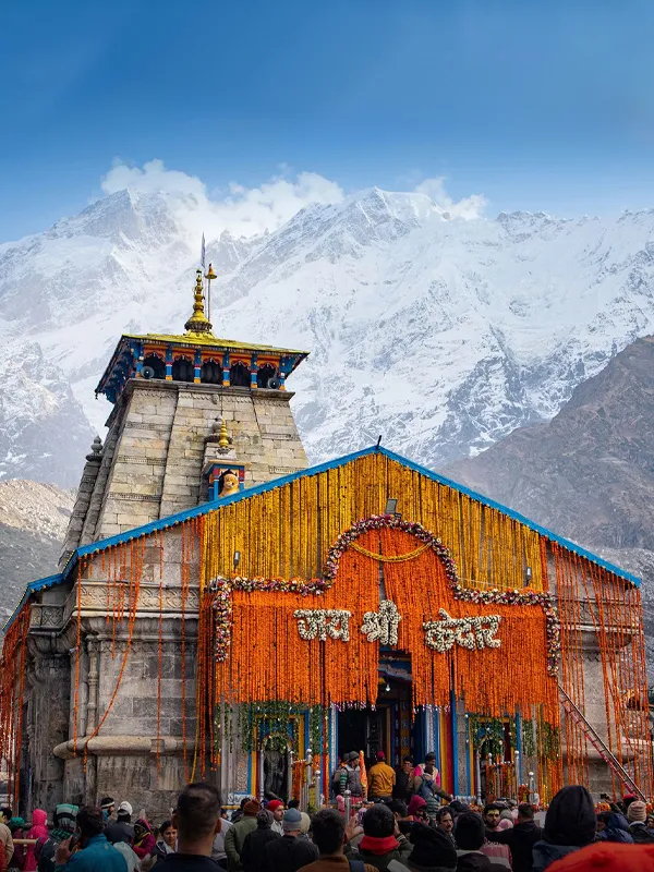
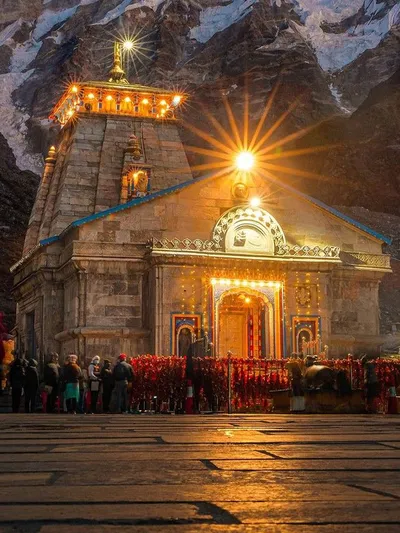
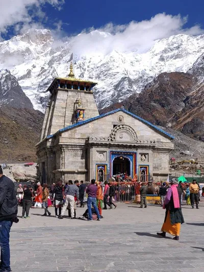
Sitting at approximately 3,583 metres in Rudraprayag district, Kedarnath offers some of the most dramatic terrain in the Garhwal Himalayas. This guide to Kedarnath geography and demographics covers the temple's exact setting, the Mandakini River, the surrounding peaks, and verified population data — correcting a few figures often repeated inaccurately across travel sites.
Kedarnath Geography at a Glance
- District: Rudraprayag, Uttarakhand
- Coordinates: Approximately 30.73°N, 79.07°E
- Altitude: ~3,583 metres
- Source river: Mandakini (from Chorabari Glacier)
- Nearby peaks: Kedarnath Peak (6,940 m), Kedar Dome (~6,831 m)
- Protected area: Kedarnath Wildlife Sanctuary (975 sq km)
- 2011 population: 612
Where Is Kedarnath Located?
Kedarnath sits in Rudraprayag district, Uttarakhand, at roughly 30.73°N, 79.07°E. It lies within the Garhwal Himalayas, close to the Chorabari (Kedar) Glacier and the wider Kedarnath Wildlife Sanctuary.
The nearest large town is Rudraprayag, connected by road to Gaurikund, from where the final stretch to the temple continues on foot. Badrinath, the next major Char Dham shrine, lies roughly 220–230 km away by road via Rudraprayag, on the opposite side of the same mountain system.
This location, deep in a glacier-fed valley at over 3,500 metres, is what gives Kedarnath both its dramatic scenery and its short pilgrimage season.
Geographical Relief
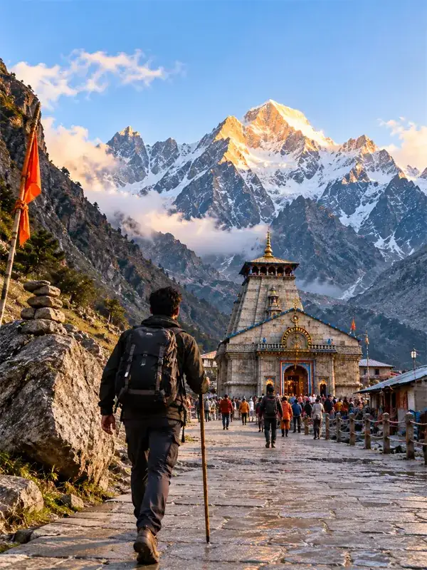
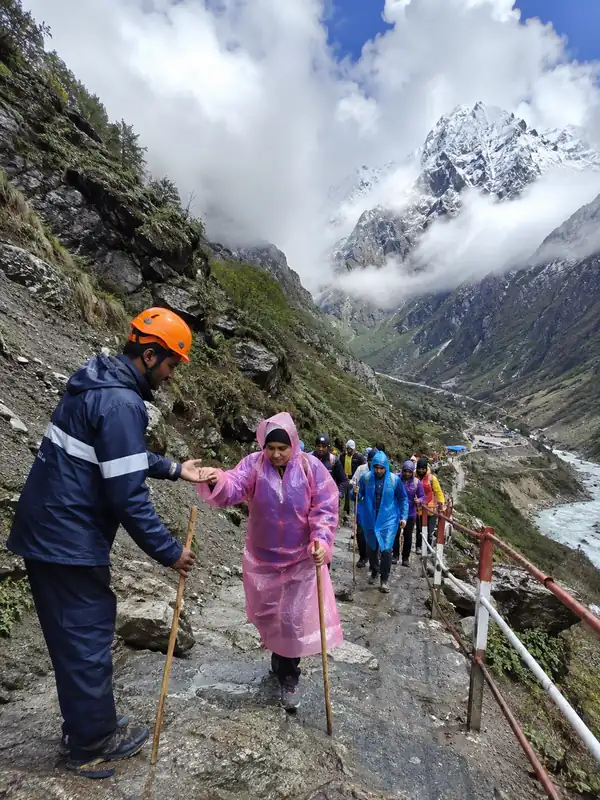
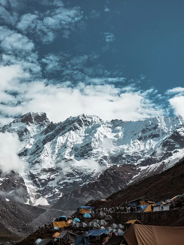
Kedarnath town sits close to the Chorabari Glacier, which — along with surrounding snowfields — feeds the Mandakini River. The trekking route from Gaurikund winds through hairpin bends and paved mountain paths cut into the hillside.
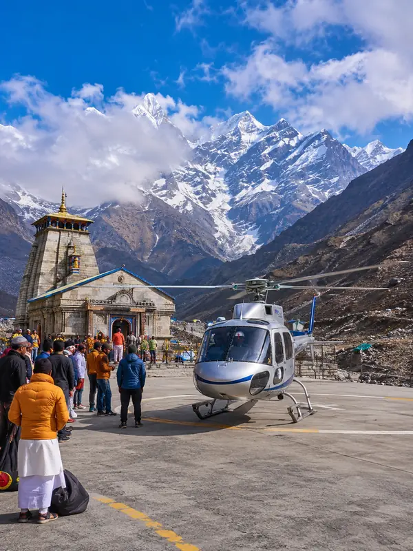
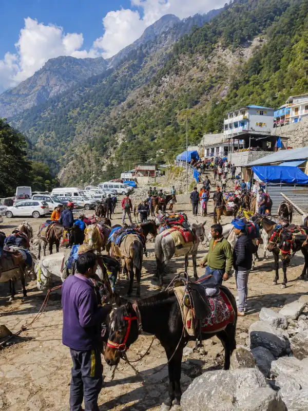
By road, Rudraprayag to Gaurikund is approximately 72–75 km. From Gaurikund, pilgrims continue on the final trek (or by pony, palanquin, or helicopter) to reach the temple itself — a distinction worth knowing, since no road runs all the way to Kedarnath.
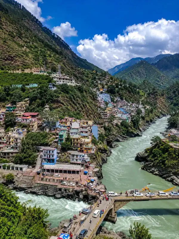
Rolling hills with jagged ridgelines surround the valley, with the Mandakini's fast-flowing water cutting through it.
Mandakini River and Its Origin
The Mandakini is one of Uttarakhand's most sacred rivers, running for approximately 80–81 km from its source at the Chorabari (Kedar) Glacier and its surrounding snowfields near Kedarnath.
The river is joined by important tributaries — including the Vasuki Ganga, Kali Ganga, and Madhyamaheshwar Ganga — before meeting the Alaknanda at Rudraprayag.
The river's sanctity comes from flowing past both the Kedarnath and Madhyamaheshwar temples, not from any specific mention in the Bhagavad Gita — a common mix-up, since a different, unrelated Mandakini River appears in the Ramayana's Chitrakoot episode. Devout Hindus still take a holy dip at these confluences (Prayags) as a purifying ritual.
Kedarnath Valley and Nearby Landscape Features
Beyond the temple itself, the Kedarnath valley includes several notable geographic features. Chorabari Tal, sometimes called Gandhi Sarovar, is a glacial lake close to the Chorabari Glacier — it was also the site of the 2013 flash-flood disaster after a moraine-dammed section gave way during heavy rainfall.
Vasuki Tal, a higher-altitude lake surrounded by peaks, lies on a separate trekking route from Kedarnath and offers views of the Chaukhamba massif. Both lakes sit within the same glacier-fed system that ultimately feeds the Mandakini River, illustrating how closely Kedarnath's religious geography and physical geography are connected.
Climate and Topography
Kedarnath's high-altitude topography means short summers and long, snow-bound winters. The pilgrimage season runs roughly May to October; outside this window, heavy snowfall makes the area inaccessible and unsafe.
Summer daytime temperatures typically stay in single digits to low teens (°C), dropping well below freezing at night even in peak season. Monsoon months (July–August) bring heavy rainfall and landslide risk along the approach roads, which is part of why the temple committee restricts the season to roughly six months.
The terrain itself is a mix of glacial moraine, alpine meadows, and steep rocky slopes — part of the same high-altitude ecosystem protected under the Kedarnath Wildlife Sanctuary, a large protected area covering roughly 975 sq km that shelters species like the Himalayan musk deer, snow leopard, and Himalayan monal.
The Peaks of Kedarnath
Kedarnath Peak (6,940 m) and Kedar Dome (approximately 6,831 m) are two prominent summits of the Gangotri Group in the western Garhwal Himalayas, standing about 15 km south of Gaumukh, the source of the Ganges.
Kedarnath is the highest peak on the southern side of the Gangotri Glacier. Kedar Dome is one of the group's other notable summits, rather than a strictly ranked "third highest" — mountaineering sources don't consistently agree on that ranking, so it's safer to describe it simply as prominent.
Both peaks were first climbed together in 1947 by a Swiss team led by André Roch, and Kedar Dome's northwest flank remains a popular spring skiing route today.
Demographics
According to Census 2011 data, Kedarnath's resident population was 612, with a heavily male-skewed ratio of roughly 609 males to just 3 females. Literacy here is high overall: male literacy stood at 98.36% and female literacy at 66.67%.
This imbalance exists because Kedarnath isn't a residential town in the usual sense — nearly everyone counted here is a seasonal worker, priest, or trader, not a family unit. The resident population declines sharply during winter, as workers, traders, and pilgrims leave once the temple closes and return to hometowns in the lower valleys.
Numbers swell briefly each spring, in the days before the Kapat (temple doors) open, as seasonal staff arrive ahead of the pilgrimage season. For context, Kedarnath's recorded population rose from 482 in the 2001 census to 612 in 2011 — a reminder that even these "resident" figures reflect a growing seasonal workforce rather than a stable family-based town.
Geography of the Wider Panch Kedar Region
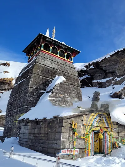
Kedarnath's geography connects directly to four other Himalayan shrines in the Panch Kedar circuit — Tungnath (3,680 m, the highest Shiva temple in the world), Rudranath, Madhyamaheshwar, and Kalpeshwar.
Each sits in a distinct micro-terrain, from Tungnath's alpine meadows near Chopta to Kalpeshwar's lower, forested valley that stays open all year, while Rudranath and Madhyamaheshwar occupy remote, less-trekked valleys further east. All five lie within or near the Kedarnath Wildlife Sanctuary, which is part of why the region supports such varied flora and fauna alongside its religious significance. Together, they make the wider Kedar valley one of the most geographically varied pilgrimage regions in the Himalayas.
Conclusion
Kedarnath's geography and demographics tell a story of extremes: a glacier-fed sacred river, some of the Garhwal Himalayas' most striking peaks, and a population that drops sharply every winter. Understanding this Kedar Dham terrain and its verified population data helps pilgrims plan a safer, more informed visit.
FAQs
Q1. What is the population of Kedarnath as per the 2011 census?
Ans: 612, according to Census of India 2011 data.
Q2. Where exactly is Kedarnath located?
Ans: In Rudraprayag district, Uttarakhand, at approximately 30.73°N, 79.07°E, in the Garhwal Himalayas.
Q3. Which glacier feeds the Mandakini River?
Ans: The Chorabari (Kedar) Glacier and its surrounding snowfields, near the Kedarnath summit.
Q4. How long is the Mandakini River?
Ans: Approximately 80–81 km from its source to its confluence with the Alaknanda at Rudraprayag.
Q5. Is Kedarnath connected to Gaurikund by road?
Ans: Yes, roughly 72–75 km by road from Rudraprayag; the final stretch to the temple is on foot or by pony/helicopter.
Q6. Is the Mandakini River mentioned in the Bhagavad Gita?
Ans: No; that claim usually confuses it with a different Mandakini River from the Ramayana's Chitrakoot episode.
Q7. What is the literacy rate in Kedarnath?
Ans: Male literacy is 98.36% and female literacy is 66.67%, as per the 2011 census.
Q8. Which are the major peaks near Kedarnath?
Ans: Kedarnath Peak (6,940 m) and Kedar Dome (approximately 6,831 m), both part of the Gangotri Group.
Q9. Why does Kedarnath's population drop sharply in winter?
Ans: Nearly everyone living there is a seasonal worker, priest, or trader who returns to lower-altitude hometowns once the temple closes.
Q10. What is the best time to experience Kedarnath's climate and terrain?
Ans: May to October, before heavy snowfall makes the high-altitude terrain inaccessible.
Q11. Is Kedarnath part of a protected wildlife area?
Ans: Yes, it lies within the Kedarnath Wildlife Sanctuary, home to species like the Himalayan musk deer and snow leopard.
Q12. How does Kedarnath's geography relate to the Panch Kedar circuit?
Ans: It anchors the circuit alongside Tungnath, Rudranath, Madhyamaheshwar, and Kalpeshwar, each in a different Himalayan micro-terrain.
Kedarnath Travel Guide





Kedarnath Travel Packages



Important Safety Notice
Beware of Fake Char Dham & Kedarnath Helicopter Booking Websites
Fake websites, WhatsApp accounts and advertisements may impersonate genuine travel companies or helicopter operators. Always verify before paying.