Char Dham Yatra Route Map 2026
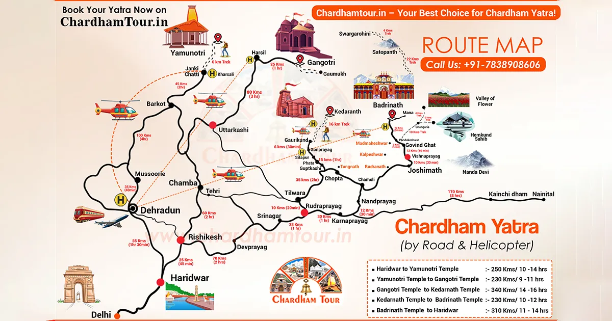
Uttarakhand is known as Devbhumi — land of the gods — and the Char Dham Yatra route through the Garhwal Himalayas is where that name feels most literal. The Yatra covers four Himalayan temples — Yamunotri, Gangotri, Kedarnath, and Badrinath — also called the Chota Char Dham, to separate it from the larger all-India Char Dham of Badrinath, Puri, Dwarka and Rameswaram.
Each dham sits at a different altitude in a different valley, and the roads connecting them range from proper highway stretches to narrow single-lane tracks that a landslide can shut for days. This page gives the real road distance and road condition for each leg, checked against Uttarakhand government sources.
The standard route from Haridwar runs Yamunotri → Gangotri → Kedarnath → Badrinath. Total road distance for the full circuit is roughly 1,500–1,600 km, depending on the exact route your driver takes. Trek sections at Yamunotri (6 km) and Kedarnath (16 km) come on top of that.
Registration & What's New for 2026
Online registration is compulsory and free. Register at registrationandtouristcare.uk.gov.in before you travel, and carry your Yatra Registration Letter with its QR code for verification at each shrine. Stuck on the process? The Uttarakhand Tourism helpline (1364) handles registration queries directly.
A few things reported for this year, per Indian news coverage and current travel guidance:
- Entry conditions: Indian media reported in early 2026 that Gangotri, Badrinath and Kedarnath temple committees were moving to restrict non-Hindu entry, with Yamunotri staying open to all. This was still being debated and enforced-in as the season opened — confirm the current position with the Badrinath-Kedarnath Temple Committee (BKTC) if it affects your group, rather than relying on this page alone.
- Phones and cameras: several outlets reported restrictions on phones and cameras inside temple premises this year. Check the signage at each shrine, since enforcement can differ dham to dham.
- Registration: biometric Aadhaar-based verification has been reported as compulsory in 2026, with online slots running well ahead of offline counters (Haridwar, Rishikesh, Dehradun, Barkot) in peak season. Register online early regardless.
- Fee: the official portal lists registration as free. A nominal fee was floated earlier in the year but doesn't appear to have taken effect — worth a quick check on the portal closer to your travel date, since this is the kind of rule that can shift mid-season.
Yamunotri and Gangotri opened 19 April 2026 (Akshaya Tritiya), Kedarnath on 22 April, Badrinath on 23 April. Closing dates: Gangotri November 10, Yamunotri and Kedarnath November 11, Badrinath November 13 — treat these as reliable but confirm with the temple committee nearer the date.
Where the Chardham Yatra Route Starts
Most pilgrims begin from Haridwar or Rishikesh, both well connected by rail. Dehradun, about 40 km from Rishikesh, has the nearest airport and works well if you're flying in — starting there instead of Delhi saves real driving time.
From any of these three cities, pilgrims almost always follow the same order into the mountains — Yamunotri, then Gangotri, Kedarnath, Badrinath. That's partly tradition and partly the road network: this sequence avoids doubling back across the state, which a reversed or reordered route usually can't.
Char Dham Yatra Route Map from Dehradun
If you're flying in from Mumbai, Bangalore, Hyderabad or Pune, Dehradun works better than Delhi as a starting point. The sequence stays the same — only this opening leg looks different:
| Route Leg | Distance | Approx. Drive Time |
|---|---|---|
| Dehradun → Barkot | ~180 km | ~6–7 hrs |
| Barkot → Janki Chatti (drive) | ~36 km | ~1.5–2 hrs |
| Janki Chatti → Yamunotri (trek) | ~6 km | ~3–4 hrs on foot |
| Barkot → Uttarkashi | ~80 km | ~3 hrs |
| Uttarkashi → Gangotri | ~100 km | ~3.5 hrs |
| Uttarkashi → Guptkashi | ~200 km | ~7–8 hrs |
| Guptkashi → Badrinath (via Joshimath) | ~210 km | ~8–9 hrs |
| Badrinath → Dehradun | ~330 km | ~10–11 hrs |
Total road distance from Dehradun for the full circuit is roughly 1,500 km, spread over 9–10 days, treks not included.
How to Use This Char Dham Map
Pick up a printed route map at the registration counters in Haridwar or Rishikesh as backup — Google Maps works on the highway stretches, but signal drops out past Uttarkashi and again past Joshimath.
Before you lose network: download an offline map, cross-check your driver's planned path against the distance chart below (some drivers default to longer routes through towns they know), and keep a printed route sheet in the vehicle.
Char Dham Yatra by Road — Leg-by-Leg Distances
Approximate road distances — actual figures vary with the exact route, diversions, and peak-season traffic restrictions.
| Route Leg | Distance | Approx. Drive Time |
|---|---|---|
| Delhi → Haridwar | ~210 km | ~5–6 hrs |
| Haridwar → Barkot | ~180 km | ~5–6 hrs |
| Barkot → Janki Chatti (drive) | ~35–36 km | ~1.5 hrs |
| Janki Chatti → Yamunotri (trek) | ~6 km | ~3–4 hrs on foot |
| Barkot → Uttarkashi | ~82 km | ~3 hrs |
| Uttarkashi → Gangotri | ~100 km | ~3–4 hrs |
| Uttarkashi → Rudraprayag | ~177 km | ~5–6 hrs |
| Rudraprayag → Sonprayag/Gaurikund | ~76 km | ~2.5 hrs |
| Gaurikund → Kedarnath (trek) | ~16 km | ~6–8 hrs on foot |
| Rudraprayag → Badrinath | ~150–165 km | ~5–6 hrs |
| Badrinath → Rishikesh | ~297 km | ~10–11 hrs |
| Rishikesh → Delhi | ~230 km | ~6 hrs |
Distance from Haridwar and Rishikesh — At a Glance
| From | To | Approx. Distance |
|---|---|---|
| Haridwar | Yamunotri | ~220 km road + 6 km trek |
| Haridwar | Kedarnath | ~240 km road + 16 km trek |
| Rishikesh | Yamunotri | ~210 km road + 6 km trek |
| Rishikesh | Kedarnath | ~220 km road + 16 km trek |
These are cumulative route distances, not straight-line — treat them as planning figures, not GPS readings.
Non-Adjacent Temple Distances
If your itinerary skips a leg or reorders the circuit, here's the distance between points that aren't adjacent on the standard route. Nobody drives a straight road between these — budget two driving days for either one.
- Yamunotri to Gangotri: ~230 km, 9–11 hours, via Uttarkashi.
- Gangotri to Kedarnath: ~340 km, 14–16 hours, via Rudraprayag.
- Kedarnath to Badrinath: ~230 km, 10–12 hours, via Rudraprayag and Joshimath.
- Yamunotri to Kedarnath (skipping Gangotri): ~380 km, 12–14 hours, before the trek.
- Badrinath to Gangotri (reverse partial circuit): ~430 km, 14–16 hours.
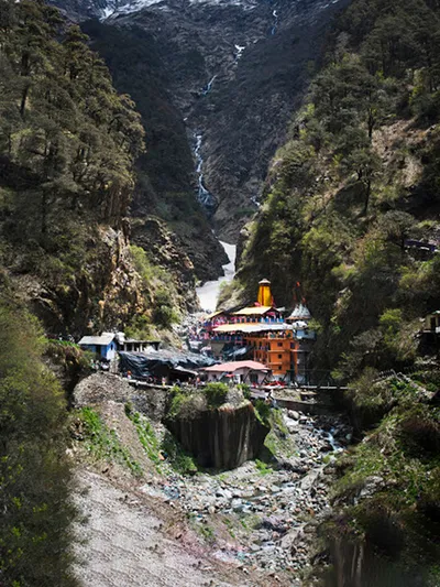
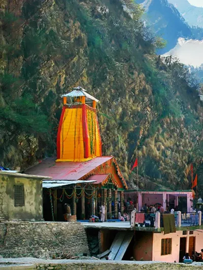
Yamunotri — Route & Road Conditions
Altitude: ~3,293 m | Dedicated to Goddess Yamuna, source of the Yamuna River
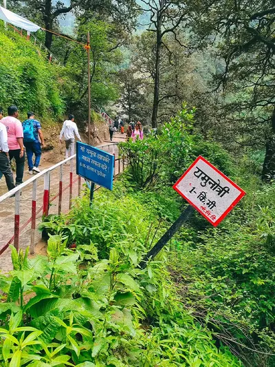
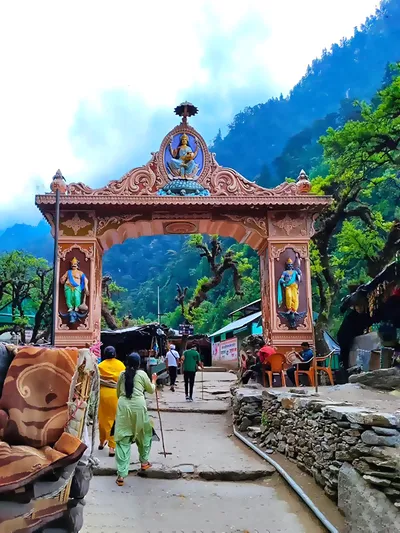
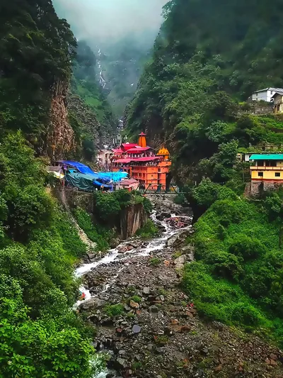
Yamunotri temple was built by Maharaja Pratap Shah of Tehri Garhwal. Janki Chatti is where the road ends — from there it's a 6 km trek on foot, with pony or palki options if you can't walk it. Delhi–Haridwar is straight highway driving; Haridwar–Barkot gets hillier past the Mussoorie bypass; Barkot–Janki Chatti narrows enough that an SUV handles it better than a sedan. The trek itself is steep in stretches but well marked.
Route Summary: Delhi → Haridwar 210 km · Haridwar → Barkot 180 km · Barkot → Janki Chatti 35–36 km (drive) · Janki Chatti → Yamunotri 6 km (trek, 3–4 hours).
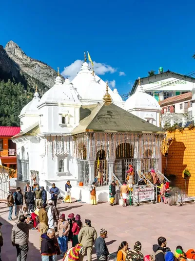
Gangotri — Route & Road Conditions
Altitude: ~3,100 m | Origin of the Bhagirathi River; temple built by General Amar Singh Thapa in the early 19th century
Gangotri is the one dham you can walk to directly from the road — no separate trek. The Bhagirathi runs past the town, and the mood is quieter than at Kedarnath or Badrinath; Gaumukh, the glacier source, sits 18 km further up a separate trek. Uttarkashi to Gangotri is one of the better roads on the circuit — mostly paved, a few sharp hairpins.
Route Summary: Yamunotri → Uttarkashi 125 km · Uttarkashi → Gangotri 100 km (3–4 hours).
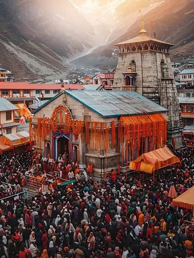
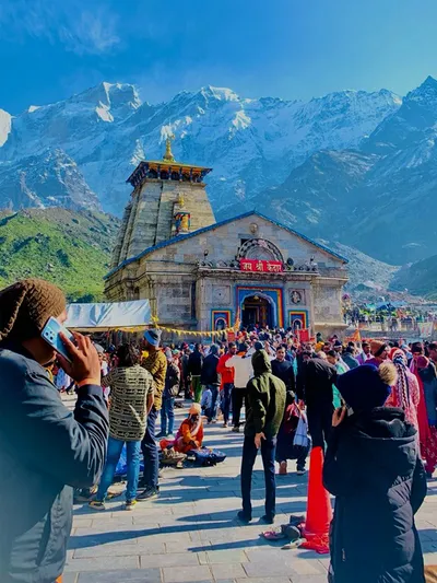
Kedarnath — Route & Road Conditions
Altitude: ~3,583 m | One of the 12 Jyotirlingas of Lord Shiva
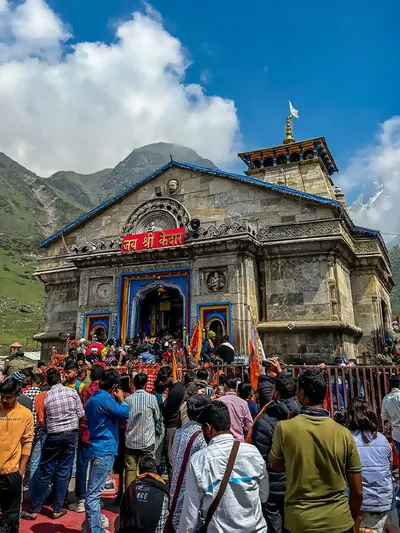
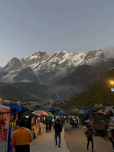
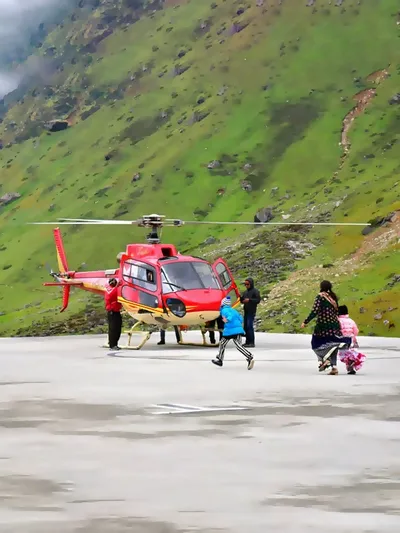
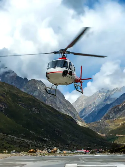
Kedarnath sits above the Mandakini River, and the trek follows this valley for most of its length. The route today isn't the pre-2013 one — the original path ran closer to the riverbed through Rambara (destroyed in the 2013 floods) and measured roughly 14 km. The rebuilt trek runs higher via Jungle Chatti, Bheembali and Lincholi — about 16 km now, longer but clear of the river. The road goes as far as Sonprayag, a shared jeep runs to Gaurikund, and from there it's the 16 km trek, 6–8 hours for most people. Helicopter services run seasonally from helipads near Guptkashi — check heliyatra.irctc.co.in for current fares rather than trusting a number found elsewhere.
Road Conditions: Gangotri–Rudraprayag is a long day (~274 km), tiring but decent surface. Rudraprayag–Sonprayag narrows near Ukhimath and Sitapur, and this stretch takes the worst of the monsoon landslide risk on the circuit. The trek is steep and rocky in patches — the toughest stretch of the entire yatra.
Route Summary: Gangotri → Rudraprayag 274 km · Rudraprayag → Gaurikund 72 km (drive) · Gaurikund → Kedarnath 16 km (trek, 6–8 hours).
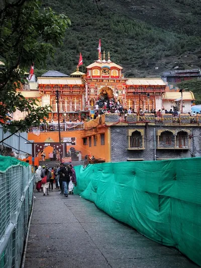
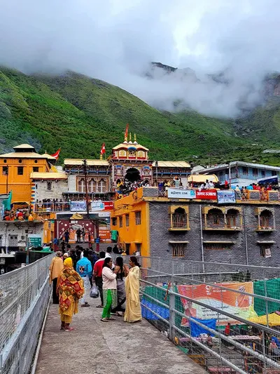
Badrinath — Route & Road Conditions
Altitude: 3,133 m (official Uttarakhand Tourism figure) | Dedicated to Lord Vishnu; final stop of the circuit
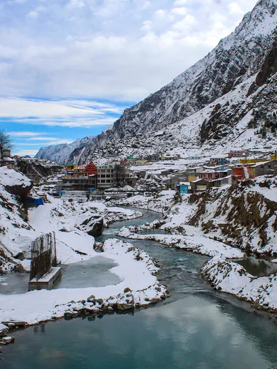
Badrinath is the only dham with the temple directly on the road — no trek. It sits on the Alaknanda River with Neelkanth peak behind it; Mana village, 3–4 km away, is the last stop before the road ends near the Tibet frontier. The route here runs via Rudraprayag and Joshimath, passing Devprayag and Srinagar (Garhwal) — workable but narrow in places, and the Joshimath–Badrinath stretch slows down in peak season mostly from traffic volume, not road quality.
Route Summary: Kedarnath area (Gaurikund) → Rudraprayag 72 km · Rudraprayag → Badrinath ~150–165 km.
Travel Tips for Char Dham Yatra by Road
- Start early every day. Traffic restrictions can apply on specific stretches in peak season — check with your hotel the night before.
- Use low gears on descents, especially on Joshimath–Badrinath and Gaurikund–Rudraprayag, to avoid overheating the brakes.
- Don't drive after dark. Hill routes carry a night-travel restriction, commonly 8 PM–5 AM (some seasons have used 10 PM–4 AM) — check the current notification.
- Monsoon changes everything. July–mid-August carries real landslide risk; a blocked road can stay blocked for hours or days. Build in buffer days and check local road status each morning.
- Trek at a steady pace — most people who struggle pushed too hard in the first hour.
- Watch for altitude sickness. All four dhams sit above 3,000 m; descend if headache, nausea or dizziness don't ease with rest. This is general guidance, not medical advice — anyone with a heart, BP or breathing condition should get cleared by a doctor first.
- Carry cash — connectivity is unreliable in remote sections.
Char Dham Yatra by Own Car — What to Know
Driving your own car is allowed and common. Get it serviced beforehand — brakes, tyres and battery matter more than horsepower on hill roads — and carry your registration, insurance and licence at all times; checkpoint checks have gotten stricter under the 2026 rules. On single-lane stretches, downhill traffic gives way to vehicles coming up.
Avoid an inexperienced hill driver behind the wheel, stick to the night-driving window above, and don't overload the car. If your own vehicle isn't built for hill roads, a rented SUV or taxi service is the safer call.
Best Time for Char Dham Yatra
| Season | Months | Conditions | Verdict |
|---|---|---|---|
| Opening | Late Apr – June | Clear skies, peak crowds in May–June | Book stays early |
| Monsoon | July – mid-Aug | Heavy rain, landslide risk | Avoid if you can |
| Post-Monsoon | Sept – Oct | Clearer visibility, thinner crowds | Usually the best window |
| Closing | Nov onwards | Snowfall, temples shut | Confirm exact dates |
Char Dham Yatra by Road vs. Helicopter
| Factor | By Road | By Helicopter |
|---|---|---|
| Duration | 10–14 days | 4–6 days |
| Physical effort | Treks required (6 km, 16 km) | Minimal walking |
| Cost | Lower — fuel, hotels, driver | Higher, seasonal |
| Best suited for | Families, flexible schedules | Senior citizens, limited time |
| Weather risk | Monsoon landslide delays | Flight cancellations |
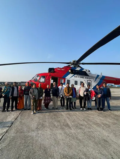
| Booking | Direct with operator/taxi | Government-listed Kedarnath heli sectors go through IRCTC HeliYatra |
It comes down to how many days you can spare, and whether the trek itself is part of why you wanted this yatra.
Char Dham Yatra Day-by-Day Itinerary (10 Days from Haridwar)
| Day | Route | Notes |
|---|---|---|
| 1 | Haridwar → Barkot | Highway, then hill roads past Mussoorie |
| 2 | Barkot → Yamunotri → Barkot | Early trek start, back by evening |
| 3 | Barkot → Uttarkashi | Rest day |
| 4 | Uttarkashi → Gangotri → Uttarkashi | Same-day up and back |
| 5 | Uttarkashi → Guptkashi | Longest driving day |
| 6 | Guptkashi → Sonprayag → Gaurikund → Kedarnath (trek) | Overnight at Kedarnath |
| 7 | Kedarnath → Gaurikund → Guptkashi | Trek down, rest |
| 8 | Guptkashi → Badrinath (via Rudraprayag, Joshimath) | Long day, narrow hill road in stretches |
| 9 | Badrinath darshan → Joshimath/Pipalkoti | Fit in Mana village |
| 10 | Return to Haridwar/Dehradun | Via Rudraprayag, Devprayag, Rishikesh |
Treat this as a working plan — road blocks and daily start times can shift it by a day either way (see the monsoon note under Travel Tips for July–August travel).
Places Worth Visiting Along the Route
- Triyuginarayan Temple — detour off the Sonprayag/Guptkashi side of the Kedarnath route; believed site of Shiva-Parvati's wedding.
- Valley of Flowers — via Joshimath and Govindghat; UNESCO site, flowers roughly July–September.
- Hemkund Sahib — Sikh pilgrimage site at 4,329 m, near Valley of Flowers.
- Mana Village — 3–4 km from Badrinath; market, dhabas, Vyas Gufa.
- Devprayag — where the Alaknanda and Bhagirathi meet to form the Ganga; 30-minute stop on the Rishikesh–Badrinath road.
- Ukhimath — winter seat of the Kedarnath deity; quieter than Guptkashi.
Frequently Asked Questions
Q1. What are the main routes to reach Char Dham?
Yamunotri: Rishikesh → Barkot → Janki Chatti. Gangotri: Rishikesh → Uttarkashi → Gangotri. Kedarnath: Rishikesh → Devprayag → Rudraprayag → Gaurikund. Badrinath: Rudraprayag → Chamoli → Joshimath. Most pilgrims follow the sequence Yamunotri → Gangotri → Kedarnath → Badrinath.
Q2. What is the best route from Haridwar?
Haridwar → Barkot → Yamunotri → Uttarkashi → Gangotri → Guptkashi → Kedarnath → Joshimath → Badrinath → Haridwar. Follows the traditional order without backtracking.
Q3. How many days does the full yatra take by road?
Allow 10–14 days from Haridwar for a comfortable trip. 7–8 days is possible but means very long driving days with little temple time — first-timers and older travellers should lean toward the longer end.
Q4. Is registration compulsory in 2026?
Yes — see the Registration & What's New section above for the full process. Short version: register at registrationandtouristcare.uk.gov.in, it's free, QR code gets verified at each shrine.
Q5. What's the best time of year?
May–early June draws the biggest crowds with reliable weather. September–October is quieter with sharper post-monsoon visibility. Avoid July–August if you can — the landslide risk isn't worth it.
Q6. Opening and closing dates for 2026?
Yamunotri and Gangotri opened 19 April, Kedarnath 22 April, Badrinath 23 April. Closing: Gangotri Nov 10, Yamunotri/Kedarnath Nov 11, Badrinath Nov 13 — confirm nearer the date.
Q7. Are non-Hindus allowed to visit in 2026?
Yamunotri stays open to all. Gangotri, Badrinath and Kedarnath have introduced entry conditions for non-Hindus this year, still being enforced-in. Check current status with BKTC if this affects your group.
Q8. Can I carry my phone or camera inside the temples?
No, not this year, at any of the four dhams — keep devices in your bag before the sanctum area.
Q9. Is Aadhaar mandatory for registration?
Yes, biometric Aadhaar verification is compulsory in 2026 — see the Registration & What's New section above for the full detail.
Q10. Which is the most difficult part of the yatra?
Kedarnath, for most pilgrims — the 16 km uphill trek at 3,583 m is longer and steeper than anything else on the circuit. Yamunotri's 6 km trek is tiring but shorter; Gangotri and Badrinath need no trek at all.
Q11. Other places worth visiting along the route?
Devprayag sits directly on the Rishikesh–Badrinath road. Triyuginarayan is a short Kedarnath-route detour. Mana Village is 3–4 km from Badrinath. Valley of Flowers and Hemkund Sahib need a 1–2 day detour via Govindghat.
Q12. Can senior citizens or physically unfit pilgrims complete the yatra?
Many do — it depends on fitness more than age. Pony, palki and kandi services cover the Yamunotri and Kedarnath treks, and helicopter options cut the physical effort considerably. Anyone with a significant heart, BP or breathing condition should get a doctor's opinion before travelling above 3,000 m.
Q13. What if a road is blocked by a landslide?
Stay at the nearest halt point — don't try to cross on foot, especially after dark. Clearance time depends on the block and weather; nobody can promise a fixed number of hours. Call the Uttarakhand Tourism helpline (1364) for current status.
Chardham Travel Guide
Chardham Travel Packages
Hotels in Chardham
Beware of Fake Char Dham & Kedarnath Helicopter Booking Websites
Fake websites, WhatsApp accounts and advertisements may impersonate genuine travel companies or helicopter operators. Always verify before paying.