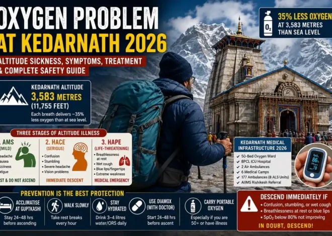
Kedarnath Wildlife Sanctuary sits across Chamoli and Rudraprayag districts in the Garhwal Himalayas, and most people who walk through it don’t realise they’re inside a protected area at all. It was notified in 1972 to protect the Himalayan musk deer, and at 975.2 sq km, it’s one of the largest protected areas in the Western Himalayas. The elevation runs from about 1,160 m up to 7,068 m at Chaukhamba — that top figure is a boundary peak, not somewhere you’ll actually stand, but it explains why the terrain shifts so much across the sanctuary.
At a glance
| Fact | Details |
|---|---|
| Location | Chamoli & Rudraprayag, Uttarakhand |
| Area | 975.2 sq km |
| Established | 1972 |
| Elevation | ~1,160 m to 7,068 m |
| Also known as | Kedarnath Musk Deer Sanctuary |
| Recorded species | 1,100+ plants, 30+ mammals, 240 birds, 147 butterflies |
| Best time | Depends on activity — trekking, pilgrimage, or wildlife |
Location, Area & Elevation
The sanctuary isn’t one uniform altitude. It climbs from roughly 1,160 m at the lower end to the Chaukhamba peak at 7,068 m, bordered by Kedarnath peak (6,940 m) and Mandani (6,193 m) to the north. That range is the reason the landscape changes so fast as you gain height — forest gives way to meadow, and meadow gives way to rock and permanent snow within a fairly short trekking distance.
Flora and Fauna
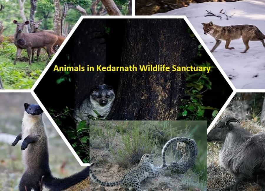
Recorded numbers here are genuinely large: over 1,100 plant species, 30-plus mammal species, 240 bird species, and 147 butterfly species. That’s not a random spread of biodiversity — it’s what happens when a single protected area spans subtropical forest at the base and alpine terrain near the top.
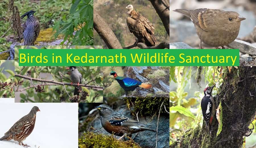
The key mammal here is the Himalayan musk deer, which is why the sanctuary carries its alternate name. Snow leopard, Himalayan tahr, and Himalayan black bear also live within the sanctuary boundary, along with more commonly sighted leopard and jackal. None of these are guaranteed sightings. Musk deer and snow leopard in particular are elusive, and most visitors who pass through on the pilgrim trail or the Chopta-Tungnath trek won’t see them. Birders have better odds — the Himalayan monal, Uttarakhand’s state bird, is regularly spotted around Chopta and Tungnath, along with a wide range of other high-altitude species.
Climate and Best Time to Visit
Temperature here depends entirely on altitude, so a single number for “the sanctuary” doesn’t mean much. What’s consistent is the rainfall pattern: around 3,000 mm annually, most of it falling during the June–September monsoon, and heavy snowfall at higher elevations between December and February.
Best time depends on why you’re going. For trekking, May–June and September–October are the more favourable windows, weather permitting. For the Kedarnath pilgrimage, you’re bound to the official kapat dates rather than general seasonal advice. For wildlife, there’s no season that guarantees sightings — you’re working with probability, not certainty.
How to Reach
A stretch of the Gaurikund–Kedarnath pilgrimage route runs through the Kedarnath Musk Deer Sanctuary, which is why most visitors end up combining a Yatra trip with a sanctuary visit without planning to.
| Mode | Details |
|---|---|
| By Air | Jolly Grant Airport, Dehradun — roughly 220 km from Chopta by road |
| By Rail | Rishikesh railway station — roughly 200 km from Chopta by road |
| By Road | Delhi/Haridwar/Rishikesh → Devprayag → Srinagar → Rudraprayag → Ukhimath → Chopta |
Road distances shift a little depending on the exact route and which point in the Chopta area you’re measuring to — treat these as working numbers, not fixed ones.
Forest rest houses and Dharamshalas exist at points like Madhyamaheshwar, Trijuginarayan, Mandal, Gaurikund, Kedarnath, and Sonprayag. Booking processes for these change from season to season, so confirm directly with the relevant forest division or temple committee before relying on them.
Trekking Routes
Beyond the pilgrim trail, this is one of Uttarakhand’s better-known trekking zones. Chopta to Tungnath runs about 3 km, and Tungnath to Chandrashila summit is another 1.5 km — a short but steep final push. Tungnath itself sits at 3,680 m and is widely recognised as the world’s highest Shiva temple. Chandrashila tops out around 4,000 m, with 360-degree views of Nanda Devi, Trishul, and Chaukhamba on a clear day.
Deoriatal, reached from Sari village, is a shorter, easier walk and sits just outside the immediate Chopta-Tungnath circuit — worth doing as a separate outing rather than squeezing it into the same day.
Entry rules and forest fees for the Tungnath-Chandrashila trek can change by season. Check at the forest checkpoint near Chopta market before you start rather than assuming a fixed fee applies.
Religious and Cultural Importance
Kedarnath Temple is one of the twelve Jyotirlingas and one of the most important Shiva pilgrimage sites in India, sitting at roughly 3,580 m. It’s part of the Panch Kedar circuit along with four other temples: Tungnath, Rudranath, Madhyamaheshwar, and Kalpeshwar. Mandani and Ansuya Devi are separate sacred sites in the region — they’re not part of the Panch Kedar group, and it’s worth keeping that distinction clear since the two get conflated often.
Kedarnath 2026 dates: the temple opened on 22 April 2026. The closing date follows Bhai Dooj each year and hadn’t been officially confirmed on the government portal at the time of writing — check the BKTC announcement closer to the date rather than treating any specific November date as final.
Places In and Around the Sanctuary
Gandhi Sarovar, Vasuki Tal, Sonprayag, Chopta, Chandrashila, Tungnath, and Deoriatal are the names that come up most. Some sit inside the sanctuary boundary, others just outside it in the surrounding tourism circuit — either way, they’re reachable from the same base points and worth planning together.
Responsible Travel & Wildlife Safety
- Don’t feed, approach, or provoke wildlife if you spot any.
- Stay on marked trails and follow Forest Department instructions on the ground.
- Carry your own water and food — supplies inside the sanctuary are limited.
- Pack out your waste.
- Avoid loud noise near forest sections; it does more to keep wildlife away than bright clothing does.
Pro Tips
Book accommodation early if you’re travelling in May or June — pilgrim and trekker traffic overlaps on the same roads and the same guesthouses. Carry your Char Dham registration details in both printed and digital form, since network coverage gets patchy past the lower checkpoints. And if you’re doing the Yatra and the Tungnath trek in one trip, give yourself an extra day rather than trying to compress both — altitude and fatigue catch up faster than people expect.
Conclusion
The sanctuary is easy to undersell as just “the forest the Kedarnath trail passes through.” It’s a 975 sq km protected area with a 6,000-metre elevation range, over 1,100 recorded plant species, and wildlife that includes snow leopard and Himalayan tahr alongside the musk deer it was created to protect. Plan around the two things that actually change every year — your Char Dham registration and the current kapat dates — and the rest of the trip is straightforward.
FAQs
Q1. What is Kedarnath Wildlife Sanctuary also known as?
It’s also known as the Kedarnath Musk Deer Sanctuary, named for its role in protecting the Himalayan musk deer.
Q2. How big is Kedarnath Wildlife Sanctuary?
It covers 975.2 sq km across Chamoli and Rudraprayag districts — one of the largest protected areas in the Western Himalayas.
Q3. What is the elevation range of the sanctuary?
Roughly 1,160 m to 7,068 m at Chaukhamba peak, which forms part of the sanctuary’s northern boundary rather than an accessible tourist point.
Q4. What animals live in Kedarnath Wildlife Sanctuary?
Himalayan musk deer, snow leopard, Himalayan tahr, Himalayan black bear, and leopard, among 30-plus recorded mammal species. Sightings of the rarer species aren’t guaranteed.
Q5. When is the best time to visit?
It depends on the activity. May–June and September–October generally suit trekking better; the Kedarnath pilgrimage follows its own official dates regardless of season.
Q6. Is there a fee to trek to Tungnath and Chandrashila?
There’s typically a forest entry fee collected near the Chopta trailhead, but the exact requirement can change by season — confirm at the checkpoint rather than assuming a fixed amount.
Q7. Is Char Dham registration required for the Kedarnath route?
Yes, it’s mandatory and free. Register at registrationandtouristcare.uk.gov.in and carry your confirmation for verification at the Dham entry points.
Q8. What are the Kedarnath Temple dates for 2026?
The temple opened on 22 April 2026. The closing date is expected around Bhai Dooj but wasn’t officially confirmed at time of writing — check the BKTC announcement before finalising late-season travel.
Q9. How far is Chopta from Rishikesh and Delhi?
Roughly 200 km from Rishikesh and 415–450 km from Delhi by road, depending on route. The Delhi drive typically takes most of a day.
Q10. Which temples make up the Panch Kedar?
Kedarnath, Tungnath, Rudranath, Madhyamaheshwar, and Kalpeshwar.
Q11. What is the distance between Chopta, Tungnath, and Chandrashila?
Chopta to Tungnath is about 3 km. Tungnath to Chandrashila summit is another 1.5 km, steeper than the first stretch.
Q12. Is the sanctuary accessible in winter?
Higher sections become difficult to reach once heavy snowfall sets in, typically December through February. Lower areas remain more accessible, but conditions vary by year.