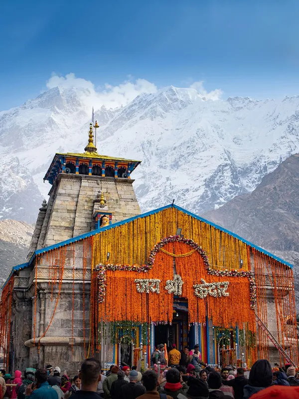
Kedarnath Yatra Route Map 2026
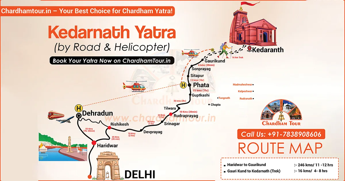
Route, altitude and distance figures below are drawn from the current Uttarakhand Tourism registration portal, BKTC, and Rudraprayag district sources, cross-checked where those sources gave different numbers. Where official figures don't agree with each other, we've said so instead of picking one and presenting it as settled.
There is no road to Kedarnath Temple itself. Pilgrims travelling by road continue on foot, pony, or palki from Gaurikund, and helicopter services fly directly to a helipad near the temple from three approved take-off points. Delhi, Haridwar, Rishikesh, and Dehradun all connect by road to the base of this route; getting to Gaurikund or a helipad is the easy part, the last stretch is where the planning matters.
Quick Answer
Most pilgrims travel by road to Gaurikund and trek the remaining stretch. The current Uttarakhand Tourism portal lists that trek at 16 km, taking roughly 6-8 hours on foot. A district government page for Rudraprayag lists it as 17 km — the gap likely comes down to where each source measures from. Helicopter shuttles run from Sersi, Phata, and Guptkashi. Kedarnath Temple opened for the 2026 season on 22 April; the official portal hadn't published an opening time as of this writing, so treat any specific hour you see online as unconfirmed.
Char Dham registration is mandatory for this route. Here's what the journey actually looks like, corrected against the figures above.
Kedarnath Yatra 2026 at a Glance
| Detail | Information |
|---|---|
| Temple opening 2026 | 22 April |
| Closing 2026 | Expected around Bhai Dooj (mid-November); BKTC confirms the exact date closer to the season |
| Trek distance | Approximately 16 km from Gaurikund, per the current Uttarakhand Tourism portal (a Rudraprayag district page lists 17 km) |
| Trek time | Approximately 6-8 hours |
| Kedarnath altitude | Approximately 3,580 m (official sources vary between 3,580 m and 3,586 m) |
| Registration | Mandatory, free, at registrationandtouristcare.uk.gov.in |
| Nearest airport | Jolly Grant, Dehradun |
| Nearest railhead | Rishikesh |
Travel Routes to Kedarnath
By Road
The road network runs through Rishikesh, Devprayag, Srinagar, Rudraprayag, Guptkashi, and Sonprayag before ending at Gaurikund, the last bus station on this route. Buses, shared taxis, and private cabs cover this stretch from Haridwar, Rishikesh, and Dehradun. During May-June and September-October, expect the last few kilometres to move slowly — vehicles bunch up near Sonprayag during peak hours.
Sonprayag functions as the main traffic-management and parking point on this route. From there, pilgrims continue toward Gaurikund using the locally permitted transport arrangements, which run about 5 km. Check the current traffic instructions at Sonprayag before assuming your own vehicle can go further — the arrangement can change year to year and even week to week during peak season.
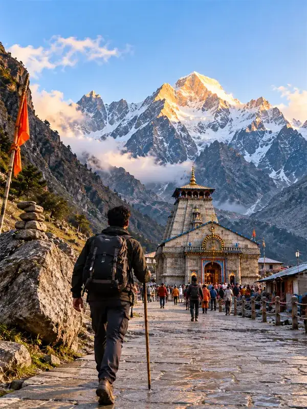
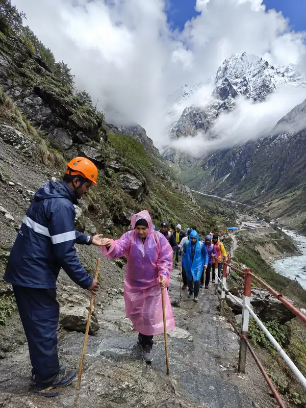
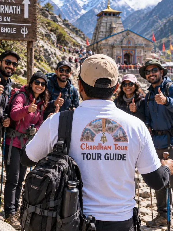
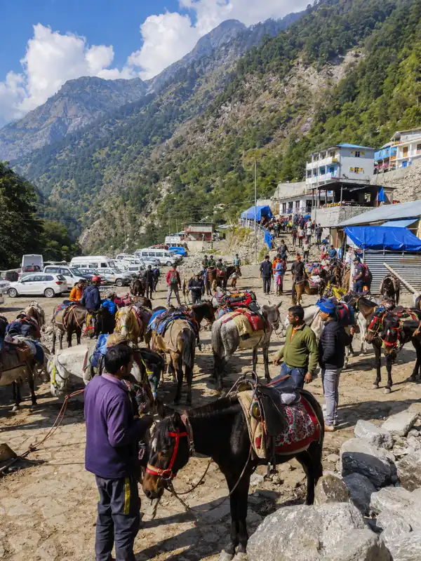
From Gaurikund, the trek to Kedarnath begins. You can walk it, or arrange a pony, palki, or porter at the counters there.
By Helicopter
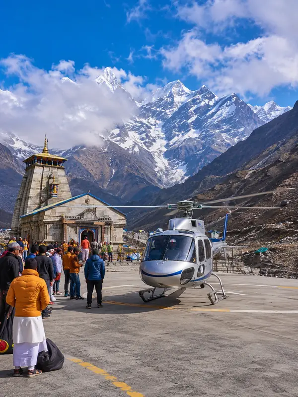
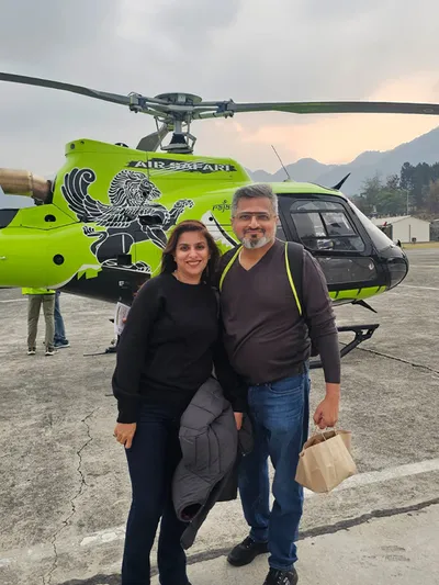
Shuttle services fly from three helipads on the Rudraprayag side of the route: Sersi (also called Sitapur), Phata, and Guptkashi. Flight time is short — most operators quote somewhere around 7-15 minutes depending on the helipad, weather, and traffic in the air corridor that day.
Tickets are sold only through the official IRCTC HeliYatra portal (heliyatra.irctc.co.in), and Char Dham registration has to be completed before you can book. Widely reported 2026 round-trip fares put Sersi around ₹6,300-6,400, Phata around ₹10,000-10,200, and Guptkashi around ₹12,700-12,800, on top of a convenience fee and GST. We haven't been able to pull these numbers directly off an IRCTC fare notification ourselves, so check the live fare on the portal before you pay — don't book against a number you found on a blog, including this one.
Guptkashi sits at lower altitude than Sersi and has considerably more hotel options nearby, which matters if a flight gets rescheduled and you need a bed for an extra night.
Only book through the official portal. There's a dedicated safety section further down this page on fake helicopter booking sites — read it before you pay anyone.
By Air
Jolly Grant Airport, Dehradun, is the nearest airport. Road distance from there to the Kedarnath route depends on which reference point you're measuring to and which source you check — official figures range from roughly 230 to 250 km. Rishikesh is about 16-18 km from the airport, a 20-30 minute drive. Jolly Grant has regular flights from Delhi and several other Indian cities. Travellers from Chennai, Bengaluru, Kerala, or elsewhere in South India typically fly into Delhi or Dehradun and take a taxi from there.
By Train
Rishikesh is the nearest major railway option, with road distance onward to the Kedarnath route reported anywhere from about 210 to 228 km depending on the source. Haridwar Junction sits at a similar distance but connects far better to Delhi, Mumbai, Ahmedabad, Amritsar, and Howrah. Dehradun Railway Station is another usable option, slightly farther out.
From any of these three stations, the rest of the journey is by road.
Where Do You Park Your Vehicle?
During the yatra, pilgrims generally park at designated facilities around Sonprayag and continue toward Gaurikund on the locally permitted shared transport. That's the practical answer. Whether a specific rule bans every private vehicle beyond Sonprayag in every circumstance isn't something we found spelled out in a current official notice, so treat it as the standard arrangement rather than an absolute law, and check the parking and traffic instructions posted at Sonprayag when you arrive.
Arriving early in the day gets you a parking spot faster, particularly in May-June and September-October.
Kedarnath Yatra Registration
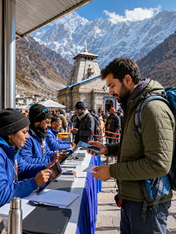
Registration is mandatory and free, done at registrationandtouristcare.uk.gov.in. The process:
- Create an account with your mobile number and verify via OTP.
- Enter your travel details, including your planned Kedarnath visit date.
- Upload a valid ID — Aadhaar, Passport, or Voter ID.
- Download your QR-coded registration slip. Keep a printed copy along with the digital one.
Registration/verification facilities are also available at designated points on the route, including Sonprayag and Gaurikund, according to the portal's own FAQ — so travelling without pre-registration isn't necessarily a dead end, though it's not the recommended way to do this. Register before you leave home if you can. Register as early as possible for peak dates; we didn't find an official rule specifying exactly how many days in advance, and the portal's own slot-availability system suggests that popular dates simply fill up rather than being capped by a fixed daily number that's published anywhere.
The Trek Route
The route in current use — Gaurikund to Jungle Chatti to Bhimbali to Linchauli to Kedarnath — was rebuilt and substantially improved after the 2013 disaster damaged the earlier path and the motor road leading up to it. Specific claims about which exact bridge or engineering team did which piece of that reconstruction vary depending on which source you read, so we've kept this to what's broadly agreed on rather than a single detailed account.
Monsoon & Route Safety
The Sonprayag-Gaurikund stretch has a real landslide history, and BKTC itself flags July to mid-September as the period with the most rain, the highest landslide risk, and the most difficult travel conditions. That's not a generic caution — it's the temple committee's own seasonal assessment.
If the IMD or the local administration issues a severe weather advisory for this belt, reconsider your travel dates and follow the official instructions rather than pushing ahead. Many pilgrims prefer May-June and September-October for this reason; treat that as a general preference rather than an official "best season" ruling. Check the current route status before you leave your hotel each morning — a trail that was open yesterday isn't guaranteed to be open today.
Facilities Along the Trek
Medical and emergency assistance is available at designated points along the route, though exact locations and capacity can change season to season — don't treat trek-side facilities as a substitute for your own preparation and fitness. Mobile connectivity is intermittent in parts of the route; don't count on a signal for maps or calls once you're past Gaurikund.
Route Maps and Distances
Haridwar to Kedarnath
Current Uttarakhand Tourism figures put this at roughly 240 km by road plus the 16 km trek, at around 9-10 hours driving and 6-8 hours walking. Adding up the individual legs below gets you closer to 245-246 km — a difference that comes down to route and reference point, not an error in either number.
| Segment | Distance | Highlights |
|---|---|---|
| Haridwar → Rishikesh | 25 km | Ganga Aarti, Triveni Ghat, Laxman Jhula |
| Rishikesh → Devprayag | 70 km | Confluence of Alaknanda & Bhagirathi rivers |
| Devprayag → Srinagar | 36 km | Alaknanda river views |
| Srinagar → Rudraprayag | 33 km | Confluence of Alaknanda & Mandakini |
| Rudraprayag → Tilwara | 10 km | Himalayan foothills |
| Tilwara → Guptkashi | 35 km | Mandakini valley views; ancient Vishwanath Temple |
| Guptkashi → Phata | 15 km | Helicopter helipad access point |
| Phata → Sonprayag | 16 km | Approach to the last stretch |
| Sonprayag → Gaurikund | 5 km | Locally permitted shared transport |
| Gaurikund → Kedarnath | 16 km | Trek via Jungle Chatti, Bhimbali, Linchauli |
Guptkashi's Vishwanath Temple is an important Shiva shrine and a common overnight halt — we didn't find a reliable source calling it a replica of Kedarnath, so we've left that claim out.
Kedarnath to Badrinath
Many pilgrims combine both shrines in one trip. The current Uttarakhand Tourism figure for this leg is approximately 230 km by road after the descent to Gaurikund, plus the 16 km trek down. BKTC's own figures range from 229 to 247 km depending on which route is used, so treat 230 km as a working figure rather than an exact one.
| Segment | Distance | Highlights |
|---|---|---|
| Kedarnath → Gaurikund | 16 km | Downhill trek; ponies/palkis available |
| Gaurikund → Sonprayag | 5 km | Shared transport |
| Sonprayag → Guptkashi | 15 km | Ancient Vishwanath Temple |
| Guptkashi → Tilwara | 35 km | Mandakini valley scenery |
| Tilwara → Rudraprayag | 10 km | Alaknanda & Mandakini confluence |
| Rudraprayag → Karanprayag | 30 km | Alaknanda & Pindari confluence |
| Karanprayag → Nandprayag | 12 km | Alaknanda & Nandakini confluence |
| Nandprayag → Pipalkoti | 27 km | Common overnight halt |
| Pipalkoti → Joshimath | 35 km | Narasimha Temple; gateway to Auli |
| Joshimath → Vishnuprayag | 10 km | Dhauliganga & Alaknanda confluence |
| Vishnuprayag → Govindghat | 12 km | Start point for Hemkund Sahib / Valley of Flowers |
| Govindghat → Pandukeshwar | 2 km | Yogadhyan Badri Temple |
| Pandukeshwar → Badrinath | 22 km | Badrinath Temple, Tapt Kund, Narad Kund |
| Badrinath → Mana Village | 3 km | Bhim Pul, Vyas Gufa, Saraswati River |
Distance by Starting Point
| Starting point | Approximate distance |
|---|---|
| Haridwar | ~240 km road + 16 km trek |
| Rishikesh | ~220 km road + 16 km trek |
| Dehradun | ~250 km road + 16 km trek |
| Badrinath | ~230 km road + 16 km trek |
These figures come from the current Uttarakhand Tourism portal. A city-by-city distance table for places like Chennai or Nashik looks impressive but doesn't tell you whether it's measuring road distance, straight-line distance, or something else entirely — we've left that kind of table out rather than publish a number nobody can verify.
Common Mistakes on This Route
- Assuming a private car can go past Sonprayag without checking the current arrangement.
- Skipping registration and hoping to sort it out at the checkpoint — possible in principle, but not the smooth version of this trip.
- Booking helicopter tickets from a site that isn't heliyatra.irctc.co.in because the price looked better.
- Starting the trek late enough that the descent happens after dark or in a weather shift.
- Ignoring a weather advisory because the trail was fine the day before.
Travel Tips
Get a basic fitness check before the trip if you're over 50 or have a heart or lung condition — this is a high-altitude trek, and that's not a small caveat. Download offline maps before you lose signal. Carry cash; ATMs thin out past Guptkashi. Eat a light breakfast rather than a heavy one before starting the climb.
For emergencies, the Rudraprayag district's Yatra Control Room numbers are 01364-297878 and 01364-297879, with a dedicated Kedarnath heli helpline at +91 98709 63731. The general emergency number is 112, medical emergency is 108, and Uttarakhand Tourism's tourist helpline is 1364. For booking fraud specifically, the National Cyber Crime Helpline is 1930.
Frequently Asked Questions
Q1. How do you reach Kedarnath?
Most pilgrims travel by road through Rudraprayag and Guptkashi to Gaurikund, then trek the final stretch. Helicopter shuttles from Sersi, Phata, and Guptkashi skip the trek entirely.
Q2. What is the Kedarnath trek distance?
The current Uttarakhand Tourism portal lists it as 16 km one way from Gaurikund. A Rudraprayag district page lists 17 km — the two figures don't fully agree, which is worth knowing before you plan your day around an exact number.
Q3. Where does the Kedarnath trek start?
At Gaurikund, the last bus station on the route.
Q4. Can I take my car to Gaurikund?
The standard arrangement has pilgrims parking around Sonprayag and continuing to Gaurikund on shared local transport. Check the current instructions posted at Sonprayag when you arrive, since this can change.
Q5. Is registration mandatory for Kedarnath Yatra?
Yes, and it's free. Complete it online before you travel if possible; registration/verification is also available at points along the route, including Sonprayag.
Q6. Where do I book Kedarnath helicopter tickets?
Only through heliyatra.irctc.co.in. Any other site claiming to sell official tickets should be treated as suspect.
Q7. What are the helicopter fares for 2026?
Widely reported round-trip fares are roughly ₹6,300-6,400 from Sersi, ₹10,000-10,200 from Phata, and ₹12,700-12,800 from Guptkashi, before convenience fee and GST. Confirm the live fare on the official portal before paying — we can't verify these against an IRCTC notification directly.
Q8. What is the distance from Kedarnath to Badrinath?
Approximately 230 km by road after the descent to Gaurikund, per the current Uttarakhand Tourism figure. BKTC's own numbers range from 229 to 247 km depending on the route taken.
Q9. When did Kedarnath open in 2026, and when does it close?
It opened on 22 April 2026. The closing date is expected around Bhai Dooj in mid-November, confirmed by BKTC closer to the date — we don't have an official closing-date confirmation to point to yet.
Q10. Is the route safe during monsoon?
BKTC itself names July to mid-September as the period with the most rain and the highest landslide risk on this stretch. Most pilgrims plan around it rather than through it.
Q11. What is Kedarnath's altitude?
Official sources put it between 3,580 m and 3,586 m depending on which one you check. 3,580 m is the figure used by both Uttarakhand Tourism and Incredible India.
Q12. What should I do if I suspect a fake helicopter booking site?
Stop the transaction. Contact your bank if you've already paid, call the National Cyber Crime Helpline at 1930, and report it through the National Cyber Crime Reporting Portal.
Conclusion
The route to Kedarnath hasn't fundamentally changed: road to Gaurikund, then a trek or a helicopter for the last stretch. What changes year to year is the fine print — registration rules, parking arrangements, helicopter fares, and how bad the monsoon gets on the Sonprayag-Gaurikund stretch. Register early, book helicopter tickets only through the official portal, and check the weather advisory before you start walking, not after.
Kedarnath Travel Guide





Kedarnath Travel Packages


Important Safety Notice
Beware of Fake Char Dham & Kedarnath Helicopter Booking Websites
Fake websites, WhatsApp accounts and advertisements may impersonate genuine travel companies or helicopter operators. Always verify before paying.