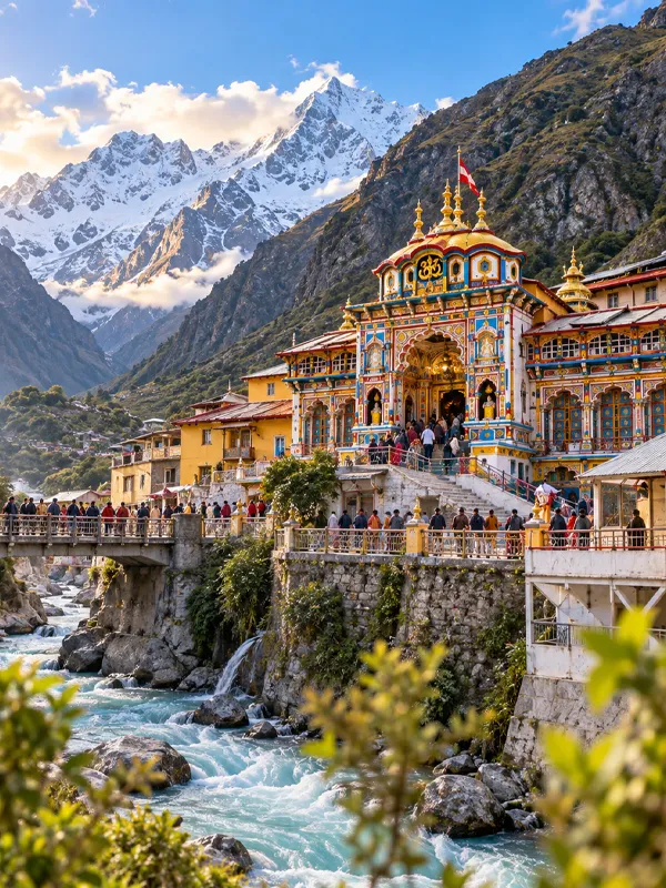
Badrinath Dham Geographical Features

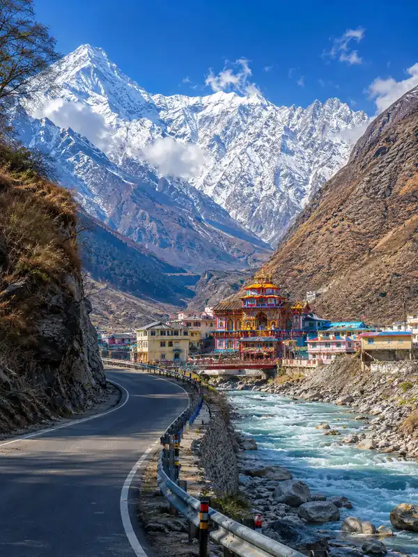
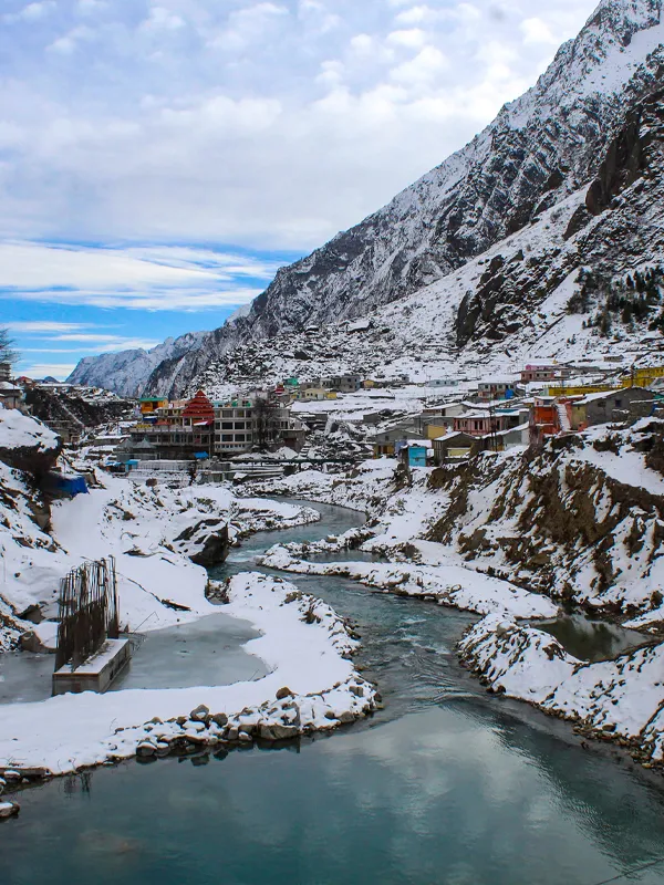
Badrinath isn't just a temple — it's a temple set into one of the more extreme pieces of geography in the Indian Himalayas. Understanding the terrain here isn't trivia; it explains why the roads close every winter, why the river runs so fast right past the temple steps, and why the town only exists for about six months of the year.
Quick Overview:
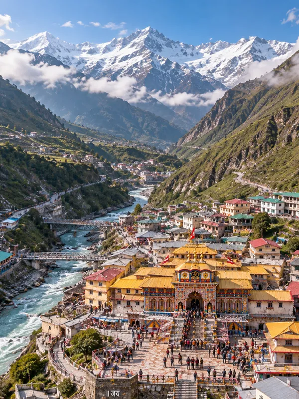
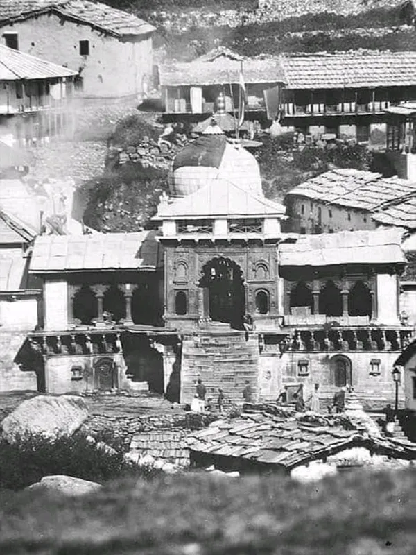
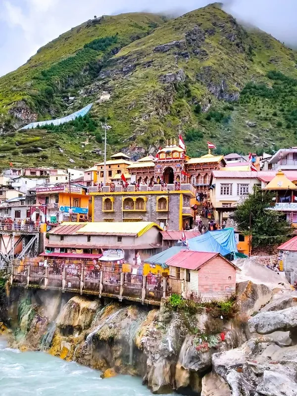
Badrinath is located in the Chamoli district of Uttarakhand, in the Garhwal Himalayas, at an elevation of 3,133 metres. It sits on the right bank of the Alaknanda River, in a narrow valley flanked by the Nar and Narayan mountain ranges, with Neelkanth Peak rising behind it.
Badrinath is located in the Chamoli district of Uttarakhand, in the Garhwal Himalayas, at an elevation of 3,133 metres. It sits on the right bank of the Alaknanda River, in a narrow valley flanked by the Nar and Narayan mountain ranges, with Neelkanth Peak rising behind it.
Location and Administrative Setting
Badrinath falls under Chamoli district, part of the Garhwal division of Uttarakhand, a district that spans roughly 8,030 sq. km and borders the Tibet Autonomous Region of China to the north. Chamoli's terrain ranges from around 800 m at its lowest point near Gauchar to 7,817 m at Nanda Devi, India's second-highest peak — which gives you a sense of just how much vertical relief this one district contains. Badrinath sits close to the district's northern edge, near the end of the motorable road before the terrain becomes high-altitude wilderness leading toward the Mana Pass and the Tibetan border.
Coordinates: Badrinath Temple is located at approximately 30°44′41″N, 79°29′28″E.
Elevation and Terrain
The temple stands at 3,133 metres (10,279 ft) above sea level, in a narrow valley squeezed between two mountain walls. Compared to Kedarnath — which requires a strenuous multi-kilometre trek from the roadhead — Badrinath is considerably easier to reach on foot, since vehicles can drive right up to a point close to the temple's main gate. That accessibility doesn't offset the altitude effects, though; visitors still often notice mild breathlessness or fatigue in their first day at this height (see the altitude section below).
The land around Badrinath consists of steep, glacially carved slopes and forests of birch (bhojpatra), fir, juniper, and rhododendron lower in the valley. The region's famous high-altitude meadows (bugyals, such as Auli, Gorson, and Bedni) lie in the wider Chamoli district rather than immediately around Badrinath town itself. Above the treeline, the landscape turns to bare rock, scree, and permanent snowfields on the higher peaks.
The Alaknanda River and Its Real Origin
The Alaknanda River runs directly past the Badrinath temple, and it's one of the two principal headstreams of the Ganga (the other being the Bhagirathi). A common mix-up worth clearing up: the Alaknanda does not originate from the Gaumukh glacier — that's the source of the Bhagirathi, a different river that starts near Gangotri. The Alaknanda instead originates from the confluence of the Satopanth Glacier and the Bhagirath Kharak Glacier, high in the mountains above Mana village, at roughly 3,880 m elevation.
From its source, the river flows down to Mana, where it's joined by the Saraswati River, then continues past Badrinath and through a chain of sacred confluences — Vishnuprayag, Nandprayag, Karnaprayag, Rudraprayag, and finally Devprayag, where it merges with the Bhagirathi to officially become the Ganga. The Alaknanda runs roughly 195 km in total from source to that confluence. In Hindu tradition, the Alaknanda's descent is tied to the story of King Bhagirath's penance to bring the river Ganga down to earth — a legend that adds to why this stretch of the river is treated as sacred rather than just scenic.
Nar and Narayan Mountain Ranges
Framing Badrinath on either side are the Nar and Narayan ranges, twin mountain chains named after the sage-pair Nar-Narayan from Hindu mythology, said to have meditated in this valley. The Alaknanda cuts directly between the two ranges. Their upper slopes stay snow-covered through most of the year, and their jagged, forested lower slopes give the town its enclosed, valley-bottom feel — Badrinath sits inside the mountains rather than merely near them.
Neelkanth Peak
Directly behind the temple, forming part of the Narayan range, is Neelkanth Peak, a pyramid-shaped summit rising to 6,596 m (some tourism sources cite 6,507 m instead; Wikipedia's mountaineering data lists 6,596 m). It's often called the "Garhwal Queen" and sits roughly 9 km east of Badrinath. Mountaineer Frank Smythe made the first recorded attempt on the peak in 1937; the first successful summit wasn't until 1974. Its steep faces have kept ascents rare since.
Geology and Seismic Character
Badrinath lies within the Higher Himalayan zone, a geologically young and still-active mountain belt formed by the ongoing collision between the Indian and Eurasian tectonic plates. This isn't a settled landscape — the Himalayas here continue to rise gradually, and the region sits close to major fault systems, including the Main Central Thrust. The bedrock in this zone is part of the Higher Himalayan Crystalline sequence, dominated by high-grade metamorphic rocks — gneiss and schist — along with granite intrusions.
Chamoli district falls in Seismic Zone V, the highest-risk category under India's official seismic zoning code, and the area has experienced significant earthquakes in the past, including a magnitude 6.4 quake near Chamoli in 1999. Combined with steep slopes and heavy monsoon rainfall, this geology is also why landslides are common on the approach roads between July and September — the ground here is simply not stable in the way a plains highway would be.
Climate Shaped by the Terrain
Badrinath's geography directly drives its climate: high altitude keeps it cold even in summer, and the surrounding peaks force moist monsoon air upward, intensifying rainfall through what's known as the orographic effect. Broadly, summers (April–June) are mild and clear, monsoon (July–September) brings heavy rain and landslide risk, and winters (December–March) bury the entire valley under snow, forcing the temple to close. For month-by-month temperatures and current travel-season conditions, see our full Badrinath Weather Guide.
Flora, Fauna, and Protected Areas Nearby
Chamoli district — the wider region Badrinath sits within — is home to two UNESCO World Heritage Sites: the Valley of Flowers National Park (around 87 sq. km, famous for over 600 species of alpine flora) and the Nanda Devi National Park, together forming the Nanda Devi Biosphere Reserve. While these aren't inside Badrinath town itself, they sit within the same district and share the same high-altitude ecology — alpine meadows, rhododendron and birch forests, and species like the Himalayan musk deer and snow leopard in the more remote zones. Near Badrinath itself, the terrain supports hardier alpine vegetation, with the tree line giving way to open meadows and bare rock above roughly 3,600–3,800 m.
Nearby Geographical Points of Interest
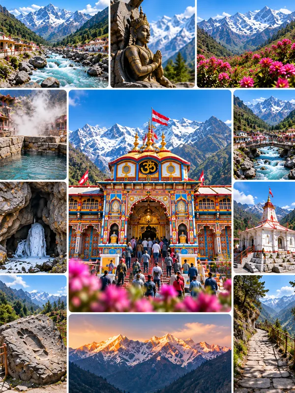
- Mana Village — roughly 3–4 km from Badrinath, the last inhabited village before the Tibet border, sitting near the Saraswati-Alaknanda confluence
- Vasudhara Falls — a waterfall about 9 km from Badrinath (including a trek from Mana village), commonly cited at roughly 120–145 m (400 ft) high
- Charan Paduka — a rock formation about 3 km out, marking the start of the Neelkanth trek route
- Tapt Kund — a natural hot spring beside the temple, fed by geothermal activity linked to the region's tectonic setting
- Satopanth Glacier — the river's source glacier, roughly a multi-day trek from Badrinath, popular with experienced trekkers
Distances from Badrinath
| Route | Approx. Distance |
|---|---|
| Haridwar → Badrinath | ~320 km |
| Rishikesh → Badrinath | ~295 km |
| Delhi → Badrinath | ~530 km |
| Joshimath → Badrinath | ~45 km |
| Mana Village → Badrinath | ~3–4 km |
Common Misconceptions About Badrinath's Geography
- "The Alaknanda comes from Gaumukh." It doesn't — that's the Bhagirathi's source. The Alaknanda's source is the Satopanth–Bhagirath Kharak glacier confluence.
- "Badrinath and Kedarnath are close together." As the crow flies, the two shrines are only about 40 km apart. But there's no direct road link — the route winds through three river valleys via Rudraprayag, Karnaprayag, Chamoli, and Joshimath, making the actual driving distance roughly 210–240 km depending on the route taken.
- "The whole region is one uniform climate zone." Elevation changes drastically over short distances here, so weather at Badrinath (3,133 m) can differ sharply from Joshimath (just 45 km away, at a lower elevation).
FAQs
Q1. In which district is Badrinath located?
Ans: Badrinath is located in Chamoli district, in the Garhwal division of Uttarakhand.
Q2. What is the elevation of Badrinath?
Ans: Badrinath sits at 3,133 metres (10,279 ft) above sea level.
Q3. Which river flows through Badrinath?
Ans: The Alaknanda River flows past the Badrinath temple, on its way to eventually forming the Ganga at Devprayag.
Q4. Where does the Alaknanda River originate?
Ans: From the confluence of the Satopanth Glacier and the Bhagirath Kharak Glacier, near Mana village — not from Gaumukh, which is a common misconception.
Q5. What mountain ranges surround Badrinath?
Ans: The Nar and Narayan ranges flank the town on either side, with Neelkanth Peak, part of the Narayan range, rising directly behind the temple.
Q6. How tall is Neelkanth Peak?
Ans: About 6,596 metres (some sources cite 6,507 m); it lies roughly 9 km east of Badrinath and has been successfully climbed only rarely, first in 1974.
Q7. Is Badrinath in an earthquake-prone zone?
Ans: Yes. Chamoli district falls under Seismic Zone V, India's highest official seismic risk category, due to its position in the tectonically active Higher Himalaya.
Q8. Is Badrinath geographically close to Kedarnath?
Ans: As the crow flies, only about 40 km — but there's no direct road between them. The actual driving distance is roughly 210–240 km via Rudraprayag, Karnaprayag, Chamoli, and Joshimath.
Q9. What kind of terrain does Badrinath have?
Ans: A narrow glacial valley with steep mountain walls, alpine meadows above the treeline, and coniferous forest lower down — typical of the Higher Himalayan zone.
Q10. Are the Valley of Flowers and Nanda Devi National Park near Badrinath?
Ans: They're within the same district (Chamoli) but not adjacent to Badrinath town itself — both are separate protected areas reached via different routes, generally through Joshimath and Govindghat.
Conclusion
Badrinath's geography explains almost everything practical about visiting it — why it's only open half the year, why the roads are landslide-prone, and why the mountain views are as striking as they are. It sits in a young, still-rising mountain range, in a valley the Alaknanda carved out of solid rock, framed by peaks that continental collision is still pushing skyward. None of that is incidental detail — it's the reason pilgrims need to plan around season, altitude, and terrain rather than treating Badrinath like any other temple town.
Badrinath Travel Guide


Badrinath Travel Packages


Important Safety Notice
Beware of Fake Char Dham & Kedarnath Helicopter Booking Websites
Fake websites, WhatsApp accounts and advertisements may impersonate genuine travel companies or helicopter operators. Always verify before paying.