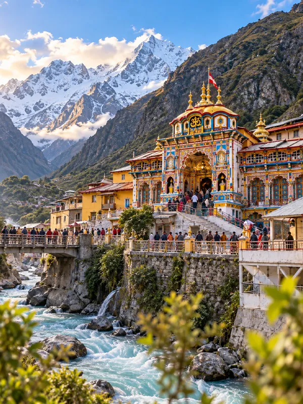
Badrinath Yatra Road Condition 2026
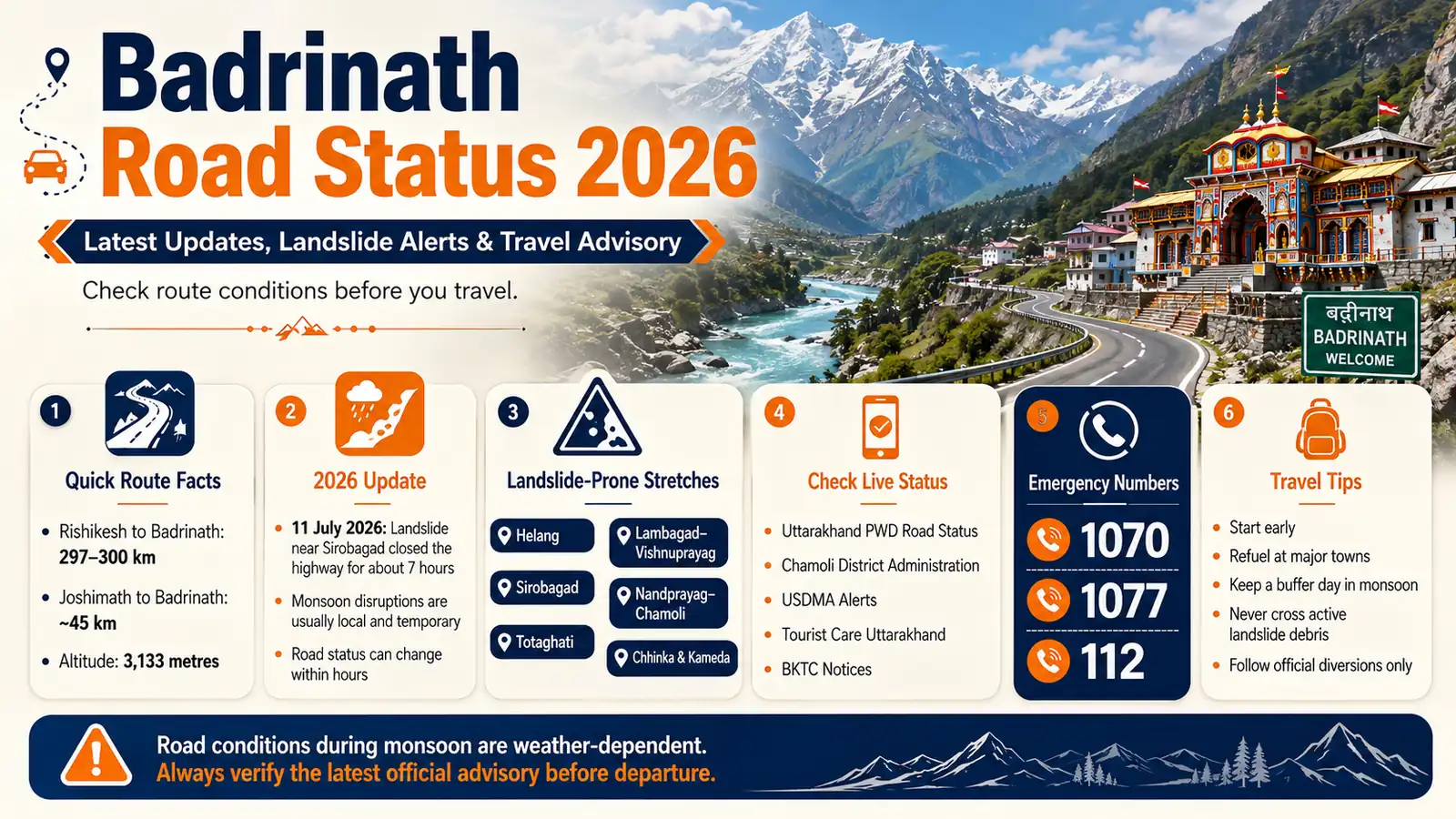
The Badrinath route remains weather-dependent through the monsoon months, with temporary debris and landslide-related disruptions reported on vulnerable stretches — most recently a landslide near Sirobagad in Rudraprayag district that closed the highway for about seven hours on 11 July 2026. Closures like this are typically localized rather than corridor-wide, and most clear within hours, though larger landslides or infrastructure damage can take considerably longer. Road status can change within hours during this season, so treat "open" as a snapshot, not a guarantee.
This article covers what's actually driving these disruptions, which stretches see recurring trouble, and exactly where to check before you leave.
Quick distance reference:
Quick distance reference: Rishikesh to Badrinath is approximately 297–300 km by road (government sources round this slightly differently); Joshimath to Badrinath is about 45 km; Badrinath sits at an altitude of 3,133 metres.
Quick distance reference: Rishikesh to Badrinath is approximately 297–300 km by road (government sources round this slightly differently); Joshimath to Badrinath is about 45 km; Badrinath sits at an altitude of 3,133 metres.
What's Been Happening on the Route in 2026
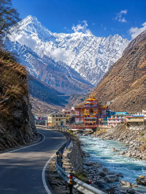
The Badrinath National Highway (connected via the Rishikesh–Badrinath–Mana corridor, historically referenced as NH-58 in some official material) saw routes reported open and motorable through mid-July. Monsoon rainfall through July and August brought the usual seasonal disruption:
- 11 July 2026: A landslide at Sirobagad in Rudraprayag district closed the highway for roughly seven hours before it was cleared and traffic resumed — a good example of how these disruptions typically play out: sudden, localized, and cleared within a working day.
- Recurring trouble spots: Locations including Helang, Totaghati, Nandprayag, Chhinka, and Kameda have a documented history of debris and landslide-related disruption in past monsoon seasons. Whether any of these are currently affected depends on the day's rainfall — check official sources rather than assuming.
- Planned infrastructure work also periodically affects sections of this corridor independent of weather, so a closure notice isn't always monsoon-related.
A closure at one specific point doesn't mean the entire Rishikesh–Badrinath corridor is shut — sections often stay open on either side of an affected stretch. Historical closures on this route have ranged from a few hours to, in rarer cases involving major debris clearance or planned repair work, several weeks.
Why This Route Is Sensitive During Monsoon
The Badrinath highway runs through young Himalayan terrain, cut into steep river-valley slopes along the Alaknanda. A few structural reasons this stretch sees repeat disruption:
- Loose, geologically young rock in the Chamoli and Rudraprayag sections is prone to debris flow after sustained rain.
- Narrow, single-carriageway sections mean even a modest landslide can block both directions of traffic.
- The Chardham Mahamarg Vikas Pariyojana (CMVP), the government's wider all-weather road-widening programme covering roughly 825 km across all four Dham corridors in 53 packages, is still incomplete in patches. A 2025 Ministry of Road Transport & Highways update reported around 629 km finished at that time — these figures describe the broader multi-route programme, not the Badrinath corridor specifically, so treat them as background context rather than a Badrinath-specific completion percentage.
Road-widening and improvement work continues on parts of this network, so travelers may encounter construction-related traffic management in addition to weather-related disruption. The corridor also serves as a strategic route toward the India-China border, which has meant substantial investment in its upkeep — but that doesn't eliminate monsoon landslide or debris risk on any given day.
Landslide-Prone Stretches to Watch
Locations that have experienced recurring debris or landslide-related disruption in past monsoon seasons include:
| Stretch | Typical Issue |
|---|---|
| Helang (near Joshimath) | Debris flow after heavy rain |
| Sirobagad (Rudraprayag) | Site of a July 2026 landslide closure |
| Totaghati | Known sensitive slope, periodic road work |
| Lambagad–Vishnuprayag | Occasional rockfall on curves |
| Nandprayag–Chamoli | Debris blockages during monsoon |
| Chhinka, Kameda | Historically recurring landslide points in Chamoli district |
This isn't a ranked list of which stretch is "worst" — conditions vary by season and rainfall. It's a guide to where you're more likely to encounter a delay, so you can build in buffer time accordingly.
Where to Check the Live Status Before You Travel
Don't rely on any single blog (including this one) for the day-of decision. Cross-check these official sources:
- Uttarakhand PWD Road Status — the primary source for actual road closure/reopening information
- Chamoli District Administration's Badrinath Yatra bulletin — posts corridor-specific updates during the yatra season
- USDMA (Uttarakhand State Disaster Management Authority) — issues road and weather alerts, and links through to the PWD road-status system
- Uttarakhand Tourist Care weather and advisory page (registrationandtouristcare.uk.gov.in) — pulls a live forecast for each Dham and posts yatra advisories
- BKTC (badrinath-kedarnath.gov.in) — posts temple and yatra-specific notices
- Emergency helplines — 1070 (State Emergency Operation Centre), 1077 (District Emergency Operation Centre), and 112 for immediate emergency services
If the Main Route Is Blocked
A commonly used alternate runs via Kotdwar–Pauri–Srinagar, rejoining the main corridor before Rudraprayag. It's worth knowing this exists — but it only helps if the disruption is on the lower Rishikesh–Devprayag stretch. It does not bypass closures further north toward Karnaprayag, Chamoli, Joshimath, or the final approach to Badrinath. Don't assume this route solves every closure; follow the specific diversion announced by local police or district administration rather than deciding on your own to take it.
Practical Tips for Traveling During an Uncertain Season
- Start early in the day to allow more buffer time for delays and changing mountain-road conditions.
- Refuel at major towns — Rudraprayag, Karnaprayag, and Joshimath — before entering longer mountain stretches, rather than counting on a specific fuel stop being operational.
- Don't try to cross active landslide debris. Wait for clearance teams (BRO/PWD) rather than attempting to drive or walk around fresh debris.
- Build a buffer day into your itinerary, especially if you're traveling in July or August. A same-day round trip leaves no room for a multi-hour closure.
- Tell someone your route plan each morning before you set off, and don't rely entirely on mobile connectivity holding up ahead.
- A reported closure doesn't mean the whole route is shut. Check the exact location, expected reopening time, and official diversion before changing your plans.
- Save the emergency helpline numbers (1070, 1077, and 112) in your phone before you start the drive, not after you need them.
Frequently Asked Questions
Q1. Is the Badrinath road open right now?
Ans: Conditions can change quickly during monsoon season. Check Uttarakhand PWD Road Status, the Chamoli District Badrinath Yatra bulletin, and Tourist Care Uttarakhand's advisory page immediately before you travel.
Q2. Which stretches of the Badrinath highway see the most landslide activity?
Ans: Several locations have a documented history of recurring debris or landslide-related disruption, including Helang, Totaghati, Sirobagad, Chhinka, Kameda, and the Nandprayag–Chamoli stretch. This isn't a ranking — conditions vary with rainfall and current road work.
Q3. When is the Badrinath route most likely to be disrupted?
Ans: July through mid-September, during the monsoon, sees the highest risk of debris flow and temporary closures.
Q4. How long do landslide closures on this route usually last?
Ans: It varies widely — minor debris blockages are often cleared within a few hours, while major landslides or damaged road sections have taken anywhere from a day to several weeks to fully repair. Always check the current official reopening estimate rather than assuming a typical duration.
Q5. Is it safe to travel to Badrinath during monsoon?
Ans: Travel is possible, but heavy rain can trigger landslides, debris, and temporary closures that create real delays and safety risks. Check official advisories before departing, and be prepared to postpone if authorities advise against travel.
Q6. What should I do if I encounter a landslide on the road?
Ans: Don't attempt to cross active debris. Wait at a safe distance for BRO or PWD clearance teams.
Q7. Does the Badrinath corridor get priority maintenance?
Ans: It has received substantial road-improvement and strategic-road investment, since it also serves as a route toward the India-China border. That investment doesn't eliminate monsoon landslide or debris risk on any given day.
Q8. What's the emergency helpline for road issues on this route?
Ans: Call 1070 (State Emergency Operation Centre) or 1077 (District Emergency Operation Centre) for disaster-related information, or 112 for immediate emergency services.
Q9. Is there an alternate route if the main road is blocked?
Ans: A commonly used alternate runs via Kotdwar–Pauri–Srinagar, rejoining the main corridor before Rudraprayag. It only helps for closures on the lower Rishikesh–Devprayag stretch — it doesn't bypass closures further north toward Karnaprayag, Chamoli, Joshimath, or Badrinath. Follow the diversion specifically announced by local authorities rather than deciding to reroute on your own.
Q10. Does the Badrinath highway close completely during heavy rain?
Ans: A closure at one point doesn't necessarily mean the entire Rishikesh–Badrinath corridor is shut — sections often stay open on either side of the affected stretch. That said, individual sections have been fully closed for anywhere from a few hours to several weeks during major incidents, so check the current status rather than assuming.
Q11. Should I cancel my Badrinath trip if I see a road closure report?
Ans: Not automatically — first check the exact location, expected reopening time, and official diversion. If authorities advise postponing or conditions are worsening, follow that guidance rather than pushing ahead.
Final Word
The Badrinath route isn't unsafe by default, but it is genuinely weather-dependent for a good stretch of the pilgrimage season. The right approach isn't to avoid travel out of caution or to assume the road is always fine — it's to check the current status through official channels on the morning you leave, build in buffer time, and adjust your plan if a closure is active.
- Suggested Trip: Badrinath Tour Packages
Badrinath Travel Guide



Badrinath Travel Packages


Important Safety Notice
Beware of Fake Char Dham & Kedarnath Helicopter Booking Websites
Fake websites, WhatsApp accounts and advertisements may impersonate genuine travel companies or helicopter operators. Always verify before paying.