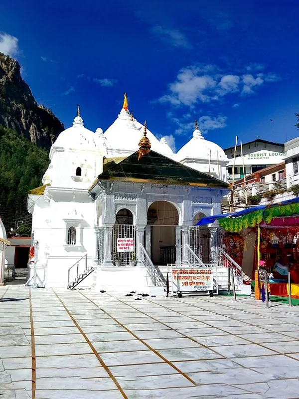
Gomukh- The Source of the Ganga River
Gomukh is not a glacier. It's the snout — the terminus — of the Gangotri Glacier, and that distinction gets blurred on almost every travel page written about it. This is the point where the Bhagirathi River comes out of the ice, where a shepherd's legend gave a melting cave its name, and where more than a century of measurement shows, in hard numbers, how much ground that ice has actually lost.
What Is Gomukh, Really?
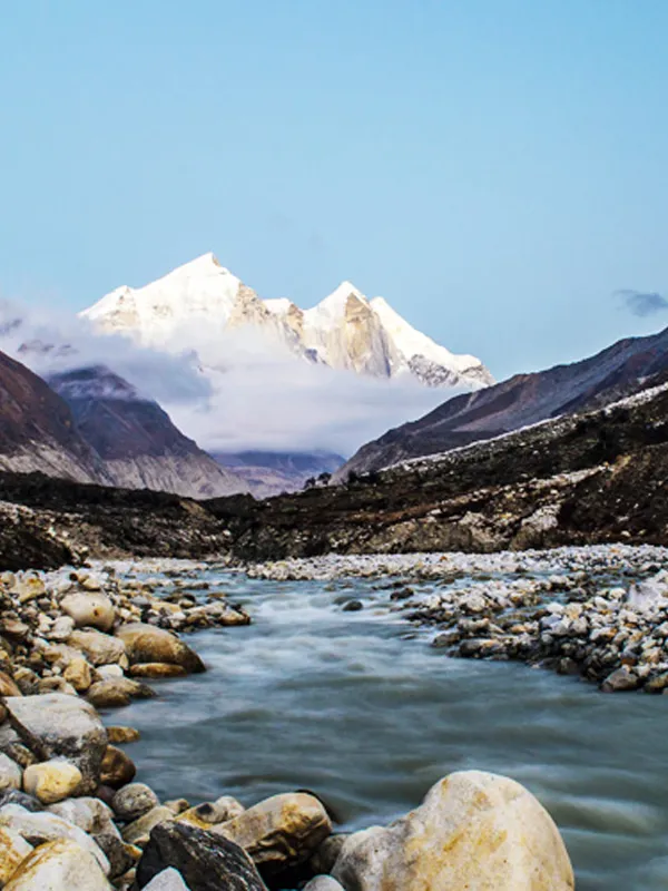
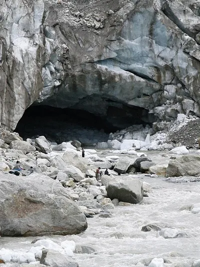
Gomukh (also spelled Gaumukh) is the terminus of the Gangotri Glacier, in Uttarkashi district, Uttarakhand. The Bhagirathi River — one of the two main headstreams that eventually form the Ganga — physically emerges from the ice at this point. Elevation figures vary by source: the Uttarkashi district administration lists 4,023 m, the National Mission for Clean Ganga gives 3,892 m, and most scientific papers round it to about 4,000 m. Its name means "mouth of a cow," after the shape the ice opening once had — a shape that's changed considerably since.
Gomukh is revered as the physical source of the Bhagirathi. The wider mythology of Ganga's descent to Earth is a separate story tied to King Bhagiratha and Lord Shiva — the two are connected in pilgrimage tradition, but one is a location and the other is a legend, and it's worth not collapsing them into the same sentence.
Where the Name Comes From
"Gomukh" combines two Hindi words: go or gau, meaning cow, and mukh, meaning mouth. A popular local legend says a shepherd boy searching for a lost sheep wandered close to the glacier and noticed the icy opening looked exactly like a cow's mouth. That's the story you'll find repeated across travel sites — but no primary Puranic text has been located that records this exact tale, so it's best treated as folk etymology rather than scripture. What isn't in dispute is that the resemblance was real: travel accounts and photographs from the 20th century confirm the shape, not just the name.
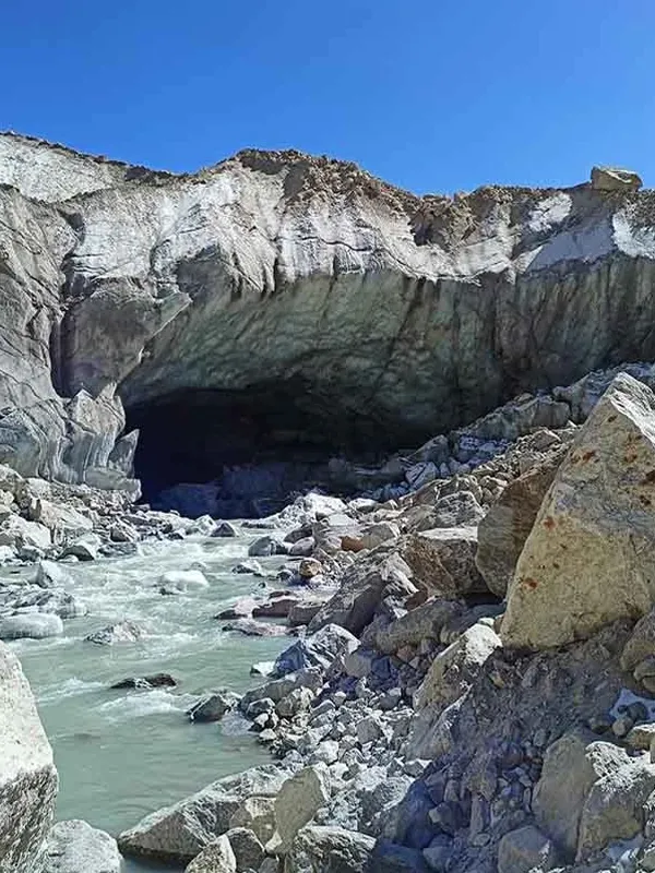
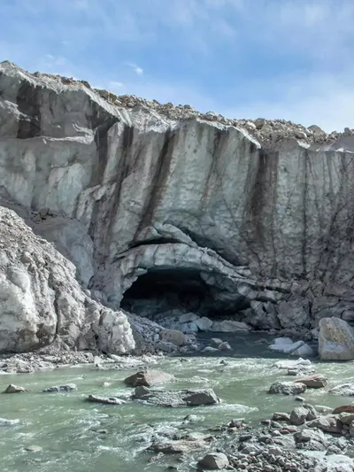
What most people don't realize is that the name may no longer fit what's actually there. If you look at photographs of the glacier terminus from the early 2000s versus today, the cave-like "mouth" has changed shape substantially — and on 26 July 2016, following heavy monsoon rain, a large section of the ice front collapsed and washed away entirely. Trekking guides who visited Gomukh regularly in the 2000s often describe the current opening as barely recognisable compared to what earlier pilgrims saw. The name has outlived the shape that inspired it.
The Puranic Legend: Why Hindus Consider This Sacred Ground
The religious weight behind Gomukh comes from the larger legend of Ganga's descent to earth, recounted with variations across the Ramayana's Bala Kanda, the Mahabharata's Anushasana Parva, and the Vishnu and Skanda Puranas.
The story begins generations before Gomukh enters the picture. King Sagara of the Ikshvaku dynasty performed a hundred Ashwamedha (horse sacrifice) rituals. Fearing his growing power, the god Indra stole the sacrificial horse and hid it near the hermitage of the meditating sage Kapila. Sagara's 60,000 sons, searching for the horse, disturbed the sage — who, in his fury, reduced them all to ash with a glance. Kapila told the grieving dynasty that only the waters of the celestial Ganga, brought down from the heavens, could liberate their souls.
Several generations later, King Bhagiratha — an ancestor of Lord Rama — took up the task. He performed intense penance, first pleasing Brahma, who agreed to send Ganga down but warned that her force would shatter the earth on impact. Only Lord Shiva could absorb that force. Shiva caught the descending river in his matted locks (jata) and released her gradually as several gentler streams, one of which became the river we know today.
In gratitude to the king whose devotion made it possible, tradition holds that stream was named Bhagirathi, after Bhagiratha — and Bhagirathi is the name given to the river that emerges from the Gangotri Glacier at Gomukh. The river is called Ganga only later, downstream, after the Bhagirathi merges with the Alaknanda at Devprayag.
There's a smaller postscript to the legend worth knowing too. As Ganga travelled onward with Bhagiratha, her waters flooded the hermitage of Sage Jahnu, who angrily drank the entire river in one gulp. Bhagiratha's pleading persuaded Jahnu to release her — from his ear — earning the river another name still used in scripture: Jahnavi, "daughter of Jahnu." The everyday Hindi phrase Bhagirath Prayas — used for a task demanding almost superhuman persistence — comes from this same legend of Bhagiratha's effort to bring Ganga down. It refers to his labour, not to the glacier itself; that's a distinction worth keeping straight.
Early European Exploration of Gangotri and Gomukh
Gomukh drew outside scientific attention long before anyone wrote a trekking blog about it. James Baillie Fraser reached Gangotri in 1815. Two years later, in 1817, John Hodgson and James Herbert reached Gaumukh itself, leaving one of the earliest European accounts of the glacier and its surroundings.
Hodgson didn't plant a modern geodetic marker — he simply described what he saw, in the terminology available to him at the time. But that description still turned out to matter. Later researchers, working with subsequent maps, photographs and satellite data, have used Hodgson's 1817 account as a historical reference point to reconstruct how far the terminus has moved since. Glaciologist Milap Chand Sharma of Jawaharlal Nehru University has cited this comparison as showing more than 3 kilometres of retreat over roughly two centuries — a figure built on the 1817 account, and worth keeping separate from the more tightly measured 1935–2022 dataset below.
Since then, Gomukh has become one of the more closely tracked glacier termini in the Indian Himalaya, monitored through Geological Survey of India topographic maps, satellite remote sensing, and repeated ground photography spanning nearly a century.
The Numbers: How Fast Is Gomukh Actually Retreating?
This is where the headline figures need separating from the noise, because the retreat rate isn't constant — it has moved through distinct phases, and the most recent one is the fastest on record.
| Period | Retreat Rate | Source |
|---|---|---|
| 1935–1996 | ~20 m per year | Wadia Institute of Himalayan Geology |
| 1980–2001 | ~21 m per year | Journal of Geological Society of India, 2023 |
| 2001–2006 | ~7 m per year (temporary slowdown) | Journal of Geological Society of India, 2023 |
| 2006–2017 | ~22 m per year | Journal of Geological Society of India, 2023 |
| 2017–2022 | ~34 m per year | Journal of Geological Society of India, 2023 |
| 1935–2022 (total) | 1,727 ± 51 m overall retreat | Wadia Institute / GSI comparative study |
Read across the full span, the glacier's terminus has moved back roughly 1.7 km since 1935 alone. The 2017–2022 rate is the outlier: at 33.8 m/year, it's about 1.5 times the 21.9 m/year measured for 2006–2017 — a 54% jump, not the "nearly doubled" figure you'll see floating around some summaries of this data.
That 1935–2022 dataset is the most rigorously documented long-term record available, but it isn't the last word. The Wadia Institute of Himalayan Geology and Uttarakhand's State Disaster Management Authority have continued monitoring the glacier through 2025, publishing periodic reports. None of that later monitoring has produced a new terminus-retreat figure with the same rigor as the 1935–2022 study, so treat 2022 as the most recent rigorously measured retreat figure, and 2025 as the most recent monitored year — those are two different claims.
Separately, a 2025 study led by IIT Indore, using the SPHY hydrological model to reconstruct discharge across the wider Gangotri Glacier System from 1980 to 2020, found the mean annual discharge running at about 28 m³/s, with snowmelt contributing roughly 64% of that flow, glacier melt about 21%, rainfall-runoff about 11%, and baseflow the remainder. Peak discharge — around 129 m³/s — has shifted from August to July since the 1990s, and the snowmelt share has been declining while rainfall-runoff and baseflow have grown. The study did not find a significant trend in annual precipitation or glacier melt itself, which is a detail often left out of the "10% snowmelt decline" headline that circulated when the study was reported — the real finding is a shifting mix of water sources, not a single clean number.
How Big Is the Gangotri Glacier, and Where Does It Sit Among Himalayan Glaciers?
Gomukh is only the visible tip of a much larger ice body. The Gangotri Glacier itself:
- Stretches roughly 30 km in length — one of the longest glaciers in the Indian Himalaya
- Varies considerably in width along its length; older references commonly cite 2–4 km, though width depends on exactly where along the glacier you measure
- Is commonly cited in reference literature at over 27 cubic kilometres of ice, though this figure predates some of the more recent system-wide remeasurements
- Originates in a cirque below the Chaukhamba massif (6,853–7,138 m)
- Feeds into and from several tributary glaciers, including Chaturangi, Raktavaran, and Meru
This makes Gangotri one of the largest and most extensively studied valley glaciers in the Indian Himalaya. The peaks around it — Shivling, Meru, Thalay Sagar, and the Bhagirathi group — are themselves major mountaineering destinations, largely because the glacier offers a relatively direct approach into some of the most demanding climbing terrain in the Garhwal Himalaya.
Gomukh's Place Inside a Living Ecosystem
Gomukh doesn't exist in isolation — it sits at the heart of Gangotri National Park, which the Wildlife Institute of India lists at about 2,390 sq. km, spanning elevations from roughly 1,800 m to 7,083 m.
The park's biodiversity is easy to overlook when the focus is on ice and pilgrimage, but it's substantial. WII documentation lists around 15 mammal species and about 150 bird species, including the snow leopard, Himalayan brown bear, Himalayan tahr, bharal (blue sheep), and the Himalayan monal.
The broader Bhagirathi basin was separately designated the Bhagirathi Eco-Sensitive Zone by a Ministry of Environment, Forests and Climate Change gazette notification dated 18 December 2012. It covers 4,179.59 sq km of watershed from Gaumukh all the way to Uttarkashi — a buffer classification distinct from, and considerably larger than, the national park boundary itself. It was originally meant to restrict large hydropower projects, riverbed mining, and unregulated land-use change across the wider catchment that feeds the glacier system.
That protection hasn't stayed fixed. The Ministry amended the notification on 16 April 2018 after the Uttarakhand government objected that the original terms were "anti-development," loosening restrictions to allow more civic infrastructure. A further amendment followed in 2022, and regulatory oversight — including recent NGT attention to construction along the Gangotri highway — has continued since. The zone is still legally protected, but the terms have moved more than once since 2012, and anything describing it as a fixed development freeze is out of date.
A Site Shaped by Disaster as Much as Devotion
Gomukh's modern history has been marked by sudden, visible change rather than slow decline alone. Heavy precipitation during the 2013 Uttarakhand disaster affected the wider Gangotri Glacier region and has since been studied for its effect on the glacier's frontal dynamics. Then, in July 2016, following heavy monsoon rain, a large section of the ice front collapsed and washed away — an event that substantially altered the shape of the opening the site was named for. A year later, in July 2017, a debris flow linked to the nearby Meru Glacier stream — triggered by intense rain and slope failure — created a small proglacial lake and reshaped part of the ground near Gomukh.
None of this should be read as a single unfolding disaster. The 2013 Kedarnath floods and the 2021 Chamoli disaster, both of which killed hundreds of people, had their own distinct meteorological and geomorphological causes. They're evidence of how exposed Uttarakhand's high-mountain terrain is to extreme rainfall, slope failure and glacial hazards generally — not proof that the same mechanism is reshaping Gomukh specifically. It's tempting to draw a straight line between them; the science doesn't support drawing it that tightly.
A Point of Global Hindu Connection
A story often repeated about Gomukh is that in 1972, Sir Seewoosagur Ramgoolam, then Prime Minister of Mauritius, carried holy water from Gomukh back to Mauritius and mixed it into Grand Bassin, a crater lake later renamed Ganga Talao for the island's Hindu community. It's a good story and it's widely repeated — but a specific, primary Mauritian government or archival source for the exact 1972-and-Gomukh sequence wasn't found in this research. Treat it as a well-known tradition rather than a fully documented historical event until a stronger source turns up.
Why This Matters Beyond the Trek
Understanding Gomukh's history changes what the walk to reach it actually means. This isn't simply a scenic endpoint — it's a site where a documented record spanning more than two centuries intersects with a religious narrative several thousand years older, and where long-term measurement shows the terminus has retreated substantially over the past century. Pilgrims in the 1980s stood somewhere the ice no longer reaches.
If you're planning the physical trek itself — permits, route, best season, and cost — that practical side is covered in detail in our companion piece, the Gangotri to Gomukh trek guide. This piece answers a different, usually earlier question: what is this place, and why has it held people's attention for thousands of years before anyone needed a permit to reach it?
Frequently Asked Questions
Q1. Why is it called Gomukh?
The name means "mouth of a cow" in Hindi. A popular local legend says a shepherd boy noticed the glacier's icy opening resembled a cow's mouth — that's a folk story, not a scripture citation, though the resemblance itself was well documented before the shape changed in recent decades.
Q2. Is Gomukh mentioned in Hindu scriptures?
Gomukh itself isn't named in the classical texts. What appears in the Ramayana's Bala Kanda, the Mahabharata's Anushasana Parva, and the Vishnu and Skanda Puranas is the broader legend of Ganga's descent through Bhagiratha and Shiva — a story pilgrimage tradition has since connected to this location, not one that names Gomukh directly.
Q3. Who was King Bhagiratha, and why is the river named after him?
Bhagiratha was a king of the Ikshvaku (solar) dynasty, an ancestor of Lord Rama, who performed intense penance to bring the Ganga to earth and liberate the souls of his ancestors. Tradition holds that the river which emerged was named Bhagirathi in his honour — the same Bhagirathi that flows out of Gomukh today.
Q4. When was Gomukh first explored by outsiders?
James Baillie Fraser reached Gangotri in 1815. John Hodgson and James Herbert reached Gaumukh itself in 1817, leaving one of the earliest recorded European accounts of the glacier.
Q5. How much has the Gangotri Glacier retreated?
The best-documented figure comes from a 1935–2022 study: 1,727 ± 51 metres of retreat. Separately, comparisons using an 1817 historical account have been cited as showing more than 3 km of retreat over roughly two centuries — a looser, older estimate that shouldn't be confused with the more tightly measured modern dataset.
Q6. Does Gomukh still look like a cow's mouth?
Not really. A major section of the ice front collapsed on 26 July 2016 following heavy monsoon rain, substantially altering the shape of the opening. A debris flow near the Meru Glacier stream in July 2017 reshaped part of the surrounding ground as well.
Q7. How big is the Gangotri Glacier?
It stretches roughly 30 km, making it one of the longest glaciers in the Indian Himalaya. Width varies considerably along its length, and its commonly cited volume of over 27 cubic kilometres comes from older reference literature rather than the most recent system-wide remeasurement.
Q8. What wildlife lives around Gomukh?
Gangotri National Park, which surrounds Gomukh and covers about 2,390 sq km, is documented habitat for snow leopards, Himalayan brown bears, Himalayan tahr and bharal, with around 150 bird species recorded by the Wildlife Institute of India.
Q9. Is Gomukh the same as Gangotri?
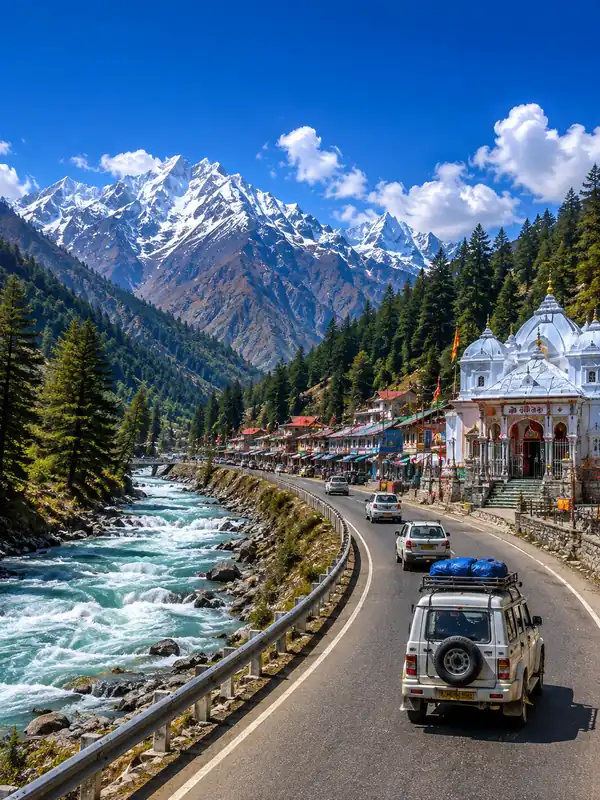
No. Gangotri is a temple town, the major pilgrimage centre. Gomukh is the glacier terminus itself, where the Bhagirathi physically emerges from the Gangotri Glacier.
Q10. Why is Gomukh sometimes connected to Mauritius?
A widely repeated story holds that in 1972, Mauritius's then Prime Minister carried holy water from Gomukh back to mix into Grand Bassin, later renamed Ganga Talao. It's a well-known tradition, though a strong primary source for the exact sequence of events wasn't found in this research.
Q11. What's driving the acceleration in Gomukh's retreat?
The 2017–2022 retreat rate of 33.8 m/year was about 1.5 times the 21.9 m/year measured for 2006–2017 — a 54% increase, not a doubling. Long-term glacier change is driven by a mix of temperature, snowfall, precipitation patterns and glacier dynamics rather than any single factor.
Q12. Is Gomukh linked to the 2013 Kedarnath floods or the 2021 Chamoli disaster?
Not directly. Those disasters had their own distinct causes and are evidence of how exposed Uttarakhand's high mountains are to extreme rainfall and slope failure generally — not proof of a shared mechanism reshaping Gomukh specifically.
Conclusion
Gomukh's story runs on two separate timelines that happen to end up in the same place. One is mythological, reaching back to the Ramayana and Mahabharata. The other is a measured scientific record that's been building since Hodgson and Herbert's 1817 account — and the two shouldn't be flattened into a single narrative, however tempting that is for a good story. What the numbers do show is real: the terminus has retreated substantially over the past century, most sharply in the last decade measured. Knowing this history doesn't replace the practical planning a Gomukh visit needs, but it explains why people have made the effort to stand there for a very long time.
Gangotri Travel Guide



Gangotri Travel Packages
Important Safety Notice
Beware of Fake Char Dham & Kedarnath Helicopter Booking Websites
Fake websites, WhatsApp accounts and advertisements may impersonate genuine travel companies or helicopter operators. Always verify before paying.