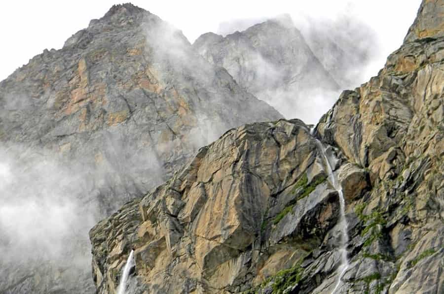
Uttarakhand has fifteen hill stations worth planning a trip around, and they don’t offer the same experience. Nainital is a lake town that gets loud in peak season. Binsar is a wildlife sanctuary where you might not see another car for an hour. Auli has actual ski slopes. This guide runs through all fifteen — what each one is known for, when to go, and how to get there — plus a few things most listicles leave out.
Quick Answer: Nainital and Mussoorie are the safest first-timer picks — good roads, plenty of hotels, lake or Mall Road at the centre of things. Auli is where you go for snow and skiing, best January to March. Binsar and Kausani are the pick for anyone who wants mountains without the crowd.
Elevation and distance figures below vary by a few hundred metres or a few kilometres depending on the source — this is normal, since official Uttarakhand Tourism data, Wikipedia, and district records sometimes measure from slightly different points in the same town. Where sources disagree meaningfully, we’ve given a range instead of a single number. Treat every distance as approximate and confirm the route with your driver before you leave.
Best Time to Visit Uttarakhand Hill Stations
| Season | Months | Best For | Recommended Hill Stations |
|---|---|---|---|
| Summer | March – June | Escaping the heat, family trips | Nainital, Mussoorie, Ranikhet, Kausani |
| Monsoon | July – September | Waterfalls, greenery — landslide risk on hill roads | Lansdowne, Mukteshwar, Dhanaulti |
| Autumn | September – November | Clear mountain views, trekking | Chopta, Binsar, Almora, Kausani |
| Winter | December – February | Snowfall, bonfires | Auli, Chopta, Mussoorie, Dhanaulti |
Auli is the one exception to the general “March–June and September–November” rule: for actual skiing, aim for January to March specifically. Snowfall isn’t guaranteed on any fixed date, so build in flexibility if snow is the whole point of your trip.
1. Nainital
- Region: Kumaon
- Elevation: Approx. 1,940–2,080 m (sources vary)
- Nearest Airport: Pantnagar, approx. 65–70 km
- Nearest Railhead: Kathgodam, approx. 23–34 km
- Top Attractions: Naini Lake, Naina Devi Temple, Tiffin Top, Snow View Point, Mall Road
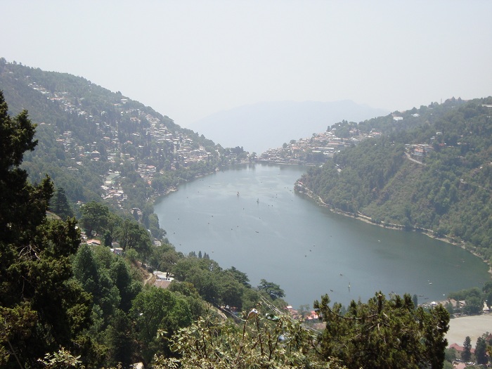
Nainital is built around Naini Lake, and boating on it is the one activity almost everyone does regardless of how long they stay. Tiffin Top is a horse-ride or short hike away; Snow View Point has a ropeway if you’d rather skip the climb. Mall Road gets genuinely crowded in May–June and around Diwali — traffic on the approach road backs up for hours some weekends. If you can travel on a weekday, or shift your dates to late March or October, you’ll get the same lake without the queue for boating tickets.
2. Almora
- Region: Kumaon
- Elevation: Approx. 1,650 m
- Nearest Airport: Pantnagar, approx. 120 km
- Nearest Railhead: Kathgodam, approx. 87 km
- Top Attractions: Kasar Devi Temple, Bright End Corner, Zero Point
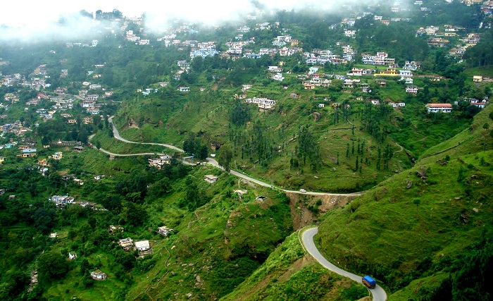
Almora isn’t a checklist town. It’s narrow bazaar lanes, copperware shops, Kumaoni thalis, and a climate cool enough that even peak summer feels manageable. Kasar Devi, just outside town, draws visitors for the temple and for its long history of attracting travellers and thinkers — Swami Vivekananda stayed here, and the area has a reputation, not officially confirmed by any scientific body we’d cite, for unusual geomagnetic readings. Take that as folklore rather than fact. Almora also works as a stopover if you’re continuing on to Binsar or Kausani.
3. Ranikhet
- Region: Almora district, Kumaon
- Elevation: Approx. 1,830 m
- Nearest Airport: Pantnagar, approx. 118 km
- Nearest Railhead: Kathgodam, approx. 78 km
- Top Attractions: Jhula Devi Temple, Upat Golf Course, Katarmal Surya Temple, Chaubatia Gardens
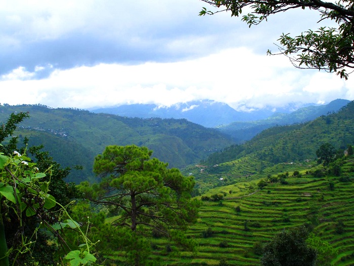
Ranikhet is still administered largely as a Kumaon Regiment cantonment, which is why it hasn’t been overrun by the commercial sprawl you see in Nainital. The Upat Golf Course sits inside oak and pine forest — a scenic, high-altitude course, not a manicured resort layout. People tend to treat Ranikhet as a quick stop on the way to somewhere else. That’s the mistake. Chaubatia’s apple orchards and the trekking trails nearby reward a slower pace.
4. Binsar
- Region: Almora district, Kumaon
- Elevation: Approx. 2,420 m
- Nearest Airport: Pantnagar, approx. 150 km
- Nearest Railhead: Kathgodam, approx. 120 km
- Top Attractions: Binsar Wildlife Sanctuary, Zero Point, Binsar Mahadev Temple
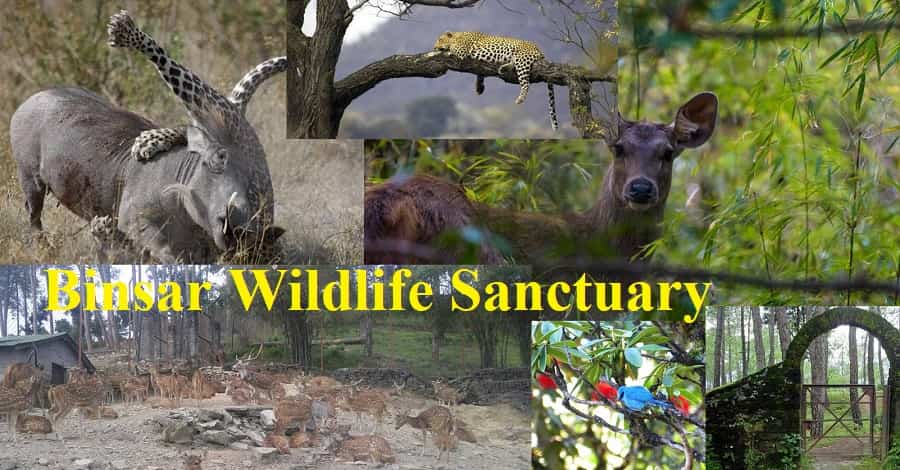
Binsar is a protected wildlife sanctuary first and a hill station second. Leopards and Himalayan black bears live in the oak, rhododendron, and deodar cover, along with a large resident and migratory bird population. Zero Point gives you Nanda Devi, Trishul, and the Panchachuli peaks in one sweep — on a clear morning. Afternoon cloud rolls in fast at this elevation, so go early. There’s a small sanctuary entry fee, which is standard for Uttarakhand’s protected forest areas.
5. Lansdowne
- Region: Pauri Garhwal
- Elevation: Approx. 1,700 m
- Distance from Delhi: Approx. 260–265 km by road
- Nearest Railhead: Kotdwar Railway Station, approx. 40 km
- Top Attractions: Bhulla Tal, Garhwal Rifles War Memorial, Tip N Top, St. Mary’s Church
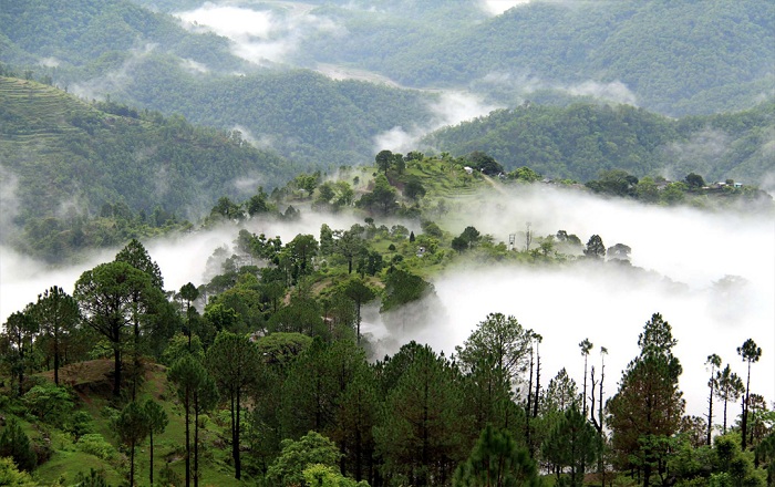
Lansdowne was set up as a British cantonment in 1887 and is still administered by the Garhwal Rifles, which keeps it noticeably cleaner and less commercial than most Uttarakhand hill towns. Bhulla Tal is an artificial lake with boating and a small zoo — pleasant, not spectacular. The Garhwal Rifles War Memorial is the stop worth making time for if you have any interest in military history. At roughly 260 km from Delhi, it’s a realistic weekend drive without the Mussoorie-level traffic on the way up.
6. Auli
- Region: Chamoli district, Garhwal
- Elevation: Approx. 2,500–3,050 m, depending on the point within Auli
- Nearest Airport: Jolly Grant Airport, approx. 280 km
- Nearest Railhead: Rishikesh, approx. 250 km
- Top Attractions: Auli Ski Resort, Auli Ropeway, Gorson Bugyal, Nanda Devi viewpoint
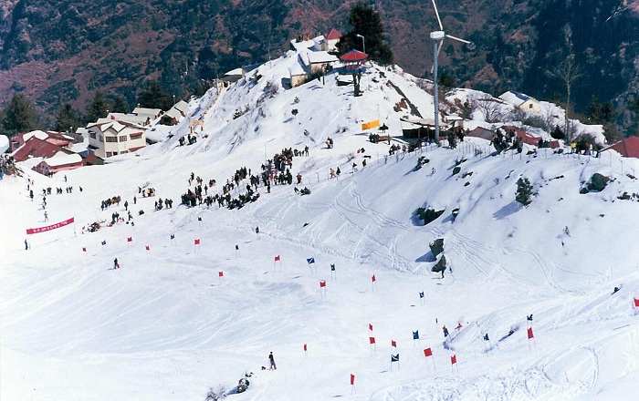
Auli is where India’s winter sports scene actually happens. It has hosted national and international skiing events, and gear rental plus short lessons are available on-site for first-timers. January to March is the strongest window for snow and skiing specifically — don’t assume December will deliver the same conditions. The ropeway from Joshimath is one of India’s highest and longest, at roughly 4 km, and it’s worth riding even outside ski season for the views alone. Operating hours and status shift with weather and maintenance, so check before you plan around it. Outside winter, the same slopes turn into green meadows good for short walks. Auli sits close to Joshimath, the winter seat of Badrinath, so it pairs naturally with a Char Dham or Badrinath leg of a longer trip.
- Check out: Skiing in Auli
7. Mussoorie
- Region: Dehradun district, Garhwal
- Elevation: Approx. 2,005 m (6,580 ft)
- Nearest Airport: Jolly Grant Airport, approx. 60 km
- Nearest Railhead: Dehradun Railway Station, approx. 34 km
- Top Attractions: Kempty Falls, Gun Hill, Camel’s Back Road, Mall Road, Lal Tibba, Landour
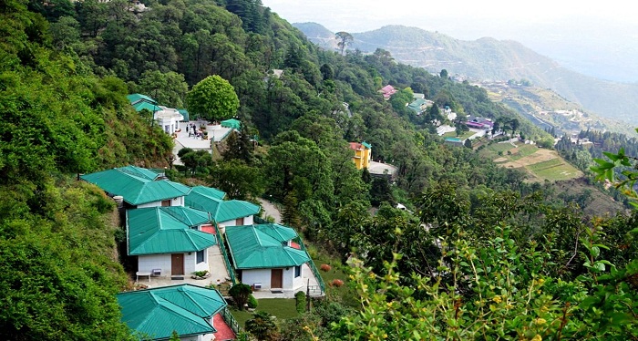
Mussoorie’s numbers hold up well across sources, which isn’t true of every hill station on this list. Gun Hill and Lal Tibba — the highest point around town at roughly 2,275 m — are both worth the trip for the sunrise view. What the brochures don’t tell you: Landour, the smaller cantonment town just above Mussoorie, is quieter and has better cafés than Mall Road itself. Stay there if you can. Kempty Falls is a solid family stop, but go before 9 AM on weekends, or you’ll spend more time in the parking queue than at the falls.
8. Kausani
- Region: Bageshwar district, Kumaon
- Elevation: Approx. 1,890 m
- Nearest Airport: Pantnagar, approx. 178 km
- Nearest Railhead: Kathgodam, approx. 141 km
- Top Attractions: Anashakti Ashram, Kausani Tea Estate, Rudradhari Falls
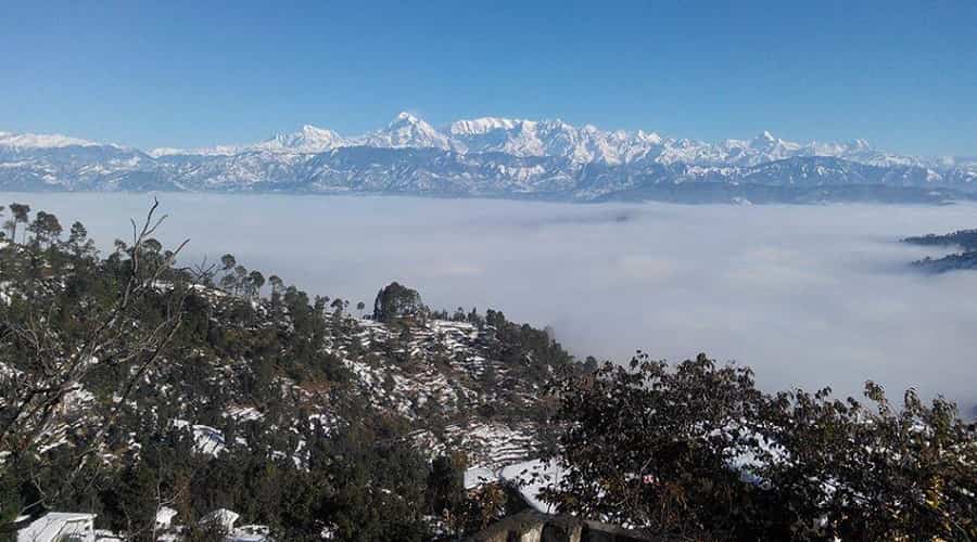
Gandhi visited Kausani in 1929 and called it the Switzerland of India — the name stuck, and the unbroken Himalayan skyline from town explains why. The Anashakti Ashram, where he wrote part of his commentary on the Gita, is worth the half-hour stop. Kausani’s tea estate is one of the few in this part of the Himalayas that’s actually open to visitors. It’s a reasonable base for Kumaon road trips toward Almora, Ranikhet, or Bageshwar — not, despite what some sites claim, a practical base for Adi Kailash, which is a separate, much longer route through the Pithoragarh region entirely.
9. Chopta
- Region: Rudraprayag district, Garhwal
- Elevation: Approx. 2,600–2,900 m, depending on the point within the valley
- Nearest Airport: Jolly Grant Airport, approx. 210 km
- Nearest Railhead: Rishikesh, approx. 180 km
- Top Attractions: Tungnath Temple, Chandrashila Peak, Deoria Tal
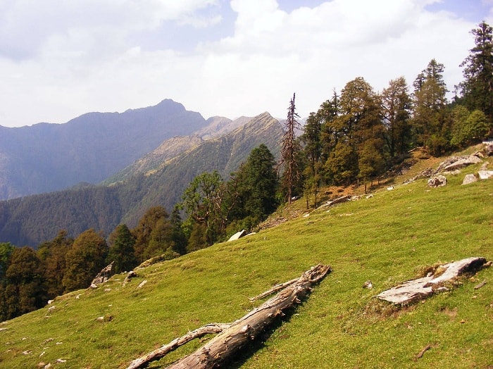
Chopta is the base for one of Uttarakhand’s best short treks. The walk to Tungnath — widely regarded as the world’s highest Shiva temple — runs roughly 3.5 to 4 km depending on your exact starting point and trail conditions. Push another 1.5 km uphill and you’re at Chandrashila Peak, with Nanda Devi, Trishul, and the Kedarnath range laid out in front of you. Deoria Tal, a small lake a short drive away, is a popular overnight camping spot. Winter treks past January need proper snow gear, and a local guide is a sensible call once the trail is fully under snow.
10. Dhanaulti
- Region: Tehri Garhwal
- Elevation: Approx. 2,000–2,300 m
- Nearest Airport: Jolly Grant Airport, approx. 60 km
- Nearest Railhead: Dehradun, approx. 35 km
- Top Attractions: Eco Park, Surkanda Devi Temple, deodar forest
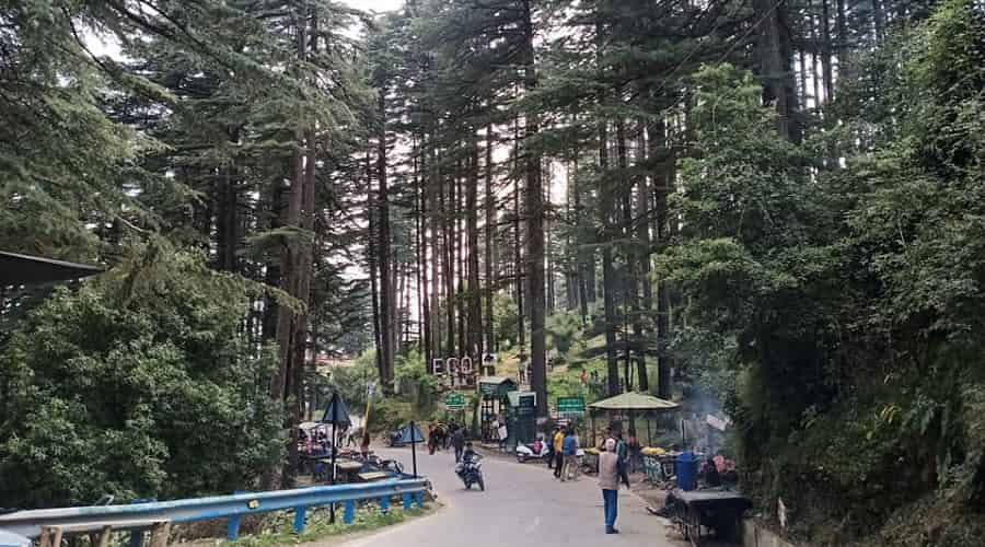
Dhanaulti sits about 24 km from Mussoorie and gets almost none of its traffic. The Eco Park is forest-department maintained, with short nature trails suited to families. Surkanda Devi Temple, an important Shakti shrine in the region, is reached from Kaddukhal by a moderate uphill walk or a ropeway, and the valley views from the top are the real reason to go. A lot of travellers are now picking Dhanaulti over Mussoorie specifically to skip the weekend jam.
11. Mukteshwar
- Region: Nainital district, Kumaon
- Elevation: Approx. 2,170–2,290 m (sources vary)
- Nearest Airport: Pantnagar, approx. 94 km
- Nearest Railhead: Kathgodam, approx. 70 km
- Top Attractions: Mukteshwar Temple, Chauli Ki Jali, apple orchard
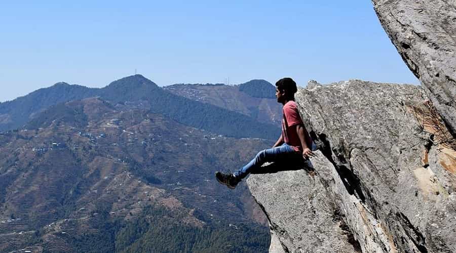
Mukteshwar’s main draw is Chauli-ki-Jali, a set of overhanging cliffs used for rock climbing and rappelling. Mukteshwar Temple sits at the town’s high point with unobstructed views toward Nanda Devi and Trishul. The town also grew up around the IVRI campus, one of the older veterinary research institutions in Asia — though access to the institutional grounds themselves may be restricted, so don’t plan a visit expecting to walk in.
12. Ramgarh
- Region: Nainital district, Kumaon
- Elevation: Approx. 1,800 m
- Top Attractions: Apple and apricot orchards, Gagar Mountain Range views
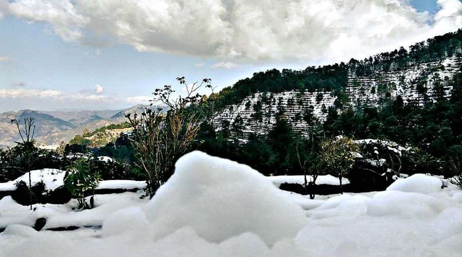
Ramgarh is known locally as the fruit bowl of Kumaon, and the orchards are genuinely the point — this isn’t a temple-and-viewpoint town, it’s somewhere you slow down for a couple of quiet days. It sits close enough to Nainital and Bhimtal to fold into a longer Kumaon circuit without adding a separate travel day.
13. Bhimtal and Sattal
- Region: Nainital district, Kumaon
- Distance: Approx. 25 km from Nainital; Kathgodam railhead approx. 20 km
- Top Attractions: Bhimtal Lake and island aquarium, Sattal’s cluster of seven interconnected lakes, birdwatching
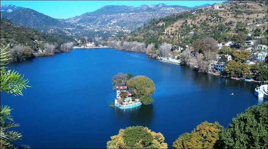
Bhimtal and Sattal are two separate lakes a few kilometres apart, not one destination — worth knowing before you plan your time. Bhimtal has an island with a small aquarium and is set up for boating, similar to Naini Lake but with a fraction of the crowd. Sattal is quieter still and better known among birdwatchers, with several species of Himalayan birds recorded around its interconnected lakes. Either makes a good half-day add-on if you’re already in Nainital.
14. Chakrata
- Region: Dehradun district, Garhwal
- Distance from Dehradun: Approx. 88 km
- Nearest Airport: Jolly Grant Airport, approx. 117 km
- Top Attractions: Tiger Falls, Deoban, pine and deodar forest trails
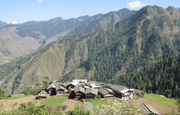
Chakrata is a former British cantonment that’s still a high-security military area, so access can come with restrictions — check current requirements before you plan a trip here rather than assuming it’s open like any other hill town. Tiger Falls is the main draw, about 20 km from the town centre with a roughly 5-km trek in. The pine and deodar forest around Deoban is genuinely less touristed than almost anywhere else on this list.
15. Munsiyari
- Region: Pithoragarh district, Kumaon
- Elevation: Approx. 2,195 m (7,200 ft)
- Nearest Airport: Naini Saini Airport, Pithoragarh, approx. 132 km
- Nearest Railhead: Kathgodam, approx. 279 km
- Top Attractions: Panchachuli peak views, base for glacier treks
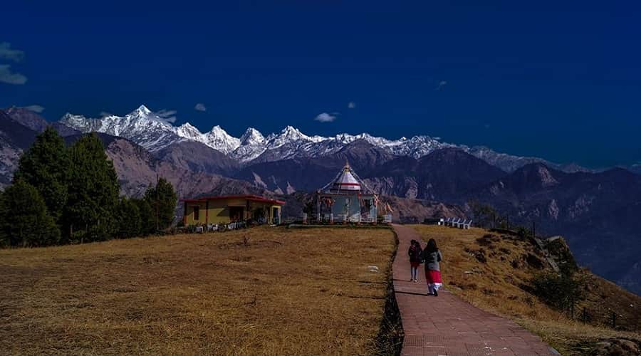
Munsiyari sits directly under the Panchachuli range and is the main jumping-off point for treks toward the Milam, Namik, and Ralam glacier regions — not just Milam, which is the version most articles repeat. It’s a long drive from anywhere, which is exactly why it stays quiet even in peak season.
How to Choose the Right Hill Station
Match your priority to the list below instead of trying to cover all fifteen in one trip:
- First-time visitor, family trip: Nainital or Mussoorie — best roads, most hotel options.
- Snow and skiing: Auli, specifically January to March.
- Trekking: Chopta, Mukteshwar, or Munsiyari.
- Quiet, low-crowd trip: Binsar, Kausani, or Ramgarh.
- Weekend from Delhi: Lansdowne. Chakrata works too, once you’ve confirmed current access.
- Combining with Char Dham or Badrinath travel: Auli, since it’s a short detour from Joshimath.
Common Mistakes to Avoid
- Booking hotels late for Holi, summer break, or Diwali. Nainital and Mussoorie sell out fast and prices climb sharply in the final two weeks before these dates.
- Driving Garhwal hill roads after dark. Visibility drops fast, and stretches near Chamba and Devprayag are more landslide-prone at night than in daylight.
- Skipping acclimatisation at altitude. Auli, Chopta, and Munsiyari all sit above 2,000 m. Go easy on day one if you’re arriving straight from the plains, and get medical attention if you notice symptoms that don’t settle.
- Ignoring monsoon road advisories. July through early September brings landslide risk on several Garhwal stretches. Check current advisories before you leave, not after you’re already on the road.
- Assuming digital payments work everywhere. Carry cash. Network coverage and card acceptance both drop off in smaller towns like Binsar, Chopta, and Munsiyari.
Indicative 2026 Trip Budget
These are editorial estimates, not quoted prices — actual cost depends on season, hotel category, and how you’re travelling. Assumptions: two people sharing a room, budget-to-mid-range hotels, and local transport included; peak-season surcharges are not factored in.
| Trip Type | Duration | Estimated Cost Per Person |
|---|---|---|
| Budget (Nainital or Mussoorie) | 3 days / 2 nights | ₹4,500 – ₹7,000 |
| Mid-range Kumaon circuit (Nainital–Almora–Kausani) | 5 days / 4 nights | ₹12,000 – ₹18,000 |
| Auli with ski gear rental | 4 days / 3 nights | ₹18,000 – ₹28,000 |
| Chopta–Tungnath–Chandrashila trek | 3 days / 2 nights | ₹6,000 – ₹10,000 |
Pro Tips
- Book hotels with flexible cancellation in peak season. Road closures and weather changes plans more often than travellers expect.
- Layer up even in summer — nights at Auli, Chopta, and Binsar drop sharply once the sun’s down.
- Morning light before the afternoon haze sets in gives the clearest mountain views, though this varies by season and location.
- If Char Dham travel is part of your plan, Auli or Mussoorie work well as an add-on that breaks up the long mountain drives.
Planning a Uttarakhand Hill Station Trip
If stitching several of these fifteen into one itinerary sounds like more coordination than you want to handle, Chardham Tour puts together custom Uttarakhand routes — a Binsar-Kausani loop for a quiet trip, or Chopta trekking paired with Auli for something more active.
Frequently Asked Questions
Which is the most beautiful hill station in Uttarakhand?
Depends what you’re after. Nainital is the most-visited for its lake, Auli for snow and skiing, Binsar for genuine wilderness. Most first-time visitors rate Nainital and Mussoorie highest overall.
Which is the coldest hill station in Uttarakhand?
There’s no single officially designated “coldest” hill station. Higher-altitude destinations — Auli, Chopta, Munsiyari — run colder through winter than lower towns like Nainital or Mussoorie.
What is the best time to visit hill stations in Uttarakhand?
March to June and September to November cover most destinations well. For snow and skiing at Auli specifically, January to March is the stronger window.
Which hill station in Uttarakhand is closest to Delhi?
Lansdowne and Chakrata are among the closer options, both under 300 km. Nainital is also relatively accessible. Exact distance depends on your starting point and route.
Is Mussoorie or Nainital better to visit?
Mussoorie suits colonial-era charm and easy Dehradun access. Nainital suits a lake-centred trip with more on-ground activity. Both get crowded in peak season — book ahead either way.
Which hill station is best for a honeymoon in Uttarakhand?
Nainital, Mukteshwar, and Dhanaulti are popular picks for scenery and quieter stay options.
Do Uttarakhand hill stations get snowfall in winter?
Auli, Chopta, Mussoorie, and Dhanaulti all see snow between December and February, with Auli offering the most consistent conditions for skiing. Snowfall isn’t guaranteed on any specific date — check the forecast before you commit to it as the reason for your trip.
Which hill stations are good for trekking?
Chopta (Tungnath–Chandrashila), Mukteshwar (Chauli Ki Jali), and Munsiyari (base for Milam, Namik, and Ralam glacier treks) are the strongest picks.
How many days are enough for a Uttarakhand hill station trip?
A single hill station like Nainital or Mussoorie needs 2–3 days. A Kumaon circuit — Nainital, Almora, Kausani, Binsar — needs 5–6 days at a comfortable pace.
Is it safe to drive to Uttarakhand hill stations during monsoon?
It needs caution rather than avoidance. Several Garhwal stretches are landslide-prone between July and early September. Check road advisories before you travel and avoid night driving in this window.
Which hill stations are the least crowded?
Binsar, Munsiyari, and Chakrata (once you’ve confirmed access) stay quieter than Nainital and Mussoorie even in peak season.
Can I combine a hill station trip with the Char Dham Yatra?
Yes. Auli pairs naturally with a Badrinath visit since both are close to Joshimath. Mussoorie or Dhanaulti also work as a short add-on near Rishikesh and Dehradun.
Final Word
Fifteen hill stations is a lot to choose from, and the honest answer is you don’t need to see all of them. Pick two or three that match what you actually want — lake town, ski slope, wildlife sanctuary, quiet forest — and build the trip around that instead of trying to do everything in one go. Book early if you’re travelling in peak season, and if you’d rather have someone else handle the routing, Chardham Tour’s travel team can build the itinerary around your dates.

Related Posts
Sayanachatti to Yamunotri Guide
Dharchula: Gateway to Adi Kailash, Om Parvat & Kailash Mansarovar