Uttarakhand sits in the lap of the Himalayas, and that’s exactly why it feels different from every other state in India. Towering seven-thousander peaks, glacier-fed rivers, ancient temples perched at the base of snow-covered mountains, and trekking routes ranging from gentle meadows to expedition-grade climbs — this state has all of it.
If you’re planning a trek, a pilgrimage, or simply want to know which peaks define Uttarakhand’s skyline, here’s a fact-checked, up-to-date list of the state’s 10 most important mountains.
Key Facts at a Glance
- Highest peak in Uttarakhand: Nanda Devi (7,817 m, UNESCO figure)
- Highest peak in the Gangotri region: Chaukhamba (7,138 m) — not Kedarnath
- Peaks above 7,000 m in the state: 12+
- Kedarnath and Kedarnath Dome are two separate summits; Kedarnath’s own height is disputed — 6,940 m (Wikipedia) vs 6,992 m (Indian Mountaineering Foundation register)
- Best trekking months: April–June and September–November
- Permits needed: Forest Department (national parks), Inner Line Permit (border areas), IMF clearance (expedition peaks)
Quick Comparison Table
| # | Peak | Height | Region | Trek Difficulty |
| 1 | Nanda Devi | 7,817 m | Kumaon (Chamoli) | Expedition-only, closed to climbing |
| 2 | Kamet | 7,756 m | Garhwal (Chamoli) | Expedition-grade |
| 3 | Chaukhamba (I) | 7,138 m | Garhwal (Gangotri region) | Expedition-grade |
| 4 | Trisul (I) | 7,120 m | Kumaon | Difficult |
| 5 | Satopanth | 7,075 m | Garhwal (Gangotri) | Difficult |
| 6 | Dunagiri | 7,066 m | Garhwal (Chamoli) | Moderate–Difficult |
| 7 | Bhagirathi Parbat (I) | 6,856 m | Garhwal (Gangotri) | Difficult |
| 8 | Kedarnath | 6,940–6,992 m* | Garhwal (Gangotri Group) | Difficult |
| 9 | Maiktoli | 6,803 m | Kumaon (Bageshwar) | Difficult |
| 10 | Shivling | 6,543 m | Garhwal (Tapovan) | Very Difficult (technical) |
*Kedarnath’s height is one of the few genuinely disputed figures in this list — see the note in its section below.
The 10 Highest Peaks in Uttarakhand by Elevation
The list above mixes the tallest peaks with mountains people actually search for by name. Kedarnath, Shivling, and Maiktoli sit lower than several 7,000-metre giants, but they matter more to most travellers because of what’s built beneath them or how often trekkers pass by them. If you want the state’s ten tallest points ranked strictly by elevation, here they are:
| Rank | Peak | Height | District |
| 1 | Nanda Devi | 7,817 m | Chamoli |
| 2 | Kamet | 7,756 m | Chamoli |
| 3 | Sunanda Devi | 7,434 m | Chamoli |
| 4 | Abi Gamin | 7,355 m | Chamoli |
| 5 | Mana Peak | 7,274 m | Chamoli |
| 6 | Mukut Parbat | 7,242 m | Chamoli |
| 7 | Hardeol | 7,151 m | Pithoragarh |
| 8 | Chaukhamba I | 7,138 m | Chamoli |
| 9 | Trisul I | 7,120 m | Chamoli/Bageshwar |
| 10 | Satopanth | 7,075 m | Chamoli |
Four of these — Sunanda Devi, Abi Gamin, Mana Peak, and Hardeol — don’t appear in the featured list below. They see almost no tourist traffic, and there’s little written about them beyond expedition logs. Kedarnath, Shivling, and Maiktoli fall outside this elevation table for the opposite reason: they’re lower, but pilgrims and trekkers actually go there, which is why the rest of this guide covers them in detail.
1. Nanda Devi (7,817 m)
- Second-highest peak in India; highest entirely within Uttarakhand
- Height: 7,817 m
- Located in the Nanda Devi Sanctuary, a UNESCO World Heritage Site
- Mountaineering and adventure activities have been banned inside Nanda Devi National Park since 1983 (UNESCO)

Nanda Devi is the highest mountain located entirely within India and the second-highest in the country overall, after Kangchenjunga. The name means “Bliss-Giving Goddess,” and locals in both Kumaon and Garhwal worship her as a patron deity — the Nanda Devi Raj Jat Yatra, held once every 12 years, is one of the most important pilgrimage events tied to this peak.
The mountain is ringed by a natural wall of surrounding peaks, which is why the Nanda Devi Sanctuary around it was declared a UNESCO World Heritage Site. Mountaineering and adventure-based activities have been banned inside the park since 1983, and UNESCO notes only limited, closely regulated community-based ecotourism is permitted in small portions of it — this isn’t an area open to general trekking.
2. Kamet (7,756 m)
- Uttarakhand’s second-highest peak, India’s third-highest
- Height: 7,756 m
- First peak above 7,500 m ever summited (1931)
- Located in Garhwal, near the Tibet border

Kamet is Uttarakhand’s second-highest peak and India’s third-highest, located in the Garhwal Himalayas near the Tibet border. It was the first peak above 7,620 m (25,000 ft) ever climbed, in 1931, by a British expedition led by Frank Smythe.
Kamet looks deceptively gentle from a distance — a long snow ridge rather than a sharp spire — but its altitude and remoteness make it a serious expedition, not a casual trek.
3. Trisul (7,120 m)
- Height: 7,120 m
- Named after Lord Shiva’s trident; has three summits
- First summited in 1907, one of the oldest 7,000ers climbed
- A favourite training peak for Indian mountaineering institutes

According to local tradition, Trisul takes its name from Lord Shiva’s trident, with its three summits said to represent the trident’s three prongs. It’s one of the oldest 7,000 m peaks in the world to have been climbed, first summited in 1907.
4. Chaukhamba (7,138 m)
- Height: 7,138 m (Chaukhamba I)
- Highest peak in the Gangotri region
- Name means “four pillars,” referring to its four summits
- Sits directly above the Gangotri Glacier

Chaukhamba is the highest peak in the entire Gangotri region — higher than the more famous Kedarnath peak nearby. “Chaukhamba” translates to “four pillars,” referring to its four summits (Chaukhamba I–IV), with Chaukhamba I the tallest at 7,138 m.
It sits directly above the Gangotri Glacier, the Bhagirathi River’s source, and is visible from Tapovan and the Gaumukh trail. Local legend links each of its four peaks to a figure from Hindu mythology — worth knowing as folklore, though this attribution isn’t independently documented.
5. Satopanth (7,075 m)
- Height: 7,075 m
- Second-highest peak inside Gangotri National Park
- Name means “the path to truth”
- Linked in local belief to the Mahabharata and Satopanth Tal

Satopanth’s name comes from two Sanskrit words — “sato” (truth) and “panth” (path) — meaning “the path to truth.” It’s the second-highest peak within Gangotri National Park, and local belief ties it to the Pandavas’ route in the Mahabharata, as well as to Satopanth Tal, a high-altitude lake where the Hindu trinity is said to descend.
The trek toward its base is one of the most scenic in the Garhwal Himalayas — alpine meadows, glacial lakes, and genuine remoteness.
6. Dunagiri (7,066 m)
- Height: 7,066 m
- Located in Chamoli district, Garhwal
- Often overshadowed by taller neighbours like Kamet
- Name translates to “beautiful gem”
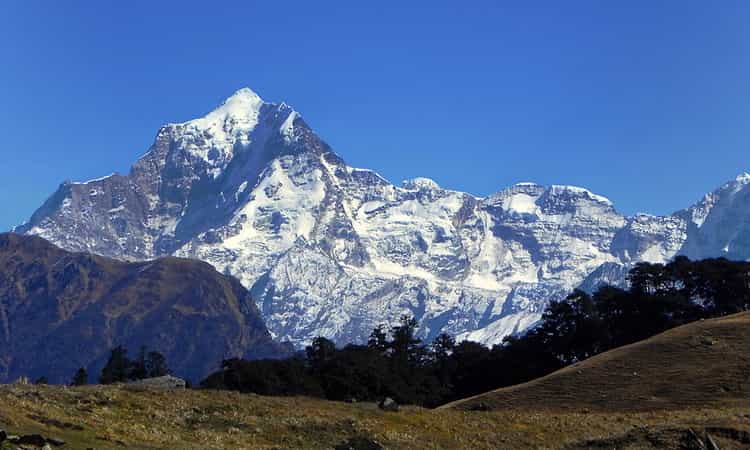
Dunagiri is often called the hidden gem of Uttarakhand, overshadowed by taller neighbours like Kamet and Mana Peak. The name roughly translates to “beautiful gem,” and treks toward its base camp offer some of the most peaceful, less-crowded views in Chamoli district.
7. Bhagirathi Parbat (6,856 m)
- Height: 6,856 m (Bhagirathi I)
- Three summits: Bhagirathi I, II, and III
- Named after the Bhagirathi River, source stream of the Ganges
- Bhagirathi III is a renowned technical rock climb

Named after the Bhagirathi River — the primary source stream of the Ganges — this massif has three summits: Bhagirathi I (6,856 m), II, and III. Bhagirathi III, at 6,454 m, is known among technical climbers for its steep granite face.
8. Kedarnath (6,940–6,992 m) and Kedarnath Dome (6,831 m)
- Kedarnath: height disputed, 6,940 m (Wikipedia) to 6,992 m (IMF); Kedarnath Dome: 6,831 m — two separate summits
- Part of the Gangotri Group
- Forms the dramatic backdrop behind Kedarnath Temple
- Not the region’s highest peak — that title belongs to Chaukhamba

This is worth clarifying: the mountain behind Kedarnath Temple actually has two separate summits — Kedarnath (the main peak) and Kedarnath Dome, a subsidiary peak roughly 2 km northwest. Kedarnath’s own height isn’t settled: Wikipedia’s geographic listing gives 6,940 m, while the Indian Mountaineering Foundation’s official peak register gives 6,992 m. Kedarnath Dome sits at 6,831–6,832 m either way. Neither summit is the region’s highest — that’s Chaukhamba (7,138 m).
What makes this mountain matter isn’t only its height, though — pilgrims walking to Kedarnath Temple get an unbroken view of this snow-covered massif, one of the most emotional sights on the Char Dham Yatra. In winter, temple and peak together form one of Uttarakhand’s most photographed scenes.
9. Maiktoli (6,803 m)
- Height: 6,803 m
- Located in Bageshwar district, Kumaon
- On the southern rim of the Nanda Devi Sanctuary
- First climbed in 1934 by Eric Shipton
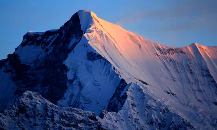
Maiktoli is a lesser-known Kumaon peak in Bageshwar district, on the southern rim of the Nanda Devi Sanctuary, close to Devtoli and Trisul. It anchors the trekking route through the Sunderdhunga Valley and Glacier — a region still fairly untouched by mass tourism.
The peak was first climbed in 1934 by British mountaineer Eric Shipton during his early Nanda Devi expeditions. It remains a serious, technical climb — the Sunderdhunga Glacier approach is remote and demands real trekking experience.
10. Shivling (6,543 m)
- Height: 6,543 m
- Near-perfect pyramid shape, resembling a Shiva lingam
- Rises above the Tapovan meadows near the Gangotri Glacier
- One of the most technically difficult climbs in the Himalayas

Shivling is named for its resemblance to a Shiva lingam — a near-perfect pyramid shape standing sharply apart from every peak around it. It rises above the Tapovan meadows near the Gangotri Glacier and is considered one of the most beautiful, and difficult, technical climbs in the Himalayas. Its steep, clean faces mean very few climbers attempt the summit; most visitors instead trek to Tapovan just to see it up close.
Other Notable Peaks Worth Knowing
- Neelkanth (6,596 m) — the “Queen of Garhwal,” towering above Badrinath temple and visible from the town itself.
- Panchachuli (highest peak 6,904 m) — a striking five-peak group in Pithoragarh district, near Munsiyari.
- Bandarpunch (6,316 m) — the first major Himalayan peak climbed by an Indian mountaineering team (with Tenzing Norgay, 1950), above Yamunotri.
- Hathi Parvat (6,727 m) — a prominent peak visible from the Joshimath–Auli region.
Best Time to Visit Uttarakhand’s Mountain Regions
| Season | Months | What to Expect |
| Summer | April–June | Clearest views, best trekking window, roads fully open |
| Monsoon | July–mid-Sept | Avoid high-altitude treks — landslide risk, poor visibility |
| Post-Monsoon | Late Sept–Nov | Crisp air, excellent visibility, second-best trekking window |
| Winter | Dec–Feb | Heavy snow at altitude, most treks close, dramatic views from lower towns |
How to Reach
- Nearest Airport: Jolly Grant Airport, Dehradun.
- By Road: Base camps are typically reached via Joshimath, Gangotri, Munsiyari, or Bageshwar depending on the range.
- On Foot: Every peak on this list needs a multi-day trek or expedition from the nearest roadhead — none are vehicle-accessible.
Permits and Regulations
- Treks inside Nanda Devi National Park, Gangotri National Park, and Govind Wildlife Sanctuary require Forest Department permits, arranged via registered trekking agencies.
- Areas near the India–Tibet border (parts of Kumaon near Milam, Panchachuli, Adi Kailash) require an Inner Line Permit (ILP) — apply early, as processing can take days.
- Expedition peaks like Kamet, Trisul, Shivling, and Bhagirathi Parbat need formal clearance from the Indian Mountaineering Foundation (IMF).
- Permit requirements are peak- and route-specific and depend on nationality and current government rules — check with the relevant park authority, district administration, and the IMF before planning; don’t rely on this list alone.
Packing Essentials
- Sturdy, broken-in trekking shoes with ankle support
- Layered woollens — thermal base, fleece, windproof outer shell
- Sleeping bag rated for sub-zero temperatures above 3,500 m
- Basic medical kit; discuss altitude-illness prevention and any medication with a qualified doctor before a high-altitude trip
- Torch/headlamp, power bank, water purification tablets
- Trekking poles for steep descents
Common Mistakes Trekkers Make
- Skipping acclimatisation days, which raises the risk of altitude-related illness and is a common reason treks above 4,000 m get cut short.
- Underestimating remote routes like Maiktoli, Panchachuli, or Satopanth, which have no mobile network or easy rescue access.
- Ignoring permit timelines — ILP and forest permits can take days.
- Attempting high-altitude routes during monsoon (July–early Sept), when landslides and road blocks are common.
Pro Tips
- Cloud cover in these valleys tends to build through the day, so mornings usually give the clearest mountain views, especially near Kedarnath and Gangotri.
- Tapovan (for Shivling) and Auli (for the Nanda Devi range) let you see a major peak up close without committing to a multi-day trek.
- Local drivers and guides track road and weather conditions in real time; confirm with them before a high-altitude push rather than relying only on an app.
Why Trek or Travel With ChardhamTour.in
Planning a Char Dham Yatra or a trek toward any of these peaks involves real logistics — permits, road conditions, altitude planning, and local transport. ChardhamTour.in has organised pilgrimage and mountain travel across Uttarakhand for over a decade, with transparent pricing and route knowledge built from completing these journeys on the ground.
FAQs
Q1: Which is the highest mountain in Uttarakhand?
Nanda Devi, at 7,817 metres (UNESCO) — the second-highest peak located entirely within India, after Kangchenjunga.
Q2: Can tourists climb Nanda Devi?
No. Climbing inside the Nanda Devi Sanctuary has been restricted since the 1980s to protect its ecology; only outer-sanctuary trails and viewpoints are open.
Q3: What is the highest peak in the Gangotri region?
Chaukhamba (7,138 m) — higher than the better-known Kedarnath peak nearby.
Q4: What’s the difference between Kedarnath Peak and Kedarnath Dome?
Kedarnath (the main peak) and Kedarnath Dome are two separate summits about 2 km apart. Kedarnath’s own height is disputed — 6,940 m per Wikipedia, 6,992 m per the Indian Mountaineering Foundation’s official register — while Kedarnath Dome sits at 6,831–6,832 m.
Q5: Do I need a permit to trek in Uttarakhand’s mountains?
Yes, for most high-altitude and border-adjacent routes — national park treks need Forest Department permits, and border-area routes need an Inner Line Permit.
Q6: When is the best time to see these peaks up close?
April–June and September–November offer the clearest views and safest conditions. Avoid the July–September monsoon window for high-altitude routes.
Q7: Which is the easiest Uttarakhand peak for beginners?
None on this list — all require prior high-altitude trekking experience. Beginners should stick to base-camp or viewpoint treks like Tapovan.
Q8: How many peaks above 7,000 metres does Uttarakhand have?
More than a dozen, including Nanda Devi, Kamet, Mukut Parbat, Chaukhamba, Trisul, and Satopanth.
Q9: Is Mount Kailash located in Uttarakhand?
No — Mount Kailash is in Tibet. Adi Kailash (Chhota Kailash), a separate similarly-shaped peak in Pithoragarh district, is in Uttarakhand and a popular pilgrimage trek.
Q10: What should I carry on my first high-altitude trek?
Good trekking shoes, layered woollens, a sub-zero sleeping bag, altitude-sickness medication, and a headlamp are essentials.
Conclusion
Uttarakhand’s mountains carry mythology, mark pilgrimage routes, and challenge some of the world’s most experienced climbers. Whether you’re planning an expedition to Kamet, a scenic trek toward Satopanth, or want to see Kedarnath’s snow-covered backdrop from the temple courtyard, knowing the real facts — height, history, and what it actually takes to get there — makes the journey more meaningful. Plan your travel to Uttarakhand with a team that knows these mountains from the ground up.