Geography & Weather of Haridwar

The district of Haridwar covers an area of 2370 km square and lies in the South western zone of Uttarkhand. The river Ganga flows through Haridwar in a series of channels which are segregated from each other all of which are well wooded. There are seasonal streams in Hardwar named as Ranipur Rao, Begam Nadi, Pithri Rao, Harunaii Rao. The major part of the Haridwar district is covered by forest area.
General Climate and Geographical Information
Haridwar is located in the western southern area of the state of Uttarkhand. It is covered between the north attitude 29 degree 35’ to 30 degree 40’ and east longitude 77 degree 43’ to 78 degree 22’. According to national survey of India haridwar falls in 53 degree sheet in J. F, G and K section. The cities of Dehradun and Pauri bind the Haridwar district in the North East and the Bijnor district binds it from the South East. Haridwar district shares its boundary with Muzzafarnagar district while the western part is bound by the district of Sahranpur. The total geographical area of the district is 2360 km2.
The district of Hridwar has three tehsil divisions i.e. Roorkee, Laksar, Bhagwanpur and three development blocks i.e. Narsan, Roorkee, Laksar, Bhagwanpur, Bahdarabad, Kanpur etc.
The central mode of irrigation in Haridwar is tube wells. Some areas of Haridwar are fed by rains. Rainfall is the primary source of water for recharging ground water. The state government has installed 225 tube wells while 32930 other private tube wells exist making up a decent water supply system.
Climatic Character of Haridwar
The Haridwar district has very moderate subtropical climate which can be high on humidity. There are 3 distinctive seasons in Haridwar I,e. summer, rains and winter.
In Haridwar the temperature begins to rise from march from about 29 degree centigrade till May where the temperature is at a peak. Summer May temperature in Haridwar is known to have touched 39 degree centigrade. By the middle of June the average temperature begins to fall.
Winter
During the winter months from November to February, humidity levels in Haridwar are quite low. The relative humidity is approximately 25% in the evening and about 35% in the morning. In contrast, summers are significantly more humid, with morning humidity at around 85% and evening humidity at 79%.Summer
Haridwar experiences moderate wind speeds that peak during the summer months. In May and June, the wind speed can reach up to 7.2 km/h, while in October, it slows down to about 2 km/h. The rate of evapo-transpiration is highest in May at 198.9 mm and lowest in December at 38.5 mm.Monsoon
The district of Haridwar receives an average annual rainfall of 1174.3 mm, with 84% of this occurring during the monsoon season. The remaining 16% falls during non-monsoon periods. The northern part of the district receives more rainfall compared to the relatively drier southern part. The heaviest rainfall is recorded in July (329.5 mm) and August (394 mm).
Topography of Haridwar
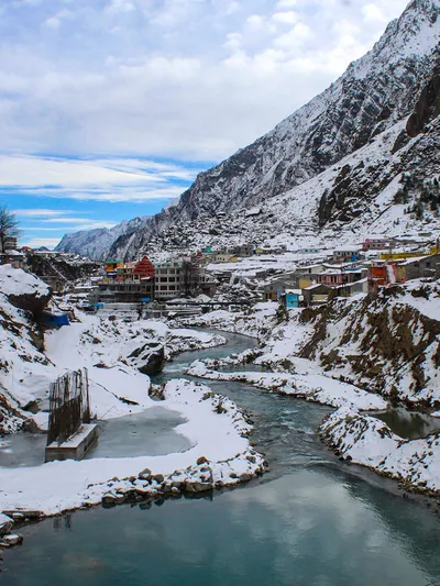
Haridwar’s topography is undulating in the north and becomes smoother as one moves southward. The altitude varies from 868 meters in the hills to 233 meters in the plains. Near the Shivalik Hills, the gradient is notably steep. Geomorphologically, Haridwar is categorized into four distinct units: flood plains, upper piedmont plains, structural hills, and lower piedmont plains.
The flood plain area is flat and low-lying, located adjacent to the Solani River. It comprises unconsolidated coarse sand mixed with clay and is prone to occasional flooding.