There’s more than one river called Mandakini in Hindu tradition, and mixing them up is a common mistake on travel pages. This article covers the Mandakini River of Uttarakhand — the one that rises near Kedarnath and joins the Alaknanda at Rudraprayag. The Mandakini described in the Valmiki Ramayana, where Ram shows Sita the river’s beauty near Chitrakuta, is a different river entirely, associated with Chitrakoot in present-day Madhya Pradesh/Uttar Pradesh. Treat that as a separate entity, not a poetic description of this one.
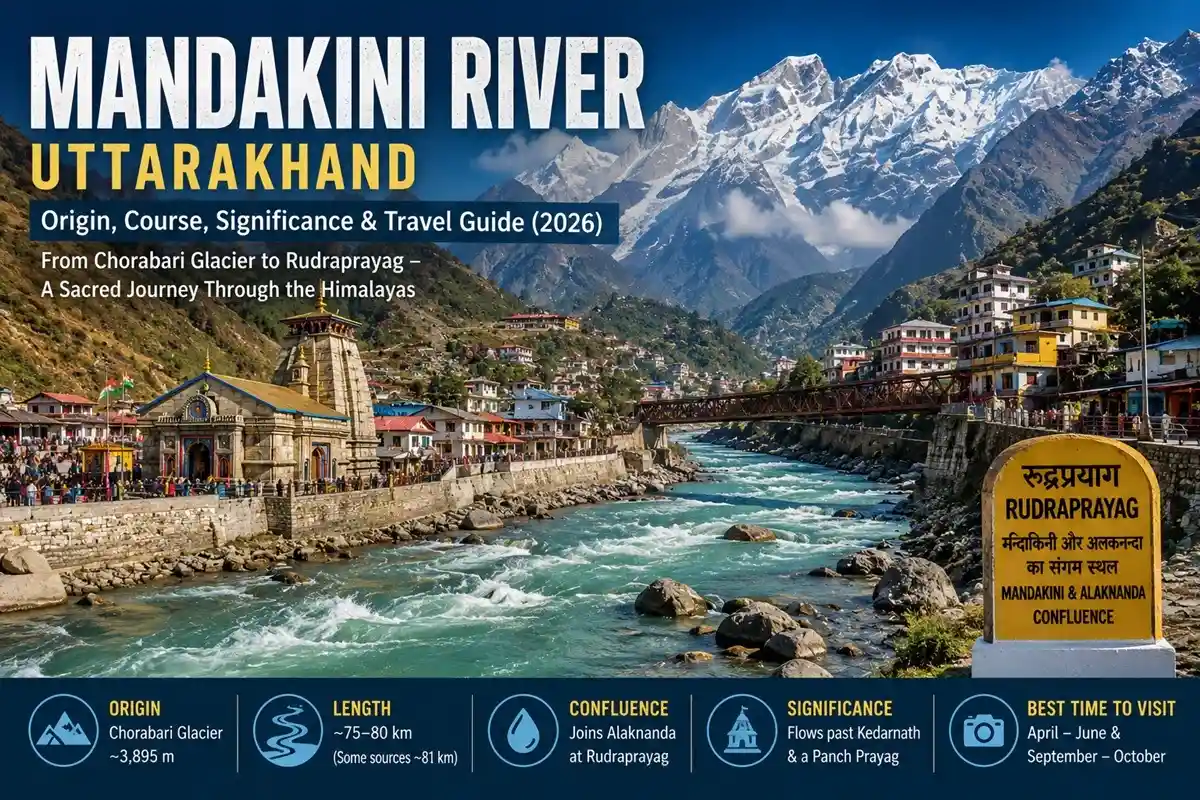
Quick Answer: The Mandakini River of Uttarakhand rises from the Chorabari Glacier system above Kedarnath, at roughly 3,895 metres, and flows through the Mandakini Valley before joining the Alaknanda at Rudraprayag. Published studies put its length at 75–80 km, with some general references rounding to 81 km — the gap comes down to how the source and channel were measured, not disagreement over the river itself.
Mandakini River at a Glance
| Feature | Details |
| State | Uttarakhand |
| Source | Chorabari Glacier system, above Kedarnath |
| Source elevation | ~3,895 m |
| Length | ~75–80 km (some references cite ~81 km) |
| Basin area | ~1,645–1,714 km², depending on the study |
| Major tributary | Vasuki Ganga (also called Songanga), joins at Sonprayag |
| Confluence | Alaknanda River, at Rudraprayag |
| River system | Feeds into the Ganga via the Alaknanda |
| Key places along the route | Kedarnath, Sonprayag, Ukhimath, Augustmuni, Rudraprayag |
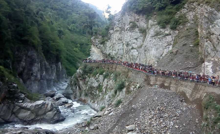
Where Does the Mandakini Originate?
The river’s source is tied to the Chorabari Glacier system above Kedarnath, at an elevation of close to 3,895 metres. The Rudraprayag district administration describes the actual origin as springs fed by Chorabari Glacier meltwater, roughly a kilometre above the Kedarnath temple — a more precise picture than simply saying “the river starts at the glacier,” since the water surfaces gradually through several spring points rather than at one clean source.
Course of the River
From its source, the Mandakini flows past Kedarnath and down the valley, picking up the Vasuki Ganga at Sonprayag — also called Songanga in scientific literature, with the confluence locally known as Vasuki Prayag. Near Ukhimath, it receives the Madhyamaheshwar Ganga, a tributary tied to the higher Madhyamaheshwar region; the river doesn’t pass the Madhyamaheshwar Temple itself, which sits well above the valley floor. The route through this stretch includes sections of NH-107, though the river and highway don’t run parallel for the entire course.
At Rudraprayag, the Mandakini joins the Alaknanda. From there the combined river continues to Devprayag, where it meets the Bhagirathi to form the Ganga.
Published sources genuinely differ on length and basin size. A morphometric study puts the main channel at 75.25 km; another gives roughly 80 km; general references round to 81 km. Basin estimates range similarly — older studies cite 1,645–1,646 km², while a 2026 geomorphic study using satellite elevation data puts it closer to 1,714 km². These aren’t contradictions so much as different delineation methods producing different numbers.
Religious Significance
The name Mandākinī does appear in the Srimad Bhagavatam, listed among the transcendental rivers in one passage and used elsewhere to describe sacred waters associated with the Ganga in a heavenly context. That’s a real scriptural reference, but it isn’t a direct identification of the Kedarnath-area river specifically — the text is naming a sacred river archetype, and treating it as proof of this particular river’s scriptural pedigree overstates what the passage actually says.
The Ramayana’s Mandakini, as noted above, belongs to Chitrakuta. This river’s own religious weight comes from something more concrete: it flows past Kedarnath, one of the twelve Jyotirlingas, and its confluence with the Alaknanda at Rudraprayag is one of Uttarakhand’s five Panch Prayag — Vishnuprayag, Nandaprayag, Karnaprayag, Rudraprayag, and Devprayag. That’s real, verifiable significance, and it doesn’t need a borrowed scriptural connection to matter.
The name itself is commonly interpreted as coming from Sanskrit roots meaning calm or unhurried — a fitting description for a river that moves gently most of the year and turns violent only in monsoon.
Chorabari Glacier: The River’s Source
Chorabari Glacier — also called Chorabari Bamak — sits close to Kedarnath, between Kedarnath peak and the town itself. Scientific studies describe it as roughly 7.5 km long and about 6.6 sq. km in area. Older travel sources sometimes cite a much larger figure, around 15 sq. km, but that doesn’t hold up against the glaciological data.
Chorabari Tal, the glacial lake tied to this system, sits at roughly 3,960 metres, about 2.1 km upstream of the Kedarnath temple complex. Before 2013 it measured close to 400 metres long and 200 metres wide, with a depth of 15–20 metres — a moraine-dammed lake rather than an open glacial pool.
Route conditions to Chorabari Tal shift with weather, snow cover, and local access restrictions. Treat this as terrain that changes season to season, and check current local guidance before attempting the route rather than assuming a fixed, easy day trek.
What Actually Happened in June 2013
This part gets oversimplified a lot. The disaster wasn’t a single lake-breach event — it unfolded over two days. On 16 June, extreme rainfall triggered severe flooding in the Saraswati and Dudh Ganga catchments, devastating the Rambara area on the Kedarnath route. On 17 June, the moraine holding back Chorabari Lake gave way, and the lake emptied in under fifteen minutes according to Central Water Commission documentation, sending water and debris down toward Kedarnath and the villages below.
Renamed Gandhi Sarovar after some of Mahatma Gandhi’s ashes were scattered there, the lake never reformed once its moraine washed out. What’s there today is a flat, boulder-strewn basin with a small stream running through it.
Rudraprayag: Where Mandakini Meets Alaknanda
Rudraprayag, named after Lord Shiva, is 34 km from Srinagar (Uttarakhand) — a figure that comes straight from the district administration’s own page rather than a rounded travel-site estimate. This is where the Mandakini’s journey ends and the Alaknanda’s continues. The confluence draws a steady stream of devotees for ritual bathing, and the town’s two most commonly visited temples are the Shiva temple and the Jagdamba temple.
Best Time to Visit the Mandakini Valley
April to June and September to October are the more suitable windows for visiting — not because either is risk-free, but because the region’s heaviest rainfall and highest landslide risk fall outside these months. Late June through August is monsoon season here, and river levels can rise fast enough that riverside travel plans need to change on short notice. This basin has a documented history of rainfall-triggered landslides and flash floods, so monsoon caution here isn’t boilerplate advice — it’s specific to this valley’s terrain.
Places to See Along the Route
Ukhimath: Winter Seat of Kedarnath. When Kedarnath Temple closes for winter, the deity’s idol moves to the Omkareshwar Temple in Ukhimath, the seasonal centre of worship until the main temple reopens.
Augustmuni. A town on the bank of the Mandakini itself, roughly 18 km from Rudraprayag at about 1,000 metres, associated with the sage Agastya — a more directly relevant stop on this river than some of the wider Uttarakhand circuit towns.
Adventure activities. Rafting and kayaking on Himalayan rivers depend on current conditions, official permissions, and operator availability in a given season. Confirm current status with an authorised local operator rather than planning around a season quoted online.
A Note on 2026 Travel Conditions
River and weather conditions in the Mandakini Valley can change quickly during heavy rainfall. Before heading to riverbanks, attempting any trek above Kedarnath, or planning adventure activities, check current advisories from the Rudraprayag district administration and Kedarnath Yatra authorities — particularly during the monsoon stretch.
FAQs
Where does the Mandakini River originate?
From springs fed by the Chorabari Glacier system, roughly a kilometre above Kedarnath, at about 3,895 metres.
Where does the Mandakini River end?
It joins the Alaknanda River at Rudraprayag, one of Uttarakhand’s five Panch Prayag confluences.
How long is the Mandakini River?
Published studies put it at 75–80 km; some general references cite around 81 km, depending on measurement method.
What is Gandhi Sarovar?
The renamed Chorabari Tal, a moraine-dammed glacial lake above Kedarnath. Its breach on 17 June 2013 was one part of that year’s two-day disaster, not the whole story on its own.
Is the Mandakini River mentioned in the Ramayana?
No — the Mandakini in the Ramayana is associated with Chitrakuta, a separate river from this one. The name overlap causes frequent confusion online.
When is the best time to visit the Mandakini Valley?
April–June and September–October are generally more suitable; monsoon months carry real landslide and flash-flood risk specific to this basin.
Can you go rafting on the Mandakini River?
Availability depends on current conditions and official permissions in a given season. Confirm directly with an authorised operator rather than relying on a fixed year-round schedule.
What caused the 2013 Kedarnath disaster?
Two events over two days — severe rainfall-driven flooding on 16 June, followed by the Chorabari Lake moraine breach on 17 June, which released the lake’s contents in under fifteen minutes.
Where can pilgrims go if Kedarnath Temple is closed for winter?
Ukhimath’s Omkareshwar Temple serves as the seasonal seat of Kedarnath’s deity during the winter closure.
What is Rudraprayag’s distance from Srinagar?
34 km, per the Rudraprayag district administration.
What are the Panch Prayag?
Uttarakhand’s five sacred Alaknanda confluences — Vishnuprayag, Nandaprayag, Karnaprayag, Rudraprayag, and Devprayag. The Mandakini joins at Rudraprayag specifically.
Which river joins the Mandakini at Sonprayag?
The Vasuki Ganga, also called Songanga in scientific literature, originating from Vasuki Tal near Kedarnath.
Final Word
The Mandakini isn’t one clean, easy-to-summarize river — it has a genuine scriptural mix-up attached to its name, real source-to-source disagreement on its length and basin size, and a disaster history that gets flattened into a single sentence far too often. Visit between April and October, skip the monsoon stretch unless you have a specific reason not to, and treat any rafting or high-altitude trek claim you read as conditional on the season, not fixed. If you’re building this into a wider Kedarnath trip, a Char Dham Yatra package is the simplest way to plan around it properly.
Sources
Geographic and hydrological details are drawn from the Rudraprayag district administration’s river-system page, Central Water Commission and NIDM disaster documentation, and peer-reviewed studies in Applied Water Science, Discover Geoscience, and related hydrology journals. Where these sources disagree — basin area, river length, tributary altitude — both figures are given rather than picking one silently.