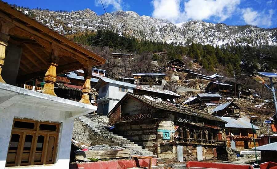
Dharali sits on the banks of the Bhagirathi River in Uttarkashi district, on the road to Gangotri Dham. Apple orchards, deodar forest, a quiet market — that was the pitch for years. On August 5, 2025, a debris flow tore through the village and buried a large part of that market. The place is still rebuilding. If you’re planning to pass through in 2026, this guide covers what’s actually changed, not what used to be true.
Quick Answer
Dharali is accessible when the Gangotri route is open, but conditions shift fast. The market area remains partly buried and under reconstruction a year after the disaster. The road has been rebuilt on a realigned path, shifted away from the riverbank, and pilgrim traffic resumed by mid-September 2025. Rain in the first week of September 2026 has already caused short highway disruptions near Uttarkashi. Check current BRO and district advisories before you travel, especially July through September.
Dharali at a Glance
| Fact | Detail |
| District | Uttarkashi, Uttarakhand |
| River | Bhagirathi |
| Local stream | Kheer Gad (also called Khir Gad or Ksheer Ganga in some sources) |
| Altitude | Roughly 2,700 m (sources range 2,650–2,745 m) |
| Distance to Gangotri | ~20–22 km by road |
| Distance to Harsil | ~3 km village-to-village; up to ~6 km measured from Harsil Market |
| Distance to Uttarkashi town | ~80 km by road |
| Disaster date | August 5, 2025 |
| Disaster type | Debris flow / flash flood in the Kheer Gad catchment |
| Disaster cause | Still debated — see below |
| Kedar Tal trek start point | Gangotri, not Dharali |
| Nelong Valley access | Daytime only, inner-line permit area |
Where Is Dharali Located?
Dharali lies in Uttarkashi district, on the Gangotri National Highway, with the Bhagirathi River running alongside it. Green slopes rise on both sides of the valley. That geography is part of why the 2025 disaster hit so hard — much of the old market sat on a debris-flow fan close to the river.
Distance from Harsil, Gangotri and Uttarkashi
Different sources measure Dharali’s distances from different reference points, so numbers vary depending on where you look. Here’s what holds up:
- To Gangotri Dham: roughly 20–22 km by road.
- To Harsil: about 3 km if you’re measuring village to village. Some road-distance tools put it closer to 6 km, because they measure from Harsil Market rather than the village center. Both figures are correct — they’re just answering slightly different questions.
- To Uttarkashi town: approximately 80 km by road.
What Happened in Dharali on August 5, 2025
Around 1:30 pm on August 5, 2025, a debris flow surged down the Kheer Gad, a tributary that meets the Bhagirathi behind Dharali. The flow carried mud, boulders and water at high speed and buried a large section of the market. Some areas were left under debris several metres deep — one 2026 study put the burial depth at up to 12–18 metres in the worst-hit sections, with an estimated 251,000 tonnes of material deposited. More than 56 hotels and homestays were destroyed, along with roads, a bridge, and apple orchards nearby. A portion of the Army camp and helipad at Harsil was also damaged.
Casualty figures vary by source, and none of them should be treated as final. A 2026 study in Natural Hazards Research recorded 61 confirmed deaths, 84 people still listed as missing, and 94 injured. A separate 2026 study in Current Science put the toll at around 60 deaths. Both numbers come from peer-reviewed reconstructions published roughly a year after the event — rescue and identification work continued for months after the disaster, which is part of why the figures still don’t fully agree.
What Caused the Dharali Disaster?
This is where the science gets genuinely unsettled, and the article that pretends otherwise is doing you a disservice. Two competing explanations have come out of 2026 research. One line of study points to persistent rainfall mobilising unstable moraine and paraglacial sediment on the slopes above the Kheer Gad, near Srikanta Glacier — essentially, saturated ground giving way. Another study, published in npj Natural Hazards, argues the trigger was an ice-patch collapse from the same glacier area, a mechanism distinct from ordinary rainfall-driven landslides. A follow-up paper in the same journal pushed back on that ice-patch theory and argued the evidence better supports rainfall-driven sediment mobilisation after all.
No single mechanism has been confirmed. What’s agreed on is that intense rainfall, unstable slopes, and construction close to the stream channel all played a part.
Dharali in 2026: Current Situation
A year on, the picture is mixed. The government has put money into rehabilitation, and the road to Gangotri has been rebuilt on a path shifted away from the riverbank — that’s confirmed, but “shifted away from the river” is a different claim from “safer,” and no authority has stated the latter outright, so this article won’t either. Field reporting from August 2026 found that most of the old market and houses remain buried, with only a small number of shops reopened. Reconstruction is real. It’s also slower than the early announcements suggested.
Practical takeaways for a 2026 trip:
- Passing through toward Gangotri or Harsil is generally workable, subject to the day’s road conditions.
- Don’t rely on any pre-2025 hotel listing. A number of properties no longer exist. Confirm directly before booking.
- The disaster site isn’t a sightseeing stop. People are still rebuilding their homes there.
Is Dharali Safe to Visit in 2026?
Safe is doing a lot of work in that question, so here’s the honest version: Dharali is accessible when the Gangotri route is operational, and it usually is outside of heavy rain. But this is a route that has seen real disruption recently — on September 3, 2026, rain temporarily blocked the Gangotri Highway near Uttarkashi before BRO cleared it, and on September 5, heavy rain closed 136 roads across the state. None of that means don’t go. It means check the same-day road and weather advisory before you leave, not the week before.
How to Reach Dharali
A common road route from Rishikesh runs via Chamba, Dharasu, Uttarkashi, Bhatwari, Gangnani, Harsil and Dharali.
- By road: This is a full-day drive from Rishikesh. Anyone who gives you a fixed number of hours is guessing — traffic, roadwork, and rain-related closures all move the needle. Budget for something in the 8 to 11-hour range and build in slack, particularly during monsoon months.
- By train: The nearest practical railway options are Rishikesh and Dehradun. From either, you continue by road toward Uttarkashi, Harsil and Dharali.
- By air: Jolly Grant Airport in Dehradun is the nearest airport. The onward drive takes most of a day.
Dharali Road Status & the Gangotri Highway
The Gangotri highway reopened to pilgrim traffic in mid-September 2025, using a managed shuttle system while repairs continued. That’s well documented and not in dispute. What’s easy to get wrong is assuming a 2025 reopening tells you anything about road conditions today — it doesn’t. The route has had short-term disruptions as recently as this month. Treat this as a road that needs a same-day check, not a fixed status you can rely on from an old blog post.
Where to Stay Near Dharali
Accommodation took a real hit in 2025, and the market is still rebuilding. What’s generally available:
- GMVN guesthouses — government-run, basic, subject to availability.
- Private hotels and lodges — fewer in number than before 2025; confirm a property is actually operating before you book it.
- Homestays — available around Dharali and Harsil.
- Ashrams and dharamshalas — budget dormitory-style stays, mainly active during yatra season.
Book through a verified operator or call ahead. Some listings still floating around travel sites reference properties that no longer exist.
Places to Visit Near Dharali
Harsil
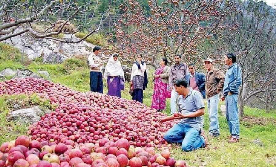
A hill hamlet about 3 km away, known for its apple orchards and the Bhagirathi flowing through it. A lot of pilgrims base themselves here rather than in Dharali, partly because accommodation options held up better post-2025.
Mukhba
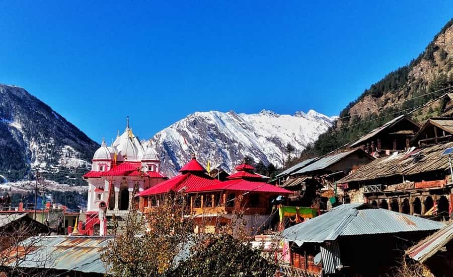
Roughly a kilometre from Dharali, Mukhba is the winter seat of Ganga Maa — the deity is moved here from Gangotri when the temple closes for the season. Worth a stop if you’re interested in the religious calendar behind the Char Dham Yatra.
Nelong (Nelong) Valley
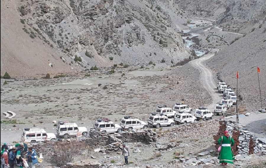
An old India–Tibet trade route, around 32.7 km away. It’s an inner-line area near the border, and the Uttarkashi district administration currently permits tourist access only during daytime — no overnight stays. Permit and security requirements can change, so check with the district administration before you plan around it.
Swami Sundaranand Viewpoint
A roadside viewpoint on NH 108 near Harsil, marked with a stone dedicated to the late yogi and Himalayan photographer. Open views of the peaks and the Bhagirathi below.
Kedar Tal Trek
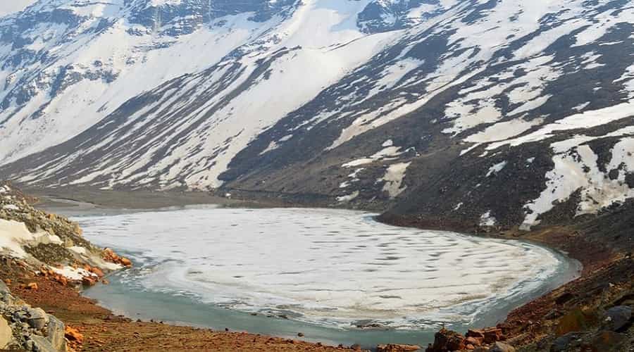
Get this one right: the Kedar Tal trek starts from Gangotri, not Dharali. Dharali sits on the approach road to Gangotri and can be part of the journey there, but it isn’t the trek’s base camp — an earlier version of this page got that wrong. Trail conditions near the route have shifted since the 2025 event, so check current status with a guide or trekking authority before setting out.
Kalp Kedar Temple
Worth a factual note rather than a recommendation: 2025 reporting documented that this small shrine, associated with the Pandavas in local lore, was swept away or buried in the disaster. If you’ve seen it listed elsewhere as a stop, that listing is out of date.
Weather and Best Time to Visit
- April–June: Cool to mild days, cold mornings. Generally the more settled window for travel.
- July–September: The wettest stretch, and the period when the 2025 disaster happened. Landslide and flash-flood risk is genuinely higher here, not just theoretically — plan around it.
- October–March: Cold, with snowfall likely and roads sometimes affected.
Late April through June is a reasonable default recommendation, mainly because monsoon rainfall is usually lower in that window. It’s not a guarantee. Weather in this valley can turn regardless of the calendar, so check the forecast close to your travel date rather than trusting the season alone.
If you’re timing a trip around the Char Dham Yatra specifically, the relevant constraint is usually the Gangotri temple’s opening and closing dates for the season, not just weather — confirm those separately.
Common Mistakes to Avoid
- Booking a Dharali hotel off an old listing without confirming it still exists.
- Driving through in peak monsoon without checking the same-day road status.
- Walking near the Kheer Gad channel or riverbank in restricted debris-flow zones.
- Assuming Nelong Valley is open on your dates without checking current permit rules.
- Treating a 2025 news report as proof of 2026 road conditions.
Dharali for Char Dham Yatra Travelers
Gangotri is one of the four Char Dham sites, and Dharali sits directly on the route to it. That’s the main reason most travelers pass through here at all — not for Dharali itself, but as a stop on the way to Gangotri. Keep that framing in mind when you’re planning: check Gangotri’s specific yatra dates and road advisories, not just general Dharali travel info.
FAQs
Q1. Is Dharali safe to visit in 2026?
It’s accessible when the Gangotri route is open, which is most of the time outside heavy rain. The area has seen short-term road disruptions as recently as September 2026, so check the same-day advisory before you leave.
Q2. What happened in Dharali in August 2025?
A debris flow from the Kheer Gad stream buried a large part of Dharali’s market on August 5, 2025, destroying hotels, shops and homes. Peer-reviewed 2026 studies put the death toll between roughly 60 and 61, with dozens still listed as missing.
Q3. What caused the Dharali disaster?
Researchers haven’t settled this. Some 2026 studies point to rainfall mobilising unstable moraine sediment near Srikanta Glacier; another proposes an ice-patch collapse, which a later paper disputes. No single cause has been confirmed.
Q4. Can I still stay overnight in Dharali?
Some accommodation is running, but a number of pre-2025 hotels no longer exist. Confirm directly with the property or a local operator before booking.
Q5. Is the Gangotri highway open through Dharali?
Yes, generally — it reopened in mid-September 2025 on a realigned path away from the river. It has still seen short weather-related closures in 2026, so check current status rather than relying on the 2025 reopening as proof.
Q6. How far is Dharali from Gangotri Dham?
Roughly 20–22 km by road.
Q7. How far is Dharali from Harsil?
About 3 km village to village; road-distance tools measuring from Harsil Market show closer to 6 km.
Q8. Does the Kedar Tal trek start from Dharali?
No. It starts from Gangotri. Dharali is on the approach road but isn’t the trek’s base camp.
Q9. Do I need a permit for Nelong Valley?
Yes — it’s an inner-line area near the India–China border, open to tourists during daytime only. Check current permit and security requirements with the Uttarkashi district administration before planning around it.
Q10. What is the best time to visit Dharali?
Late April to June tends to have lower monsoon-related risk. It’s not a guarantee — check the forecast close to your travel date regardless of season.
Q11. How do I reach Dharali from Rishikesh?
By road via Chamba, Dharasu, Uttarkashi, Bhatwari, Gangnani and Harsil. It’s a full-day drive; give yourself 8–11+ hours depending on conditions.
Q12. Is Kalp Kedar temple still there?
No. 2025 reporting documented that the shrine was swept away or buried in the disaster. Any listing that still recommends it as a stop is outdated.