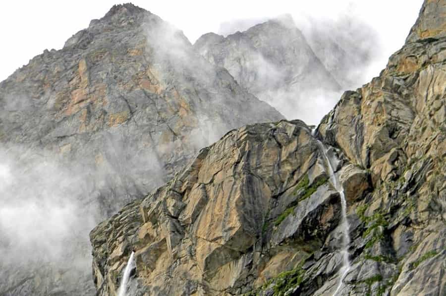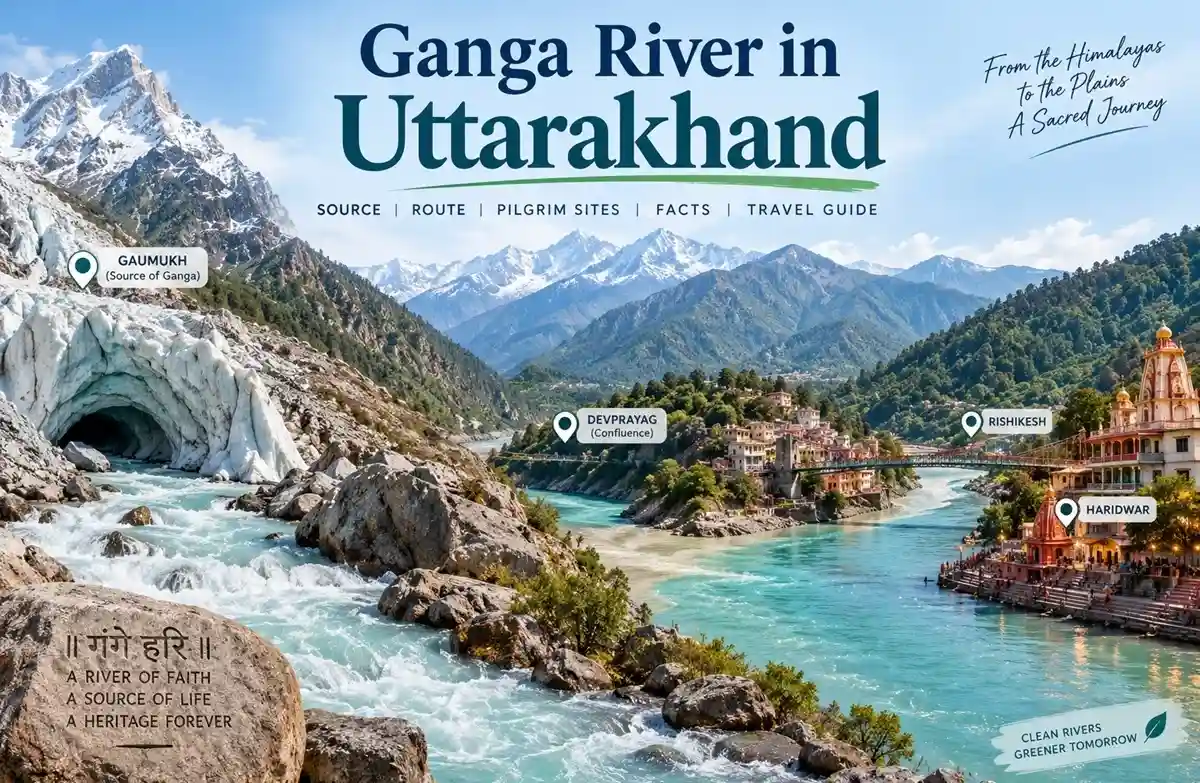
The Ganga starts as meltwater at Gaumukh, a glacial cave-mouth in Uttarakhand, and ends nearly 2,525 km away in the Sundarbans. It isn’t called the Ganga at its source — that name only applies after Devprayag. Most people driving the Char Dham route don’t know this. If you’re heading toward Gangotri, Rishikesh or Haridwar, the distinction matters, because it changes what you’re actually looking at when you stop at any of these places.
The Ganga’s source stream, the Bhagirathi, emerges at Gaumukh, the snout of the Gangotri Glacier in Uttarakhand, at an elevation of about 3,892 metres. It’s called the Bhagirathi until Devprayag, where it meets the Alaknanda River — only from that confluence onward is it officially the Ganga. The river then runs roughly 2,525 km (measured along the Bhagirathi and Hooghly) through five main-stem states before reaching the Bay of Bengal.
Key Facts
| Detail | Information |
| Source stream | Bhagirathi, emerging at Gaumukh from the Gangotri Glacier |
| Elevation at Gaumukh | ~3,892 metres (12,770 ft) |
| Point where the name changes to “Ganga” | Devprayag (Bhagirathi + Alaknanda confluence) |
| Total length | ~2,525 km, measured along the Bhagirathi and Hooghly |
| Main-stem states | Uttarakhand, Uttar Pradesh, Bihar, Jharkhand, West Bengal |
| Basin area | Covers about 26% of India’s landmass |
| Basin population | About 43% of India’s population, based on 2001 Census figures (448.3 million) |
| Status | Declared India’s National River in 2008 |
| National Aquatic Animal linked to it | Gangetic River Dolphin — decided 2009, formally notified 2010 |
Where the Ganga Actually Begins
The Bhagirathi River emerges at Gaumukh, roughly 16–19 km from Gangotri town depending on which route measurement you go by — official sources don’t agree on the exact figure, so treat any single number with some skepticism. This isn’t the “Ganga” yet. It only earns that name at Devprayag, where the Bhagirathi meets the Alaknanda. Gangotri town gets the temple and the crowds; Gaumukh is a trek away and gets the actual glacier.
Most travel writing skips this naming detail entirely. It’s worth knowing, because it explains why Gangotri and Devprayag both get described as connected to the river’s origin — they’re not describing the same thing.
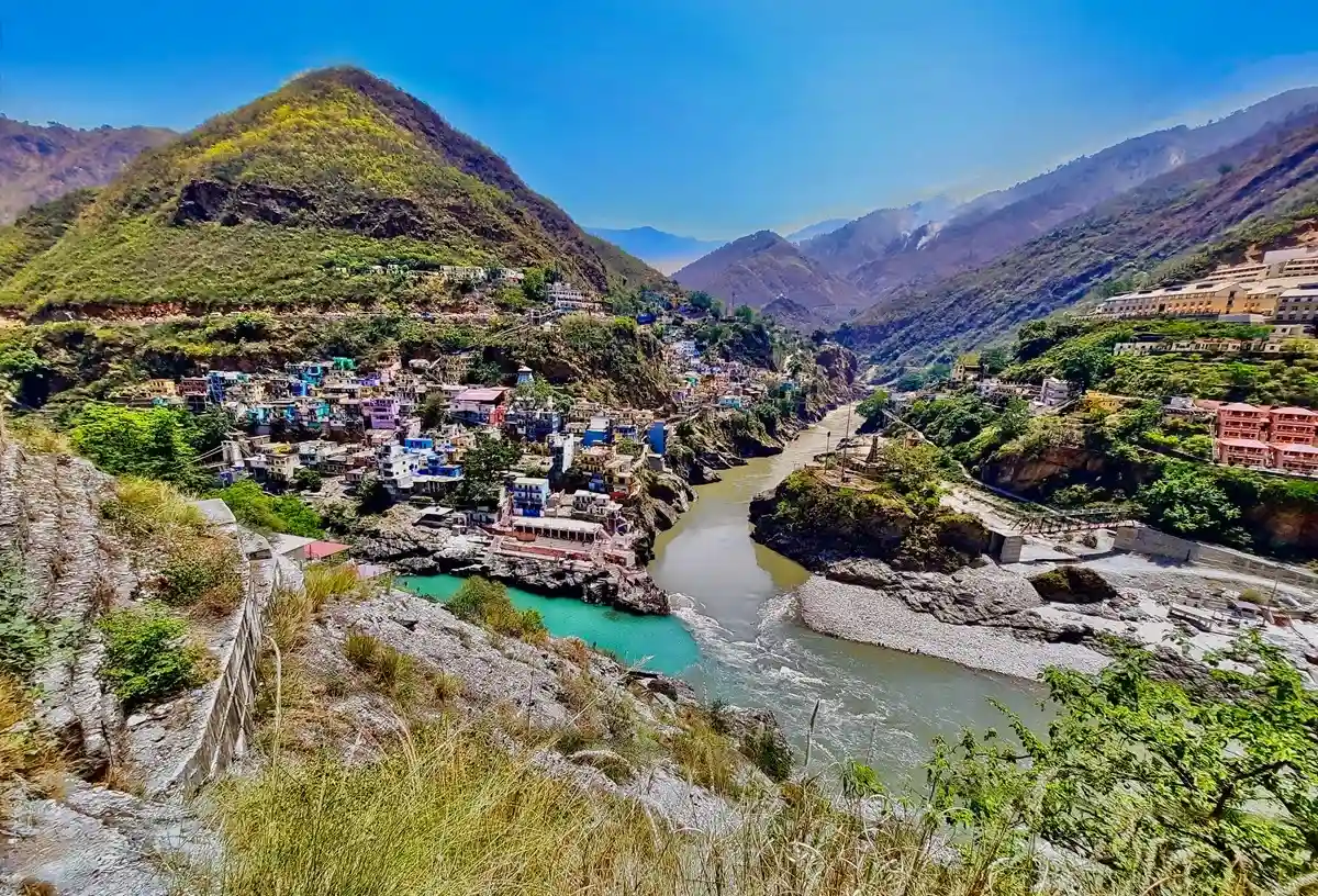
From Devprayag, the river drops into Rishikesh and Haridwar, where it leaves the mountains and enters the Indo-Gangetic Plains. From there it runs through Uttar Pradesh, Bihar, Jharkhand and West Bengal, picking up tributaries like the Gandak and Kosi along the way. Near Farakka, part of the flow splits off as the Bhagirathi-Hooghly and reaches the Bay of Bengal near Sagar Island. The main channel continues into Bangladesh as the Padma, joining the Meghna. Together with the Brahmaputra and Meghna systems, this forms the Ganges-Brahmaputra-Meghna delta — the largest delta on Earth. The Sundarbans is the mangrove ecosystem occupying the southern part of that delta, not the delta itself; it includes several UNESCO-recognized protected areas.
Panch Prayag: The Five Confluences
Uttarakhand’s five headstreams — Bhagirathi, Alaknanda, Mandakini, Dhauliganga, Pindar — meet at five confluences known as the Panch Prayag.
| Confluence | Rivers That Meet | Location |
| Vishnuprayag | Dhauliganga + Alaknanda | Near Joshimath |
| Nandprayag | Nandakini + Alaknanda | Chamoli district |
| Karnaprayag | Pindar + Alaknanda | Chamoli district |
| Rudraprayag | Mandakini + Alaknanda | Kedarnath route junction |
| Devprayag | Bhagirathi + Alaknanda | Elevation ~472m; where the river becomes “Ganga” |
Travelling from Rishikesh toward Badrinath, you pass all five. Toward Kedarnath, you mainly pass Devprayag and Rudraprayag — the route splits off before reaching the other three. Depending on season and sediment load, the colour difference between the two merging streams at these confluences is sometimes visible, sometimes not. Don’t expect a guaranteed postcard moment.
Physical Character
The upper Ganga is fast, cold and glacier-fed. By the time it reaches Varanasi it’s a slow, silt-heavy plains river — a completely different animal. Volume builds steadily as tributaries join and the river enters a heavy monsoon belt, which is also why flooding recurs in Bihar and West Bengal most years.
Plant and Animal Life
16th and 17th-century accounts describe the Ganga-Yamuna doab as dense forest with elephants, buffalo and tigers. Most of that’s gone now, cleared for farmland over generations. What survives at scale is in the Sundarbans, where Royal Bengal tigers, saltwater crocodiles and spotted deer still hold a functioning ecosystem. That’s a delta-specific pocket — don’t expect tiger habitat anywhere along the river’s middle or upper course.
The river’s best-known resident is the Gangetic River Dolphin, declared India’s National Aquatic Animal in 2009 (formal notification followed in 2010). A nationwide survey covering 8,507 km across 28 rivers put the population at 6,324. Government reporting describes increased sightings and biodiversity improvements in several monitored stretches — that’s a more accurate read than calling it a full “recovery,” since one survey establishes a baseline, not a trend.
Religious and Cultural Significance
For Hindus, this isn’t ordinary water. Devotees bathe in it, immerse ashes (Asthi Visarjan), and perform Pind Daan rites along its banks. Many carry Ganga Jal home in sealed containers, based on a long-held belief that it resists spoiling. Researchers have studied this — the river’s microbial ecology and bacteriophage activity in its cleaner upper stretches are part of that picture. That’s not the same as saying untreated Ganga water is safe to drink. It isn’t, and no amount of tradition changes that.
The Kanwar Yatra is the most visible expression of this devotion — Kanwariyas carry empty pots on foot to Haridwar and other pilgrimage centres along the river, fill them with Ganga Jal, and carry them home, often walking long distances barefoot. Mythologically, the river is said to have descended through Shiva’s matted hair after King Bhagirath’s penance persuaded Goddess Ganga to come to earth.
Ganga Aarti at Haridwar and Rishikesh
If you’re passing through Haridwar or Rishikesh, the evening Ganga Aarti is worth building time for. At Haridwar’s Har Ki Pauri and Rishikesh’s Triveni Ghat and Parmarth Niketan, priests perform synchronised aarti with large brass lamps while diyas float downstream. It’s held daily, though timing shifts with the season — check locally rather than assuming a fixed sunset hour. Arrive early during peak season if you want a spot close to the ghat; May–June and the Kanwar Yatra period get crowded fast.
Kumbh Mela: Get the Rivers Right
The Kumbh Mela rotates among four locations — Haridwar, Prayagraj, Ujjain, Nashik — with each site’s major Kumbh occurring on roughly a 12-year cycle. Only two of those four sit on the Ganga: Haridwar (directly on the Ganga) and Prayagraj (at the Triveni Sangam, where the Ganga, Yamuna and the mythical Saraswati are said to meet). Ujjain’s Kumbh happens on the Shipra. Nashik’s happens on the Godavari. Neither of those two touches the Ganga at all, despite how often the four cities get lumped together as “Ganga Kumbh sites.”
The Ardh Kumbh runs every six years, specifically at Haridwar and Prayagraj. The Maha Kumbh, traditionally described as occurring once every 144 years and held at Prayagraj, is generally described as the largest human gathering on Earth. The 2025 Prayagraj Maha Kumbh drew attendance that government estimates put in the hundreds of millions over its duration.
Pollution and the Namami Gange Cleanup
Untreated sewage and industrial effluent remain the core pollution pressures on the river, worsened by the sheer population the basin supports. That hasn’t changed. What’s changed is the scale of the government response.
As of early 2026, under the Namami Gange Programme:
- 524 projects have been sanctioned since the programme’s 2014 launch; 355 are complete — about 68%, as of February 2026.
- ₹21,340 crore has been disbursed as of 15 March 2026, of which ₹16,025.97 crore went specifically to sewage-treatment projects.
- 76 sewerage infrastructure projects with a combined treatment capacity of 3,200 MLD were completed in the five years leading up to that report.
- The programme’s stated target is 7,000 MLD of cumulative treatment capacity by December 2026 — that’s a target, not a current achievement, and the two shouldn’t be confused.
Water quality has genuinely improved in several monitored stretches — pH and dissolved oxygen levels met bathing-water criteria at most monitored locations in 2025 data. But it’s not uniform. Some stretches, particularly in Uttar Pradesh, still showed elevated BOD or faecal coliform levels in the same monitoring round. And meeting bathing-water criteria is not the same as meeting drinking-water standards — the programme’s stated objective has always been the former, not the latter. Don’t drink untreated river water regardless of what the compliance numbers say.
Getting to Gangotri and Gaumukh
Most people reach Gangotri by road from Rishikesh — roughly 270 km, and closer to 10–12 hours given the terrain, not the 8-hour figure some sites quote. From Uttarkashi it’s about 100 km. Beyond Gangotri town, reaching Gaumukh itself means a trek — Bhojbasa sits roughly at the halfway point, about 14 km in, with the last stretch to Gaumukh covering the remaining distance. The whole thing typically takes 1–2 days.
A few things worth knowing before you go:
- The trek passes through Gangotri National Park, and you’ll need forest permission — arrange it through the District Forest Officer’s office in Uttarkashi or Gangotri before setting out. Don’t assume this is optional.
- The trekking season generally runs late spring through autumn. May–June and September–October are the more favourable windows. Winter — roughly November through April — leaves the region largely inaccessible because of heavy snowfall, though exact conditions shift year to year.
- Basic accommodation exists at Bhojbasa (forest rest houses, ashram lodging). Book ahead in peak season; it fills up.
- This is a genuine high-altitude trek, not a casual walk. Carry warm layers even in June — temperatures drop fast after sunset.
Common Mistakes
- Assuming Gangotri town and Gaumukh are the same place. They’re not — Gaumukh is the trek destination, Gangotri is the temple town.
- Skipping the forest permission requirement, which can get you turned back at the checkpoint.
- Underestimating the altitude. Bhojbasa and Gaumukh both sit well above 3,500m.
- Assuming the Ganga meets drinking-water standards anywhere along this stretch. It doesn’t.
- Assuming all four Kumbh Mela cities sit on the Ganga. Two of them don’t.
Before You Go
Combine the Gangotri leg with the wider Char Dham or Do Dham circuit — Devprayag and Rudraprayag are natural stops en route regardless of which route you’re on. If the Gaumukh trek isn’t feasible, the Ganga Aarti at Rishikesh or Haridwar is a far more accessible way to engage with the same river. Carry ID for the forest permission checkpoint. Book Uttarkashi or Harsil accommodation ahead during the May–June rush — rooms go fast.
Conclusion
The Ganga’s connection to Uttarakhand’s pilgrimage geography is real and specific — Gangotri, Devprayag, Rudraprayag, Rishikesh, Haridwar — rather than some blanket claim about the whole Char Dham circuit. Knowing where the river actually starts, where the name changes, and what’s genuinely improved with the cleanup effort (and what hasn’t) gets you a more accurate picture than the mythology alone. If your route touches any of these towns, treat the Ganga stops as planned parts of the trip, not filler between temples.
FAQs
Where does the Ganga actually originate?
At Gaumukh, where the Bhagirathi emerges from the Gangotri Glacier, at about 3,892 metres. It isn’t called the Ganga yet at this point.
Why is it called the Bhagirathi before Devprayag?
The name changes to Ganga only after the Bhagirathi meets the Alaknanda at Devprayag. Before that, it’s officially the Bhagirathi.
How long is the Ganga?
About 2,525 km, measured along the Bhagirathi and Hooghly, running through Uttarakhand, Uttar Pradesh, Bihar, Jharkhand and West Bengal.
Is Gangotri the same as the source?
No. Gangotri is a temple town. The glacial source, Gaumukh, is a further 16–19 km trek away.
Do all four Kumbh Mela cities sit on the Ganga?
No. Only Haridwar and Prayagraj do. Ujjain’s Kumbh is on the Shipra, Nashik’s on the Godavari.
Is the Ganga still polluted?
Water quality has improved in several stretches under the Namami Gange Programme, but some stretches — particularly in Uttar Pradesh — still show elevated pollution levels. It meets bathing-water criteria in most monitored locations, not drinking-water standards.
What’s the best time to visit Gangotri and Gaumukh?
May–June and September–October. Winter months leave the route largely inaccessible due to heavy snowfall.
Do I need a permit for the Gaumukh trek?
Yes — forest permission from the District Forest Officer, since the route passes through Gangotri National Park.
What’s the National Aquatic Animal linked to the Ganga?
The Gangetic River Dolphin, decided on in 2009 and formally notified in 2010. A recent nationwide survey counted 6,324 across 28 rivers.
Where can I watch the Ganga Aarti?
Har Ki Pauri in Haridwar, and Triveni Ghat or Parmarth Niketan in Rishikesh. Held daily; timing shifts by season.
What are the Panch Prayag?
Five confluences of the Ganga’s headstreams — Vishnuprayag, Nandprayag, Karnaprayag, Rudraprayag, Devprayag. The Badrinath route passes all five; the Kedarnath route mainly passes Devprayag and Rudraprayag.
Does Ganga Jal really not spoil?
Its resistance to spoiling in cleaner upper stretches has scientific backing — dissolved oxygen and bacteriophage activity play a role. That doesn’t make untreated river water safe to drink.
When was the Ganga declared India’s National River?
2008.
Is the Gaumukh trek suitable for everyone?
It involves high altitude, uneven terrain and real physical exertion. Anyone with mobility limitations or a relevant medical condition should get medical advice before attempting it.

Related Posts
Sayanachatti to Yamunotri Guide
Dharchula: Gateway to Adi Kailash, Om Parvat & Kailash Mansarovar