
Swargarohini Trek 2026: Satopanth Tal Route, Distance, Permits & Best Time
Beyond Mana, one of the last inhabited villages near the Indo-Tibetan border, a cluster of Himalayan peaks rises above 6,000 metres. People call the whole group Swargarohini — the “ascent to heaven.” The name comes from the Mahabharata. Most people searching for a “Swargarohini trek” aren’t planning to climb a mountain. They’re planning to walk to Satopanth Tal, a glacial lake below the peaks, and see Swargarohini from there instead of on it.
That difference matters. Satopanth Tal is a trek. Swargarohini is an expedition. Confusing the two is the single most common mistake on this route, and it’s the reason this guide treats them as two separate things from the start.
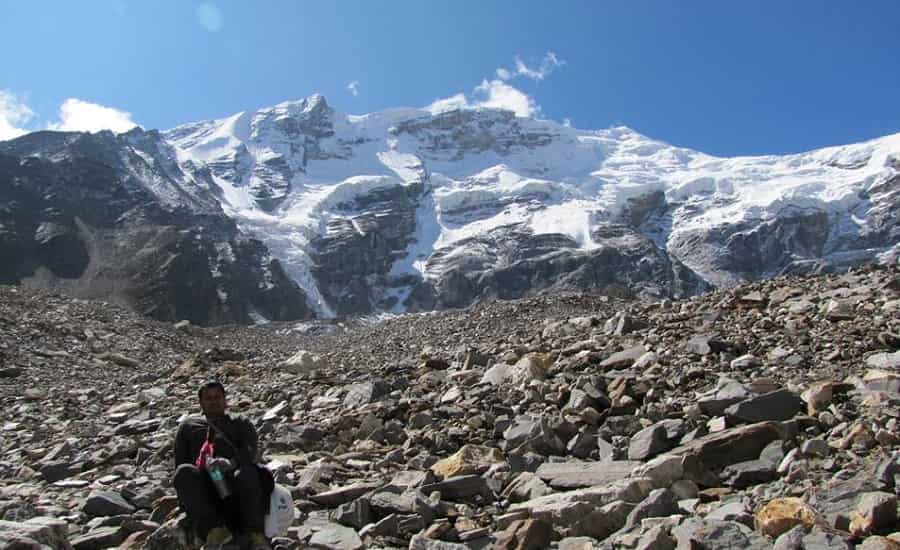
Quick Facts
Swargarohini I stands at 6,252 m in Uttarkashi district. The Satopanth Tal trek, by contrast, starts from Badrinath in Chamoli district and tops out at the lake, around 4,600 m. The route runs roughly 21 km one way from Badrinath, done over 5 days in the standard itinerary — longer if you build in weather buffer. May–June and September–October are the workable windows. An Inner Line Permit is required beyond Mana, since the trail sits close to the international border.
The Legend
According to the closing books of the Mahabharata, the five Pandava brothers, Draupadi, and a dog walked north into the mountains after giving up their kingdom, searching for a path to heaven. One by one they fell along the way. Only Yudhishthira reached the summit, with the dog beside him. This is belief, not documented history, and this article treats it that way throughout.
Where Swargarohini actually is
Swargarohini sits in Uttarkashi district, part of the Bandarpunch range of the Garhwal Himalaya. It’s not one summit — the Himalayan Club’s own historical records describe it as a group of peaks, with Swargarohini I (6,252 m) as the highest and Swargarohini II (6,247 m) close by as a separate summit. Older tourism write-ups sometimes describe I and II as “east and west summits of the same peak.” The mountaineering record doesn’t support that. They were climbed on different expeditions, in different years, by different teams.
The massif’s north face drops close to 2,000 m in under 2 km of horizontal distance. That’s a steep wall by any measure, and it’s the main reason the peak took decades to climb.
Who actually climbed it, and when
- 1974 — A Canadian-led team (D.S. Virk, with Charles Clarke, Peter Fuhrman, Bruce MacKinnon, and Indian climbers Mohan Singh and Rattan Singh) reached the summit of Swargarohini II (6,247 m). This was not Swargarohini I.
- 1990 — Instructors from the Nehru Institute of Mountaineering made the first ascent of Swargarohini I (6,252 m) on 13 May, approaching from the Ruinsara Valley side, not from Badrinath or Satopanth.
- 1993 — A later expedition is credited with the first undisputed ascent of Swargarohini I via the south face, after questions were raised about whether the 1990 team had actually stood on the true summit or stopped just short of it.
By the mid-1990s, the peak had turned back roughly fifteen documented attempts. It’s one of the harder 6,000-metre objectives in the Garhwal Himalaya, not because of altitude, but because there’s no straightforward line to the top from any side.
One more thing worth knowing: the actual mountaineering approach to Swargarohini I runs through Uttarkashi, Netwar, Taluka, and Osla to Ruinsara Tal — the same general area as the Har Ki Dun valley. That’s a different district, a different road, and a different trailhead from Badrinath. If your plan is Badrinath to Mana to Satopanth, you are nowhere near the mountaineering route to the summit.
Satopanth Tal: the trek people actually mean
This is where most of the confusion in older write-ups comes from. The trail from Mana that ends at Satopanth Tal is what’s commonly called the “Swargarohini trek,” and it’s a real, well-documented trekking route — just not a route to the peak. Hindu tradition holds that Brahma, Vishnu, and Mahesh meditated at the lake’s three corners, and that the Pandavas passed through here on their way toward the Swargarohini glacier.
From the lakeshore you can see Chaukhamba, Neelkanth, Balakun, and Swargarohini in the distance. No climbing gear needed for any of it. Reaching the lake does not put you on a route toward the summit — that’s a separate technical objective requiring its own planning, permissions, and approach from the other side of the range entirely.
Satopanth trek vs. Swargarohini expedition
| Satopanth Tal Trek | Swargarohini I Expedition | |
| Starts from | Badrinath / Mana | Uttarkashi–Netwar–Taluka–Osla–Ruinsara Tal |
| District | Chamoli | Uttarkashi |
| Destination altitude | ~4,600 m (the lake) | 6,252 m (the summit) |
| Nature of route | High-altitude trek | Technical rock/snow/ice climb |
| Gear needed | Trekking gear, camping equipment | Full mountaineering kit |
| What you see | Views of Swargarohini and neighbouring peaks | The summit itself |
Places along the trail
Badrinath Dham — Starting point of the trek, at 3,133 m, one of the four Char Dham shrines. Most people do darshan before setting out.
Mana Village — About 3 km from Badrinath, near the Indo-Tibetan border. Often called one of India’s last inhabited villages. This is where the road ends.
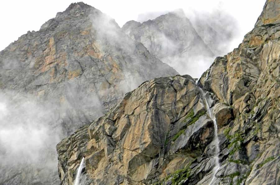
Vasudhara Falls — A short trek beyond Mana, roughly 3–5 km depending on which trail you take. A common stop before Lakshmi Van.
Ganesh Gufa and Vyas Gufa — Cave shrines near Mana, associated with the sage Ved Vyas and the composition of the Mahabharata.
Lakshmi Van and Chakratirtha — The two overnight camping stops between Mana and the lake.
Permits
The route beyond Mana sits in a border-sensitive, protected stretch of the Garhwal Himalaya. An Inner Line Permit is required, and it’s typically issued through the SDM office in Joshimath or the Nanda Devi Biosphere Reserve’s forest division. Indian nationals generally need photo ID and, depending on the season, a medical fitness certificate. Foreign nationals face additional documentation and clearance because of the border. Rules here can shift with the current administrative order, so confirm requirements with the Joshimath authorities before you leave, rather than relying on any single article — including this one — as the final word.
Carry printed and digital copies. Permits get checked again at the Mana forest post, and turning up without one is the most common reason independent trekkers get sent back.
Separately, Uttarakhand opened up mountaineering access on a large number of Himalayan peaks in February 2026, moving expedition permissions onto a digital single-window system called UKMPS. That’s relevant to anyone planning an actual Swargarohini I climb, not to Satopanth trekkers — the two permission processes aren’t the same thing.
How to reach Badrinath
By air: Jolly Grant Airport, Dehradun, is roughly 320 km from Mana by road, via Rishikesh and Joshimath.
By rail: Haridwar and Rishikesh are the two main railway gateways for this route, both well connected to Delhi.
By road: Badrinath is connected to Rishikesh, Haridwar, and Joshimath. Mana is about 3 km further, and that’s where the trek itself begins.
Route and distance
| Stretch | Approx. distance |
| Badrinath to Mana | ~3 km |
| Badrinath to Lakshmi Van | ~9 km |
| Lakshmi Van to Chakratirtha | ~7 km |
| Chakratirtha to Satopanth Tal | ~5 km |
| Satopanth Tal back to Chakratirtha | ~5 km |
| Chakratirtha back to Badrinath | ~15 km |
That puts Badrinath to Satopanth Tal at roughly 21 km one way, and the full there-and-back trek at around 42 km. Different operators quote slightly different numbers depending on exact trail and where they start counting from — treat any figure you see, including this one, as an approximation and confirm current distances with whoever you book with.
How long it takes
The standard documented itinerary runs 5 days: acclimatisation, then Badrinath to Lakshmi Van, Lakshmi Van to Chakratirtha, Chakratirtha to the lake and back, then Chakratirtha to Badrinath. Most operators stretch this to 5–7 days by adding buffer days for weather or altitude adjustment. Don’t book the tightest version if this is your first time at this altitude.
Best time to go
May–June and September–October are the two windows most trekkers use. Late June through August brings the monsoon, and that makes the trail genuinely dangerous in places — not just uncomfortable. Winter brings heavy snow that shuts the route down entirely. None of this is fixed on a calendar; actual conditions depend on the year, so check current status before you commit to dates.
Difficulty
Call it moderate to difficult. The trail includes long daily distances, loose moraine near the lake, and sustained walking above 4,000 m where the air is thin enough to slow most people down. It’s not a beginner’s first Himalayan trek, but it’s also not a mountaineering objective — fit trekkers with some prior high-altitude experience, or beginners going with an experienced operator, generally manage it fine.
Mistakes people make
- Treating this as a route to the Swargarohini summit. It isn’t. The summit is a separate expedition from a different side of the range.
- Skipping the permit application and getting turned back at Mana.
- Booking the shortest possible itinerary with no buffer day, then dealing with altitude sickness near Chakratirtha.
- Underestimating the cold. Even in June, nights at Lakshmi Van and Chakratirtha get close to freezing.
- Renting gear last-minute in Badrinath without checking it first.
Practical tips
Apply for the Inner Line Permit with a day to spare before you leave Mana, and carry a physical copy as backup — signal is unreliable past this point. Drink water consistently from day one; dehydration makes altitude sickness worse, not just more likely. If symptoms of acute mountain sickness show up — persistent headache, nausea, unusual breathlessness — stop ascending. Worsening symptoms mean descend and get evaluated, not push through. Pack for sub-zero nights regardless of the month: layered woollens, a properly rated sleeping bag, waterproof shoes. If this is your first high-altitude trek, go with an experienced operator rather than attempting it solo.
Plan the Satopanth trek with Chardham Tour
We run this route as the Satopanth Swargarohini Trek package, starting from Haridwar and covering Badrinath darshan, Mana, and the full trail to the lake. Guides handle the Inner Line Permit paperwork, camping equipment, meals, and acclimatisation stops are built into the schedule. Pilgrims combining this with a wider Char Dham trip can extend our Badrinath Yatra packages to include it.
[If you’d like a specific detail here — years operating this route, how many groups you’ve run, average group size, or your actual permit turnaround time — send it over and I’ll fold it in. That kind of specific, named detail is what separates this section from every other operator’s boilerplate “why choose us” paragraph.]
FAQs
Is the Swargarohini trek the same as the Satopanth trek?
No. Satopanth Tal is a trekking destination reached from Badrinath. Swargarohini I is a mountaineering summit reached from Uttarkashi, on the opposite side of the range. Reaching the lake gives you views of the peak, not access to it.
What is the height of Swargarohini peak?
Swargarohini I is 6,252 m. Swargarohini II, a separate nearby summit, is 6,247 m.
Is Satopanth Tal in Uttarkashi or Chamoli district?
Chamoli. Swargarohini peak itself is in Uttarkashi district — a useful distinction if you’re trying to figure out which district’s permit office to deal with.
Do I need a permit for the Satopanth trek?
Yes, an Inner Line Permit, generally issued through the SDM office in Joshimath. Requirements can change, so confirm current rules before you go.
Can foreign nationals do this trek?
They face extra documentation and security clearance because the route is close to the border. Check current rules directly rather than assuming.
What’s the best time for the Satopanth trek?
May–June and September–October. Avoid July–August monsoon and winter snow.
How far is Satopanth Tal from Badrinath?
Roughly 21 km one way by the documented route, around 42 km for the full round trip.
How many days does it take?
5 days is the standard documented itinerary; most operators run 5–7 days with buffer built in.
How difficult is the trek?
Moderate to difficult — long distances, high altitude, cold camping, but manageable for fit trekkers or beginners with an experienced guide.
Where does the trek start?
Mana village, about 3 km beyond Badrinath.
Is there accommodation near Satopanth Tal?
No. Trekkers camp in tents at Lakshmi Van and Chakratirtha; there’s nothing permanent beyond Mana.
Can I attempt the Swargarohini summit after reaching Satopanth Tal?
No. The two aren’t connected by a walkable route. A summit attempt needs a separate expedition from the Uttarkashi side, with its own permissions and technical planning.
One thought on “Swargarohini Trek 2026: Satopanth Tal Route, Distance, Permits & Best Time”
Leave a Reply

I m solo rider ‘ I never commit to the toor but I have visited to Badrinath temple ‘ mana village ‘ last tea stall’ and up to Vasudhara ‘ but up next I want to go to the swaha Rohini ‘ so tell me the route and things which I should have minimum’