Kedarnath – Geography & Demographics

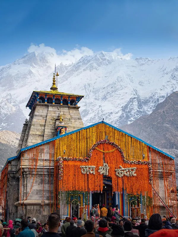
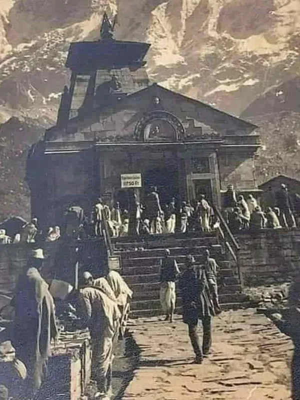
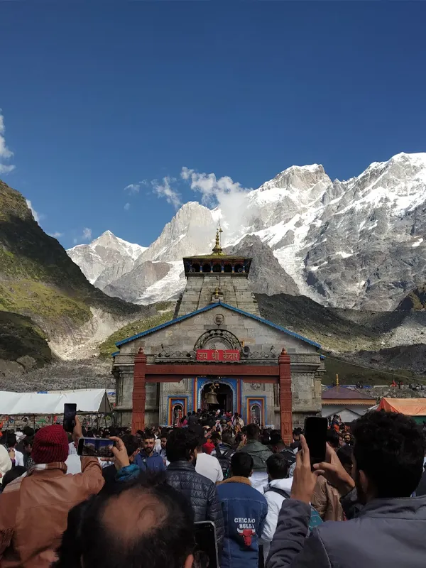
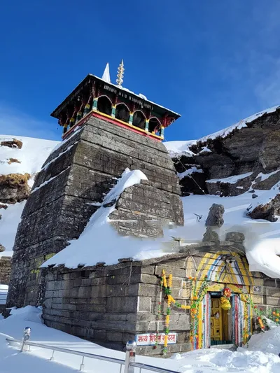
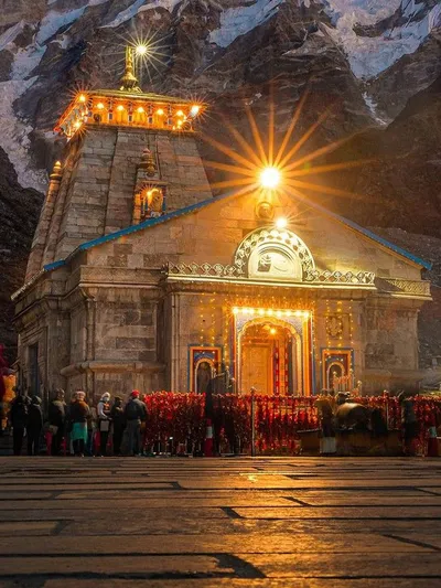
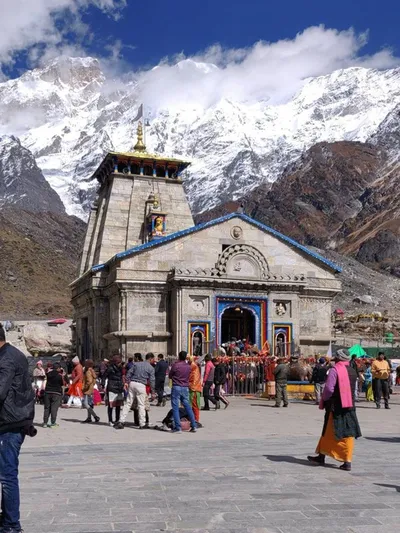
This ancient temple where Shivji is worshipped in the form of Lord Kedar is located on an elevation of 3,583 metres above sea level and is known for offering some of the most spectacular views of the surrounding. Engulfed in a spiritual vibe and surrounded by the lush green rolling green hills, the temple is offers some of the most panoramic vistas and if you are an avid photographer or a trekking enthusiast then this place will definitely be a treat for your eyes. You will be indulging in some amazing views of the flora and fauna collection of the high altitude Himalayan regions. Kedarnath Dham has found its home in the district of Rudraprayag amongst its pristine beauty. Just like all the other char Dham portals this Dham is also created by the fast flowing river.
Here are some informative details regarding the geographical features of Kedarnath which will definitely help you in planning your trip better and will also give you an idea about how to deal with other problems that generally get overlooked.
Geographical Relief
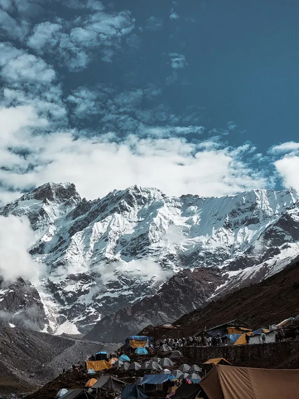
The temple of Kedarnath is situated in the district of Rudraprayag and this holy pilgrimage town is the junction centre for the pilgrims making their way from Kedarnath to Badrinath or vice versa. This ancient temple is also placed close to the glacier of Chorabari which forms the head of Mandakini river. The entire trekking route will take you through some hair pin bends and inter winding paved paths which cuts through the mountains. This holy pilgrimage town is situated at a distance of 86 kms from the main town of Rudraprayag. The valley is also surrounded by gently rolling hills with jagged features with the gushing river water of Mandakini making its way through the valley.
Mandakini River and its Origin
This tributary of the holy river of Mandakini which stretches on for a length of 72 km is one of the holiest tributaries in Uttarakhand and its source can be found in the glacier of Chorabari which is located in close proximity to the temple of Kedarnath. River Mandakini is fed by the mystifying river of Vasuki Ganga at Sonprayag. This river merges entirely with Kaliganga close to Kalimath temple and with Madhyamaheshwar Ganga close to Ukhimath. This river drains itself and finds its confluence with the holy river of Alaknanda in Rudraprayag. This river has deemed to be extremely pious among devout Hindus since it has found its mention in the holy book of Bhagavad Gita. Some people also decide to take a holy dip in the waters of these Prayags or confluences since it is considered to be an extremely soul purifying activity.
The Peaks of Kedarnath
The snow-capped mountain of main Kedarnath and Kedar dome are two prime mountains of the Gangotri group of peaks which forms the western Garhwal Himalayan ranges of Uttarakhand. These peaks are often visited by avid mountaineers and frequented by trekking enthusiasts. These peaks which form the backdrop of Kedarnath temple are located at a distance of 15 kms towards the southern end of the holy site of Gaumukh (the source of river Ganga). While Kedarnath is the highest standing peak on the southern end in the same way Kedar dome is the 3rd highest peak. Kedarnath along with Kedar dome was climbed for the very first time in 1947 by a team which was led by Andre Roch. Few parts of this mountain peak is also utilized as a top notch skiing destination during the spring season. The jagged snow bound peaks forms the pristine and breathtaking background for this holy ancient temple.
Demographics
As per the census of 2011 the overall populations of Kedarnath id 830 out of which only 1% are females while the remaining 99% constitute the male population. Male literacy rate is 63% and the female literacy rate here is 36%. Kedarnath being located at such a height and facing inhospitable weather conditions, the population of Kedarnath completely empties since all the workers and the local shopkeepers go to their respective homes in the lower regions. The Population also mostly consist of people from various different parts of India who come here only during the on season and a few days before the Kapat of the main temple of Kedarnath opens.
Kedarnath Google Map
Kedarnath Travel Guide
Kedarnath Travel Packages


Chardhamtour.in is not the official website of the Uttarakhand Government. We are a registered travel agency with Uttarakhand Tourism and provide travel-related services. For Chardham Yatra registration, visit registrationandtouristcare.uk.gov.in for pooja booking, visit badrinath-kedarnath.gov.in for Kedarnath helicopter tickets, visit heliyatra.irctc.co.in for Uttarakhand tourism info, visit uttarakhandtourism.gov.in for Karnataka government subsidy, visit sevasindhuservices.karnataka.gov.in.
Chardhamtour.in aims to provide helpful information, latest updates about Chardham Yatra, and services related to tourism in Uttarakhand.