Char Dham Yatra Route Map 2026

The Char Dham Yatra covers four temples spread across the Garhwal Himalayas — Yamunotri, Gangotri, Kedarnath, and Badrinath. Each one sits at a different altitude, in a different valley, connected by roads that range from smooth National Highways to narrow mountain tracks that see landslides every monsoon season.
Knowing the route before you leave is not just helpful — it's practical. The distances are long, the driving days are tiring, and some stretches take twice as long as Google Maps suggests. This page has the actual numbers: distances, road conditions for each leg, and what to expect on the ground.
The Yatra season opens around late April or early May (on Akshaya Tritiya) and temples close in October–November before winter snowfall. Exact opening dates vary each year — always check the official announcement before finalizing your dates.
Online registration is compulsory for all Char Dham pilgrims. Register at registrationandtouristcare.uk.gov.in before you travel and carry your printed Yatra Pass. Checkpoints on every route check for it. Entry is denied without a valid pass — this applies to road travellers and helicopter passengers both.
Where the Yatra Starts
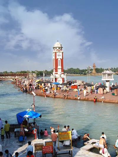
Most pilgrims begin from Haridwar or Rishikesh. Both cities have rail connections from major cities across India, and Dehradun (40 km from Rishikesh) has the nearest airport with regular flights from Delhi, Mumbai, and other metros.
From Haridwar or Rishikesh, you head into the mountains — the standard sequence is Yamunotri first, then Gangotri, then Kedarnath, then Badrinath. This west-to-east order is the traditional route and makes geographic sense given the road network.
Char Dham Yatra by Road — Leg-by-Leg Distances
| Route Leg | Distance | Approx. Drive Time |
|---|---|---|
| Delhi → Haridwar | ~210 km | ~5–6 hrs |
| Haridwar → Barkot | ~180 km | ~5–6 hrs |
| Barkot → Janki Chatti (drive) | ~36 km | ~1.5 hrs |
| Janki Chatti → Yamunotri (trek) | ~6 km | ~3–4 hrs on foot |
| Barkot → Uttarkashi | ~82 km | ~3 hrs |
| Uttarkashi → Gangotri | ~100 km | ~3–4 hrs |
| Uttarkashi → Rudraprayag | ~177 km | ~5–6 hrs |
| Rudraprayag → Sonprayag/Gaurikund | ~76 km | ~2.5 hrs |
| Gaurikund → Kedarnath (trek) | ~16 km | ~5–7 hrs on foot |
| Rudraprayag → Badrinath | ~155 km | ~5 hrs |
| Badrinath → Rishikesh | ~297 km | ~10–11 hrs |
| Rishikesh → Delhi | ~230 km | ~6 hrs |
Complete Route Diagram
The standard Char Dham circuit in order:
- Haridwar ── 235 km / 10–11 hrs ──▶ Janki Chatti 🥾 6 km / 3–4 hrs (uphill trek) ──▶ Yamunotri Temple
- Yamunotri Temple ── 230 km / 9–11 hrs ──▶ Gangotri Temple
- Gangotri Temple ── 340 km / 14–16 hrs ──▶ Gaurikund 🥾 16 km / 5–7 hrs (uphill trek) ──▶ Kedarnath Temple
- Kedarnath Temple ── 230 km / 10–12 hrs ──▶ Badrinath Temple
- Badrinath Temple ── 310 km / 13–14 hrs ──▶ Haridwar
Temple-to-Temple Distances
| From | To | Distance | Travel Time |
|---|---|---|---|
| Haridwar | Yamunotri Temple | ~245 km | 10–14 hrs |
| Yamunotri Temple | Gangotri Temple | ~230 km | 9–11 hrs |
| Gangotri Temple | Kedarnath Temple | ~340 km | 14–16 hrs |
| Kedarnath Temple | Badrinath Temple | ~230 km | 10–12 hrs |
| Badrinath Temple | Haridwar | ~310 km | 11–14 hrs |
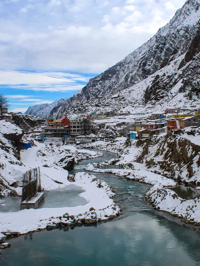
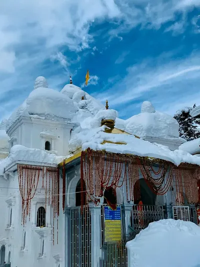
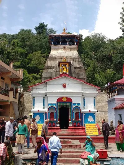
Yamunotri — Route & Road Conditions
Altitude: ~3,291 m | Dedicated to Goddess Yamuna, source of the Yamuna River
Yamunotri temple was originally built by Maharaja Pratap Shah of Tehri Garhwal. The base point for the trek is Janki Chatti — from here it's 6 km on foot to the temple. Pony and palki services are available at Janki Chatti for those who can't walk the full route.
Road Conditions
Delhi to Haridwar is NH highway — good road, straightforward drive. Haridwar to Barkot gets hillier after Mussoorie bypass; sharp turns on some stretches but manageable. The road from Barkot to Janki Chatti is narrow, with some rough patches — SUVs and tempo travellers handle it better than sedans. The 6 km trek from Janki Chatti is steep in places but clearly marked.
Route Summary
- Delhi → Haridwar: 210 km
- Haridwar → Barkot: 180 km
- Barkot → Janki Chatti: 36 km (drive)
- Janki Chatti → Yamunotri Temple: 6 km (trek) — 3 to 4 hours on foot
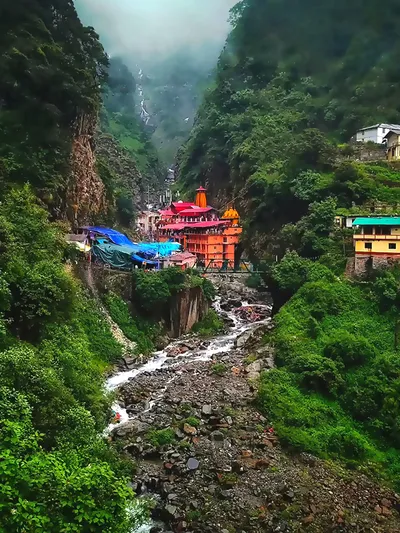
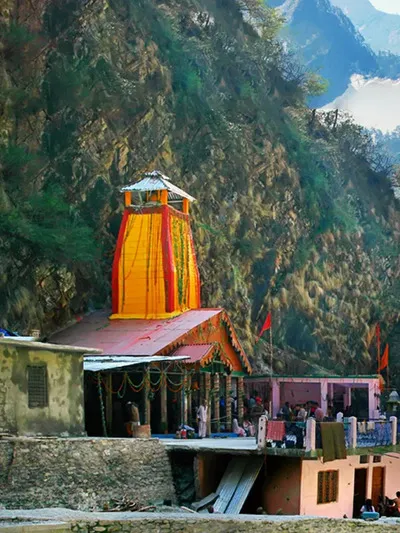
Gangotri — Route & Road Conditions
Altitude: ~3,415 m | Origin of the Bhagirathi River; temple built by General Amar Singh Thapa in the early 19th century
Gangotri is the only one of the four Dhams that doesn't require a separate trek — you can walk directly to the temple from the road. The Bhagirathi River runs alongside the town, and the atmosphere here is calmer and less crowded than Kedarnath or Badrinath. Gaumukh glacier (the actual source of the Ganga) is 18 km further — a separate trek for those who want to go.
Road Conditions
The Uttarkashi to Gangotri stretch is one of the better mountain roads on the circuit — mostly paved, with a few narrow sections and sharp hairpins. Views of the Bhagirathi valley throughout. During heavy monsoon rain, small landslides can temporarily block sections of this road — check local conditions if travelling July–August.
Route Summary
- Yamunotri → Uttarkashi: 125 km
- Uttarkashi → Gangotri: 100 km — 3 to 4 hours
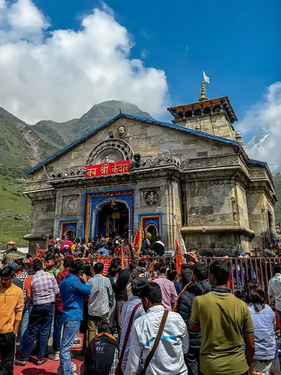
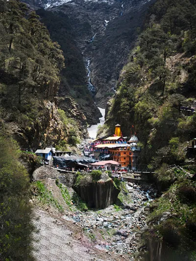
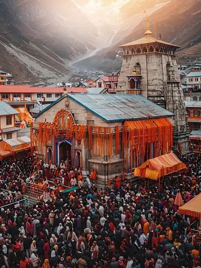
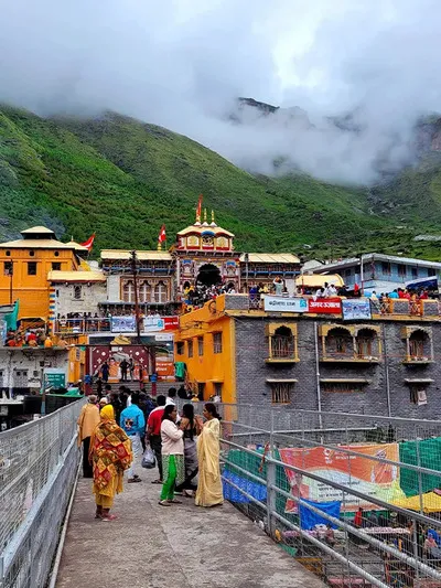
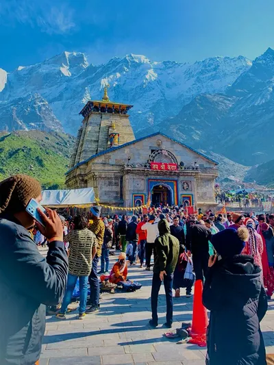
Kedarnath — Route & Road Conditions
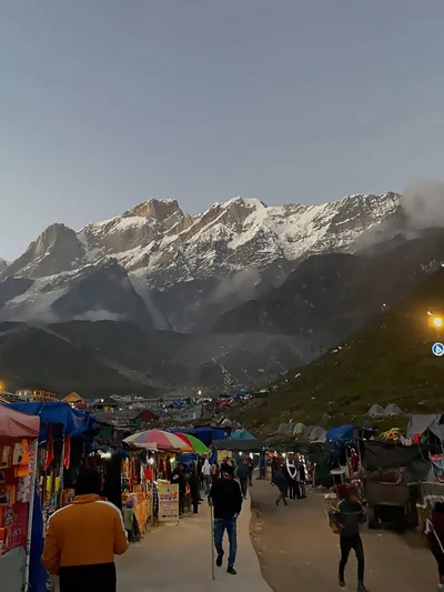
Altitude: ~3,583 m | One of the 12 Jyotirlingas of Lord Shiva; toughest trek of the four dhams
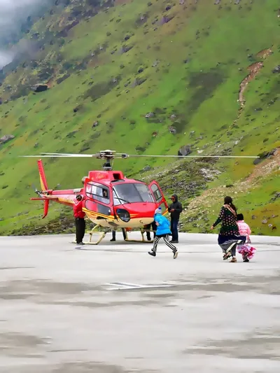
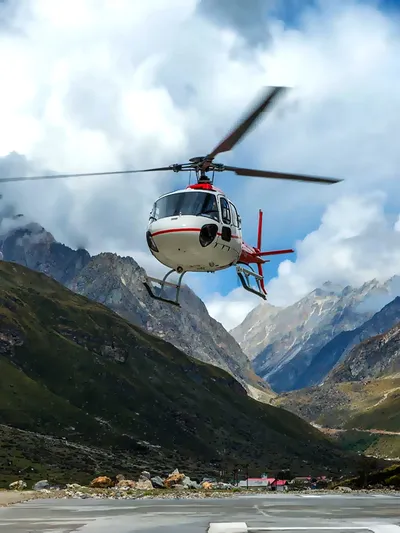
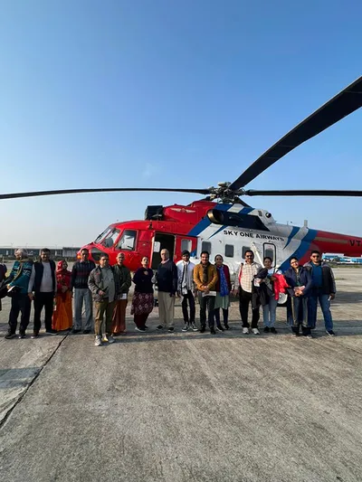
The road goes up to Sonprayag, then a shared jeep/shuttle runs to Gaurikund (the trek base). From Gaurikund, it's 16 km uphill to Kedarnath temple. The trek takes 5 to 7 hours one way for most people. Helicopter service is available from Phata, Sirsi, and Guptkashi helipads for those who can't trek.
Road Conditions
Gangotri to Rudraprayag is a long drive (~274 km) through multiple river valleys — tiring but mostly on decent roads. The section from Rudraprayag to Sonprayag narrows considerably, especially near Ukhimath and Sitapur. Gaurikund road is prone to landslides, particularly during and after monsoon. The 16 km trek from Gaurikund is steep and rocky in sections — not a casual walk at this altitude.
Route Summary
- Gangotri → Rudraprayag: 274 km
- Rudraprayag → Gaurikund: 72 km (drive)
- Gaurikund → Kedarnath Temple: 16 km (trek) — 5 to 7 hours on foot
Phata Helipad (~12 km from temple): Rs. 4,000–6,000 per person one-way. Sirsi Helipad (~14 km): Rs. 4,500–6,500. Guptkashi Helipad (~30 km): Rs. 6,000–8,000. Book through heliyatra.irctc.co.in well in advance — May–June slots go fast. Flights are weather-dependent and cancellations are common.
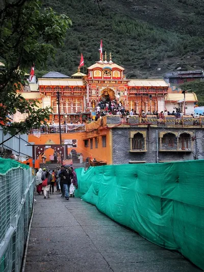
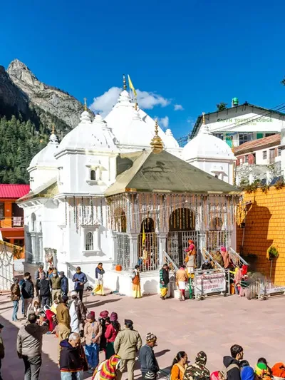
Badrinath — Route & Road Conditions
Altitude: ~3,293 m | Dedicated to Lord Vishnu; final stop of the Char Dham circuit
Badrinath is the only one of the four Dhams where the temple is directly accessible by road — no trek required. The temple sits on the banks of the Alaknanda River, with the Neelkanth peak rising behind it. Mana village, just 3 km away, is the last inhabited settlement before the Tibet border and worth visiting if you have the time.
Road Conditions
The route from Kedarnath area to Badrinath goes via Rudraprayag and Joshimath. The Rudraprayag to Joshimath stretch passes through Devprayag, Srinagar (Garhwal), and Chamoli — decent road but narrow at points. The final 45 km from Joshimath to Badrinath involves some steep switchbacks and is prone to rockfall. The entire stretch can be slow during peak season due to traffic management.
Route Summary
- Kedarnath area (Gaurikund) → Rudraprayag: 72 km
- Rudraprayag → Badrinath: 155 km
Travel Tips for Char Dham Yatra by Road
- Start early every day. Most mountain roads in Uttarakhand follow a one-way traffic schedule during peak Yatra season — check the timings at your hotel the night before and plan your departure accordingly. Waiting for a 2-hour traffic window midday when you need to cover 200 km is a day lost.
- Use low gears on descents. Don't ride the brakes on long downhill stretches — it overheats them. Shift down and let the engine do the braking. This is especially important on the Joshimath–Badrinath and Gaurikund–Rudraprayag sections.
- Avoid driving at night. Mountain roads are closed between 8 PM and 4 AM in most sections. Even where it's technically permitted, driving at night on narrow mountain roads in unfamiliar terrain is a bad idea. Plan your daily distances to reach your night halt before dark.
- July–August monsoon warning. Landslides are frequent between July and mid-August. Roads can be blocked for hours or days without warning. If you're travelling in this window, build extra buffer days into your itinerary and keep the BRO (Border Roads Organisation) helpline saved: 1800-180-3474.
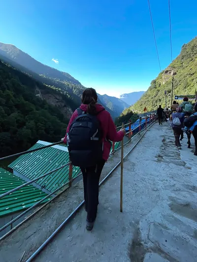
- Trek with a steady pace. Both the Yamunotri and Kedarnath treks are uphill — short steps at a consistent pace conserve more energy than rushing and stopping. Altitude affects people differently and there's no shame in going slow. Most people who struggled on these treks pushed too hard in the first hour.
- Watch for altitude sickness. All four Dhams are above 3,000 m. Headache, nausea, and dizziness at altitude are warning signs, not something to push through. Descend if symptoms don't ease with rest and water. Medical posts are available at Kedarnath and along the Gaurikund trek route.
- Carry cash. ATMs in the mountains are unreliable — they run out, they malfunction, and signal for UPI can be patchy above Uttarkashi and Joshimath. Keep enough cash for at least 2–3 days of expenses when going deeper into the mountains.
Best Time for Char Dham Yatra
| Season | Months | Conditions | Verdict |
|---|---|---|---|
| Opening | Late Apr – June | Clear skies, cool days. Peak crowd in May–June. | Good — book stays early |
| Monsoon | July – mid-Aug | Heavy rain, landslides, road blocks, slippery trails. | Risky — avoid if possible |
| Post-Monsoon | Sept – Oct | Clear visibility, thin crowds, crisp weather. | Often the best window |
| Closing | Nov onwards | Snowfall, temples shut for winter. | Last chance — verify dates |
Places Worth Visiting Along the Route
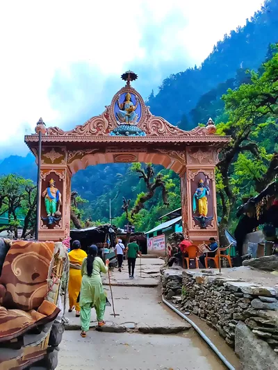
- Triyuginarayan Temple — Between Kedarnath and Badrinath, near Sonprayag. Believed to be the site of the wedding of Lord Shiva and Parvati.
- Valley of Flowers — Near Badrinath via Joshimath and Govindghat. UNESCO World Heritage site. Best in July–August when in bloom.
- Hemkund Sahib — Sikh pilgrimage site at 4,329 m, near Valley of Flowers. 14 km trek from Govindghat.
- Mana Village — 3 km from Badrinath. Last Indian village before the Tibet border. Small market, local dhabas, and the Vyas Gufa (cave).
- Devprayag — Where the Alaknanda and Bhagirathi rivers meet to form the Ganga. Worth a 30-minute stop on the Rishikesh–Badrinath drive.
- Ukhimath — Winter seat of the Kedarnath deity; quieter alternative stay near Chopta if you want to avoid the Guptkashi crowd.
Frequently Asked Questions
Q1. What are the main routes to reach Char Dham?
Ans: For Yamunotri and Gangotri, the route goes from Delhi via Rishikesh → Chamba → Barkot (for Yamunotri) and Rishikesh → Uttarkashi → Gangotri. For Kedarnath and Badrinath, the route is Rishikesh → Devprayag → Rudraprayag → Gaurikund (for Kedarnath) and Rudraprayag → Chamoli → Joshimath → Badrinath. Most pilgrims doing all four follow this west-to-east sequence: Yamunotri → Gangotri → Kedarnath → Badrinath.
Q2. What is the best route for Char Dham Yatra starting from Haridwar?
Ans: The standard and most practical route is: Haridwar → Barkot → Yamunotri → Uttarkashi → Gangotri → Guptkashi → Kedarnath → Joshimath → Badrinath → Haridwar. This route minimises unnecessary backtracking and follows the sequence in which the temples are traditionally visited.
Q3. How many days does the complete Char Dham Yatra take by road?
Ans: A comfortable Char Dham Yatra by road takes 10 to 12 days minimum from Haridwar. Rushing it in 7–8 days is possible but means very long driving days with little time at the temples. For first-timers or older pilgrims, 12–14 days is more practical and less exhausting.
Q4. Is Char Dham Yatra registration compulsory in 2026?
Ans: Yes. Online registration at registrationandtouristcare.uk.gov.in is mandatory for all pilgrims visiting any of the four Dhams. You get a Yatra Pass after registration — carry the printed copy at all times. Checkpoints on the route will deny entry without it. Registration is free.
Q5. What is the best time of year to do the Char Dham Yatra?
Ans: May and early June are the most popular — clear weather, reasonable temperatures, and temples freshly open for the season. September and October are often a better choice for people who can be flexible — crowds are thinner, visibility is sharper after the monsoon clears, and the roads are generally in good condition. July–August carries landslide risk and is best avoided.
Q6. Can travelers coming from Nepal also do the Char Dham Yatra?
Ans: Yes. The most practical entry points from Nepal are Banbasa (Uttarakhand border) or through Gorakhpur (UP). From either point, Haridwar is accessible by road or train, and the Yatra starts from there. All standard entry rules and Yatra registration requirements apply.
Q7. Which is the most difficult part of the Char Dham Yatra?
Ans: Kedarnath. The 16 km uphill trek from Gaurikund to the temple at 3,583 m is the toughest section of the entire Yatra — steep, at high altitude, and long. Yamunotri's 6 km trek is also tiring but shorter and at a lower altitude. Gangotri and Badrinath are accessible by road directly, so no trekking is required there.
Q8. Are there any other places to visit along the Char Dham route?
Ans: Yes — several. Devprayag (where the Ganga is formed) is on the main Rishikesh–Badrinath road. Triyuginarayan Temple is close to the Kedarnath route. Mana Village (last Indian village before Tibet) is 3 km from Badrinath. Valley of Flowers and Hemkund Sahib are accessible via Govindghat near Badrinath — both are worthwhile if your schedule allows a 1–2 day detour.
Q9. Can senior citizens or physically unfit pilgrims complete the Char Dham Yatra?
Ans: Yes. Pony, Palki (chair-type carrier), and Kandi (porter basket) services are available for both the Yamunotri and Kedarnath treks. Helicopter service is the most comfortable option for elderly pilgrims — it covers all four Dhams without any trekking, and multiple packages are available from Dehradun or Haridwar. A medical check-up before travelling to altitudes above 3,000 m is advisable for anyone with heart, BP, or breathing conditions.
Q10. What should I do if a road is blocked due to landslide during the Yatra?
Ans: Landslide-related road blocks are common, especially July–August but can happen anytime. Stay at the nearest town or halt point — do not attempt to cross a blocked stretch on foot at night. BRO (Border Roads Organisation) clears most blockages within a few hours to a day. Their helpline is 1800-180-3474. Check the Uttarakhand traffic police updates at smartharidwar.uk.gov.in for real-time road status.