
The district of Haridwar covers an area of 2370 km square and lies in the South western zone of Uttarkhand. The river Ganga flows through Haridwar in a series of channels which are segregated from each other all of which are well wooded. There are seasonal streams in Hardwar named as Ranipur Rao, Begam Nadi, Pithri Rao, Harunaii Rao. The major part of the Haridwar district is covered by forest area.
General Climate and Geographical Information
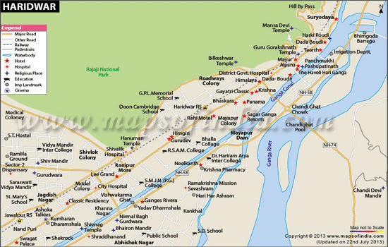
Haridwar is located in the western southern area of the state of Uttarkhand. It is covered between the north attitude 29 degree 35’ to 30 degree 40’ and east longitude 77 degree 43’ to 78 degree 22’. According to national survey of India haridwar falls in 53 degree sheet in J. F, G and K section. The cities of Dehradun and Pauri bind the Haridwar district in the North East and the Bijnor district binds it from the South East. Haridwar district shares its boundary with Muzzafarnagar district while the western part is bound by the district of Sahranpur. The total geographical area of the district is 2360 km2.
The district of Hridwar has three tehsil divisions i.e. Roorkee, Laksar, Bhagwanpur and three development blocks i.e. Narsan, Roorkee, Laksar, Bhagwanpur, Bahdarabad, Kanpur etc.
The central mode of irrigation in Haridwar is tube wells. Some areas of Haridwar are fed by rains. Rainfall is the primary source of water for recharging ground water. The state government has installed 225 tube wells while 32930 other private tube wells exist making up a decent water supply system.
Climatic Character of Haridwar
The Haridwar district has very moderate subtropical climate which can be high on humidity. There are 3 distinctive seasons in Haridwar I,e. summer, rains and winter.
In Haridwar the temperature begins to rise from march from about 29 degree centigrade till May where the temperature is at a peak. Summer May temperature in Haridwar is known to have touched 39 degree centigrade. By the middle of June the average temperature begins to fall.
Winter
It is in the winter in the months between November to February that very low humidity is observed. In winter humidity is about 25% in the evening and 355 in the morning. Summers are usually very humid with 85% humidity in the morning and 79% humidity in the evening.
Summer
Haridwar has moderate wind speed which peaks around summer. In the months of May and June the wind speed can go up to 7.2 km/ hour. In October the wind speed is around 2 km/ hour. Evapo-transpiration rate is maximum in the Month of May when it is pegged at 198.9mm and at the minimum in December when it is pegged at 38.5 mm.
Monsoon
The average annual amount of rainfall in the district of Haridwar is 1174.3 mm and 84% of this rainfall is received during the monsoon season. Only 16% of rainfall occurs in non monsoon period. Northern part of Haridwar district receives heaviest rainfall while the southern part is drier. July and the month of August see maximum rainfall and the maximum levels respectively are 329.5 and 394 respectively.
Topography of Haridwar
The topography of Haridwar is undulating in the northern region and smoother towards the south. The total altitude ranges from 868 m to 233 m. in the area near the Siawalik hills the gradient is quite steep. From the geo-morphological perspective Haridwar can be divided into 4 separate units and they are flood plains, upper piedmont plains, structured hills and lower piedmont plains.
The flood plain area is flattish and low lying while being adjacent to the river Solani. There is unconsolidated coarse sand with mixture of clay. This area is flooded with water at times.


Leave a Reply